 |
|
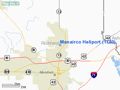
Location & QuickFacts
| FAA Information Effective: | 2008-09-25 |
| Airport Identifier: | 1OI0 |
| Airport Status: | Operational |
| Longitude/Latitude: | 082-30-40.6090W/40-48-17.2020N
-82.511280/40.804778 (Estimated) |
| Elevation: | 1265 ft / 385.57 m (Estimated) |
| Land: | 0 acres |
| From nearest city: | 2 nautical miles N of Mansfield, OH |
| Location: | Richland County, OH |
| Magnetic Variation: | 06W (1985) |
Owner & Manager
| Ownership: | Privately owned |
| Owner: | Manairco, Inc. |
| Address: | Po Box 111
Mansfield, OH 44901
MANSFIELD INDUSTRIAL PARK. |
| Phone number: | 419-524-2121 |
| Manager: | Gayle Freeman |
| Address: | Po Box 111
Mansfield, OH 44901 |
| Phone number: | 419-524-2121 |
Airport Operations and Facilities
| Airport Use: | Private |
| Wind indicator: | Yes |
| Segmented Circle: | No |
| Control Tower: | No |
| Lighting Schedule: | PHONE REQ
FOR PERIMETER LGTS CALL 419-524-2121 |
| Sectional chart: | Detroit |
| Region: | AGL - Great Lakes |
| Boundary ARTCC: | ZOB - Cleveland |
| Tie-in FSS: | CLE - Cleveland |
| FSS on Airport: | No |
| FSS Toll Free: | 1-800-WX-BRIEF |
Runway Information
Helipad H1
| Dimension: | 25 x 25 ft / 7.6 x 7.6 m |
| Surface: | TURF, |
| |
Runway H1 |
Runway |
| Traffic Pattern: | Left | Left |
|
Radio Navigation Aids
| ID |
Type |
Name |
Ch |
Freq |
Var |
Dist |
| MF | NDB | Manns | | 372.00 | 06W | 3.8 nm |
| AAU | NDB | Ashland | | 329.00 | 07W | 15.1 nm |
| MNN | NDB | Marion | | 201.00 | 05W | 27.8 nm |
| MLR | NDB | Millersburg/dcmsnd | | 382.00 | 06W | 33.1 nm |
| TII | NDB | Tiffin | | 269.00 | 05W | 36.2 nm |
| CL | NDB | Harri | | 344.00 | 07W | 40.5 nm |
| DLZ | NDB | Delaware | | 215.00 | 06W | 41.7 nm |
| PCW | NDB | Port Clinton | | 423.00 | 06W | 45.9 nm |
| FZI | NDB | Fostoria | | 379.00 | 05W | 46.3 nm |
| HEH | NDB | Newark | | 524.00 | 06W | 46.9 nm |
| BUD | VOR | Buckeye | | 109.80 | 05W | 27.6 nm |
| TVT | VOR/DME | Tiverton | 112X | 116.50 | 03W | 27.2 nm |
| DJB | VOR/DME | Dryer | 083X | 113.60 | 05W | 36.8 nm |
| SKY | VOR/DME | Sandusky | 029X | 109.20 | 04W | 38.4 nm |
| BSV | VOR/DME | Briggs | 071X | 112.40 | 04W | 49.3 nm |
| MFD | VORTAC | Mansfield | 025X | 108.80 | 03W | 5.3 nm |
| APE | VORTAC | Appleton | 114X | 116.70 | 06W | 39.5 nm |
| CLE | VOT | Cleveland | | 110.40 | | 47.2 nm |
| CAK | VOT | Akron/canton Regional | | 110.60 | | 49.1 nm |
Remarks
- (E111-2) E111 CONT'D: THE HELI OTHER THAN THOSE IN THE IMT AREA ARE FLOWN AS DIRECTED BY THE MANSFIELD-LAHM CTL TWR; TKOF/LNDG AREA IS APROPLY MARKED;
- (E111-3) E111 CONT'D: NON-OBSTRUCTING WIND INDCR IS MAINTD ADJ TO THE TKOF/LNDG AREA.
- E111: PRVDD 2-WAY COMS ARE ESTABD BTN HEL & MANSFIELD-LAHM CTL TWR PRIOR TO LIFT-OFF; ALL LIFT OFF INGRESS/EGRESS OPNS TO/FROM THE HELI.... E111 CONT'D: ARE CONDUCTED IN AN AREA BTN 340 DEGS CLKWS TO 270 DEGS USING THE PAD AS THE CNTR OF A COMPASS ROSE; ALL INGRESS/EGRESS OPNS TO/FROM....
Images and information placed above are from
http://www.airport-data.com/airport/1OI0/
We thank them for the data!
| General Info
|
| Country |
United States
|
| State |
OHIO
|
| FAA ID |
1OI0
|
| Latitude |
40-48-17.202N
|
| Longitude |
082-30-40.609W
|
| Elevation |
1265 feet
|
| Near City |
MANSFIELD
|
We don't guarantee the information is fresh and accurate. The data may
be wrong or outdated.
For more up-to-date information please refer to other sources.
|
|


