 |
|
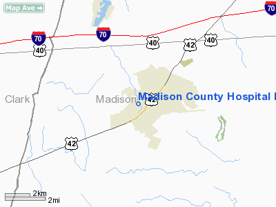
Madison County Hospital Heliport |
Location & QuickFacts
| FAA Information Effective: | 2008-09-25 |
| Airport Identifier: | OA09 |
| Airport Status: | Operational |
| Longitude/Latitude: | 083-27-10.0000W/39-53-33.0000N
-83.452778/39.892500 (Estimated) |
| Elevation: | 1057 ft / 322.17 m (Estimated) |
| Land: | 0 acres |
| From nearest city: | 0 nautical miles N of London, OH |
| Location: | Madison County, OH |
| Magnetic Variation: | 05W (1995) |
Owner & Manager
| Ownership: | Privately owned |
| Owner: | Madison County Hospital, Inc. |
| Address: | 210 North Main Street
London, OH 43140 |
| Phone number: | 614-852-1372 |
| Manager: | Keith Heinlein |
| Address: | 210 North Main Street
London, OH 43140 |
| Phone number: | 614-852-1372 |
Airport Operations and Facilities
| Airport Use: | Private
MEDICAL USE. |
| Wind indicator: | Yes |
| Segmented Circle: | No |
| Control Tower: | No |
| Lighting Schedule: | PHONE REQ
FOR PERIMETER LGTS CALL 614-852-1372. |
| Sectional chart: | Cincinnati |
| Region: | AGL - Great Lakes |
| Boundary ARTCC: | ZID - Indianapolis |
| Tie-in FSS: | DAY - Dayton |
| FSS on Airport: | No |
| FSS Toll Free: | 1-800-WX-BRIEF |
Runway Information
Helipad H1
| Dimension: | 30 x 30 ft / 9.1 x 9.1 m |
| Surface: | ASPH, |
| |
Runway H1 |
Runway |
| Traffic Pattern: | Left | Left |
|
Radio Navigation Aids
| ID |
Type |
Name |
Ch |
Freq |
Var |
Dist |
| UYF | NDB | London | | 263.00 | 06W | 2.6 nm |
| BU | NDB | Boutn | | 230.00 | 05W | 12.3 nm |
| CCJ | NDB | Clark County | | 341.00 | 04W | 15.1 nm |
| OS | NDB | Fuler | | 515.00 | 05W | 16.0 nm |
| CSS | NDB | Court House | | 414.00 | 05W | 17.8 nm |
| DKG | NDB | Don Scott | | 348.00 | 05W | 20.6 nm |
| MRT | NDB | Marysville | | 403.00 | 05W | 20.6 nm |
| CHC | NDB | Grens | | 272.00 | 04W | 20.8 nm |
| XEN | NDB | Xenia | | 395.00 | 03W | 24.5 nm |
| IL | NDB | Airbo | | 407.00 | 04W | 27.4 nm |
| DLZ | NDB | Delaware | | 215.00 | 06W | 28.2 nm |
| CYO | NDB | Circleville | | 366.00 | 05W | 31.2 nm |
| CM | NDB | Sumie | | 391.00 | 05W | 32.7 nm |
| EDJ | NDB | Bellefontaine | | 242.00 | 05W | 33.2 nm |
| RZT | NDB | Ross County | | 236.00 | 05W | 33.6 nm |
| RUV | NDB | Rushsylvania | | 326.00 | 05W | 35.5 nm |
| HW | NDB | Cubla | | 299.00 | 04W | 37.9 nm |
| HOC | NDB | Hillsboro | | 278.00 | 05W | 42.7 nm |
| HEH | NDB | Newark | | 524.00 | 06W | 46.3 nm |
| MNN | NDB | Marion | | 201.00 | 05W | 47.0 nm |
| EOP | NDB | Waverly | | 385.00 | 06W | 49.8 nm |
| XSF | TACAN | Springfield | 065X | | 04W | 18.2 nm |
| LCK | TACAN | Rickenbacker | 069X | | 05W | 24.7 nm |
| FFO | TACAN | Patterson | 099X | | 04W | 28.2 nm |
| XUB | VOR | Yellow Bud | | 112.50 | 05W | 31.1 nm |
| BUD | VOR | Buckeye | | 109.80 | 05W | 47.0 nm |
| SGH | VOR/DME | Springfield | 079X | 113.20 | 04W | 18.4 nm |
| MXQ | VOR/DME | Midwest | 076X | 112.90 | 04W | 32.2 nm |
| DQN | VOR/DME | Dayton | 092X | 114.50 | 01W | 44.1 nm |
| ROD | VORTAC | Rosewood | 122X | 117.50 | 05W | 36.1 nm |
| APE | VORTAC | Appleton | 114X | 116.70 | 06W | 42.7 nm |
| CMH | VOT | Port Columbus | | 111.00 | | 26.9 nm |
| DAY | VOT | Dayton J M Cox-day | | 111.00 | | 35.4 nm |
Remarks
- PRVDD APCH/DEP HELICOPTER OPNS CONDUCTED 055-240 DEGS USING TD PAD AS CENTER OF COMPASS ROSE; WIND INDICATOR MAINTAINED ADJ TO TKOF/LNDG AREA; ARR/DEP TFC COMPLY WITH 91.126(B)(2).
Images and information placed above are from
http://www.airport-data.com/airport/OA09/
We thank them for the data!
| General Info
|
| Country |
United States
|
| State |
OHIO
|
| FAA ID |
OA09
|
| Latitude |
39-53-33.000N
|
| Longitude |
083-27-10.000W
|
| Elevation |
1057 feet
|
| Near City |
LONDON
|
We don't guarantee the information is fresh and accurate. The data may
be wrong or outdated.
For more up-to-date information please refer to other sources.
|
|


