|
|
 |
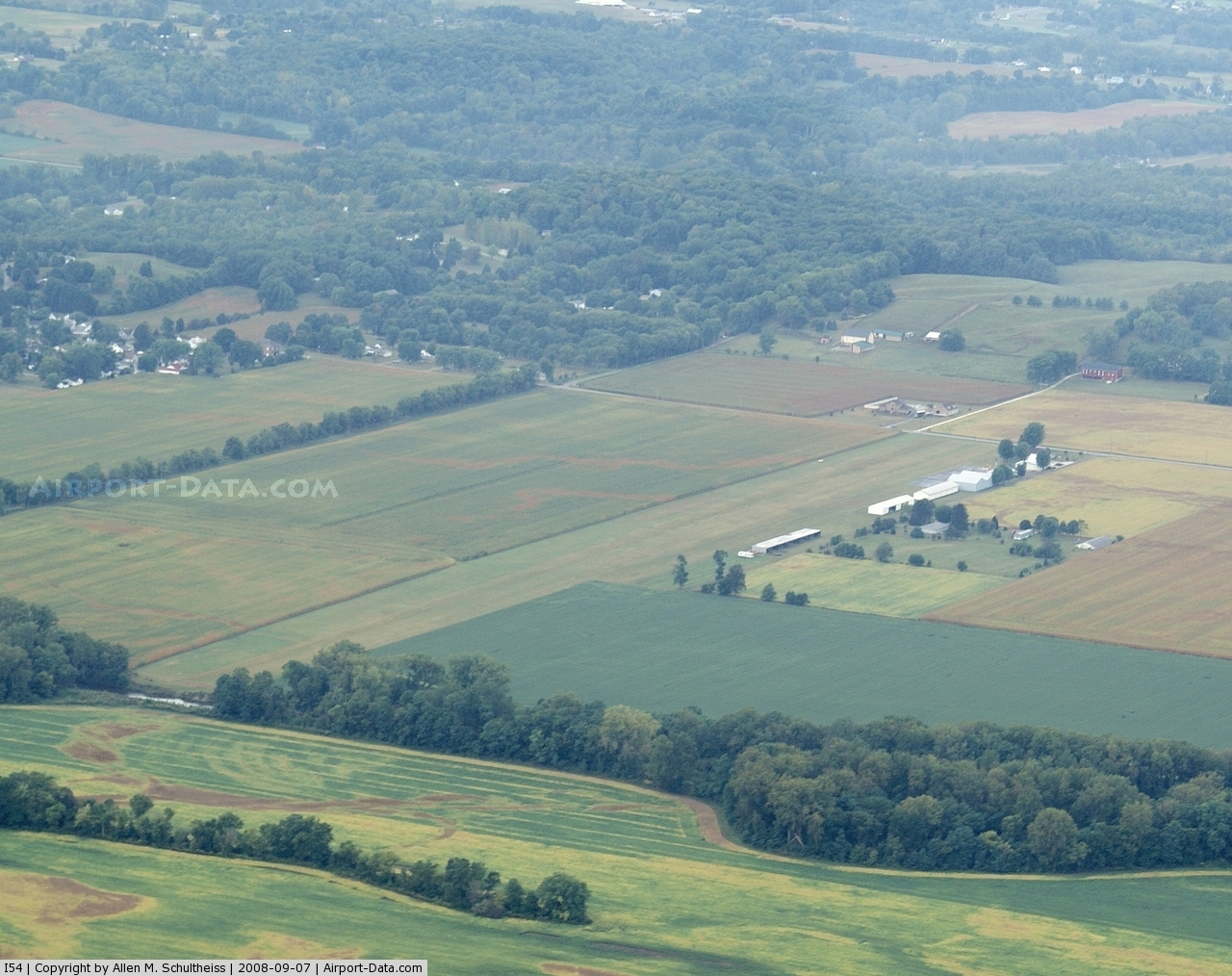
(Click on the photo to enlarge) |
Location & QuickFacts
| FAA Information Effective: | 2008-09-25 |
| Airport Identifier: | I54 |
| Airport Status: | Operational |
| Longitude/Latitude: | 083-49-42.7480W/40-01-12.2130N
-83.828541/40.020059 (Estimated) |
| Elevation: | 958 ft / 292.00 m (Estimated) |
| Land: | 35 acres |
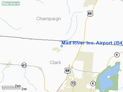
| From nearest city: | 1 nautical miles NE of Tremont City, OH |
| Location: | Clark County, OH |
| Magnetic Variation: | 04W (1985) |
Owner & Manager
| Ownership: | Privately owned |
| Owner: | Mad River Skypark Llc |
| Address: | 6488 Upper Valley Pike
Urbana, OH 43078 |
| Phone number: | 937-969-5565 |
| Manager: | Tom Printz |
| Address: | 6488 Upper Valley Pike
Urbana, OH 43078 |
| Phone number: | 937-969-8521 |
Airport Operations and Facilities
| Airport Use: | Open to public |
| Wind indicator: | Yes |
| Segmented Circle: | No |
| Control Tower: | No |
| Lighting Schedule: | PHONE REQ
ACTVT LIRL RY 09/27 - 122.8. FOR ROTG BCN CALL (513) 969-8521. |
| Beacon Color: | Clear-Green (lighted land airport) |
| Landing fee charge: | No |
| Sectional chart: | Detroit |
| Region: | AGL - Great Lakes |
| Traffic Pattern Alt: | 845 ft |
| Boundary ARTCC: | ZID - Indianapolis |
| Tie-in FSS: | DAY - Dayton |
| FSS on Airport: | No |
| FSS Toll Free: | 1-800-WX-BRIEF |
| NOTAMs Facility: | DAY (NOTAM-d service avaliable) |
Airport Communications
| CTAF: | 123.000 |
| Unicom: | 123.000 |
Airport Services
| Fuel available: | 100LL |
| Airframe Repair: | MAJOR |
| Power Plant Repair: | MINOR |
| Bottled Oxygen: | NONE |
| Bulk Oxygen: | NONE |
Runway Information
Runway 09/27
| Dimension: | 3405 x 110 ft / 1037.8 x 33.5 m |
| Surface: | TURF, Good Condition |
| Edge Lights: | Non-standard lighting system
NSTD LIRL; ONLY 2167 FT LGTD BTN DSPLCD THLDS. |
| |
Runway 09 |
Runway 27 |
| Longitude: | 083-50-04.5600W | 083-49-20.9000W |
| Latitude: | 40-01-11.4700N | 40-01-12.9400N |
| Elevation: | 955.00 ft | 955.00 ft |
| Traffic Pattern: | Left | Left |
| Markings: | None,
FIRST 340 FT NOT MKD; RY 27 FIRST 505 FT NOT MKD; ONLY 2560 FT MKD WITH ORANGE CONES; RY 09/27 DSPLCD THLD MKD WITH CONES & ONE GREEN LGT EACH SIDE OF RY. | None, |
| Displaced threshold: | 340.00 ft | 900.00 ft |
| Runway End Identifier: | No | |
| Centerline Lights: | No | No |
| Touchdown Lights: | No | No |
| Obstruction: | 25 ft pole, 60L/ ft right of centerline
RY 09 APCH SLOPE 11:1 TO DSPLCD THLD DUE TO +176 FT WOODED HILL AT 1955 FT. | 78 ft trees, 1064.0 ft from runway, 130 ft left of centerline, 13:1 slope to clear
RY 27 APCH SLOPE 13:1 TO DSPLCD THLD DUE TO +70 FT TREES AT 918 FT FR DSPLCD THLD 167 FT R. |
|
Radio Navigation Aids
| ID |
Type |
Name |
Ch |
Freq |
Var |
Dist |
| CCJ | NDB | Clark County | | 341.00 | 04W | 9.1 nm |
| UYF | NDB | London | | 263.00 | 06W | 17.5 nm |
| XEN | NDB | Xenia | | 395.00 | 03W | 18.9 nm |
| EDJ | NDB | Bellefontaine | | 242.00 | 05W | 21.1 nm |
| MRT | NDB | Marysville | | 403.00 | 05W | 25.3 nm |
| RUV | NDB | Rushsylvania | | 326.00 | 05W | 27.4 nm |
| OS | NDB | Fuler | | 515.00 | 05W | 29.2 nm |
| BU | NDB | Boutn | | 230.00 | 05W | 31.2 nm |
| IL | NDB | Airbo | | 407.00 | 04W | 32.0 nm |
| CSS | NDB | Court House | | 414.00 | 05W | 32.3 nm |
| VES | NDB | Versailles | | 356.00 | 04W | 33.8 nm |
| DKG | NDB | Don Scott | | 348.00 | 05W | 34.7 nm |
| DLZ | NDB | Delaware | | 215.00 | 06W | 36.7 nm |
| CHC | NDB | Grens | | 272.00 | 04W | 36.8 nm |
| HW | NDB | Cubla | | 299.00 | 04W | 40.1 nm |
| LYL | NDB | Lima | | 362.00 | 04W | 42.1 nm |
| HKF | NDB | Hook Field | | 239.00 | 04W | 42.4 nm |
| CQA | NDB | Lakefield | | 205.00 | 04W | 43.7 nm |
| CYO | NDB | Circleville | | 366.00 | 05W | 49.3 nm |
| CM | NDB | Sumie | | 391.00 | 05W | 49.5 nm |
| MNN | NDB | Marion | | 201.00 | 05W | 50.0 nm |
| XSF | TACAN | Springfield | 065X | | 04W | 10.9 nm |
| FFO | TACAN | Patterson | 099X | | 04W | 16.0 nm |
| LCK | TACAN | Rickenbacker | 069X | | 05W | 43.4 nm |
| AOH | VOR | Allen County | | 108.40 | 04W | 41.8 nm |
| XUB | VOR | Yellow Bud | | 112.50 | 05W | 49.2 nm |
| SGH | VOR/DME | Springfield | 079X | 113.20 | 04W | 11.1 nm |
| DQN | VOR/DME | Dayton | 092X | 114.50 | 01W | 26.2 nm |
| MXQ | VOR/DME | Midwest | 076X | 112.90 | 04W | 35.5 nm |
| ROD | VORTAC | Rosewood | 122X | 117.50 | 05W | 18.9 nm |
| RID | VORTAC | Richmond | 043X | 110.60 | 03W | 49.2 nm |
| DAY | VOT | Dayton J M Cox-day | | 111.00 | | 19.4 nm |
| CMH | VOT | Port Columbus | | 111.00 | | 43.5 nm |
Remarks
- RY LGTS OTS INDEFLY.
- VFR ONLY
Images and information placed above are from
http://www.airport-data.com/airport/I54/
We thank them for the data!
| General Info
|
| Country |
United States
|
| State |
OHIO
|
| FAA ID |
I54
|
| Latitude |
40-01-12.213N
|
| Longitude |
083-49-42.748W
|
| Elevation |
958 feet
|
| Near City |
TREMONT CITY
|
We don't guarantee the information is fresh and accurate. The data may
be wrong or outdated.
For more up-to-date information please refer to other sources.
|
|