 |
|
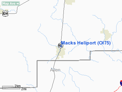
Location & QuickFacts
| FAA Information Effective: | 2008-09-25 |
| Airport Identifier: | OI75 |
| Airport Status: | Operational |
| Longitude/Latitude: | 084-03-27.8020W/40-55-41.1860N
-84.057723/40.928107 (Estimated) |
| Elevation: | 763 ft / 232.56 m (Estimated) |
| Land: | 0 acres |
| From nearest city: | 0 nautical miles NW of Columbus Grove, OH |
| Location: | Putnam County, OH |
| Magnetic Variation: | 04W (1985) |
Owner & Manager
| Ownership: | Privately owned |
| Owner: | Paul Mackaman |
| Address: | 411 N Main
Columbus Grove, OH 45830 |
| Phone number: | 419-659-5284 |
| Manager: | Paul Mackaman |
| Address: | 411 N Main
Columbus Grove, OH 45830 |
| Phone number: | 419-659-5284 |
Airport Operations and Facilities
| Airport Use: | Private |
| Wind indicator: | Yes |
| Segmented Circle: | Yes |
| Control Tower: | No |
| Lighting Schedule: | PHONE REQ
FOR LGTS PHONE 419-659-5284. |
| Landing fee charge: | No |
| Sectional chart: | Detroit |
| Region: | AGL - Great Lakes |
| Boundary ARTCC: | ZOB - Cleveland |
| Tie-in FSS: | CLE - Cleveland |
| FSS on Airport: | No |
| FSS Toll Free: | 1-800-WX-BRIEF |
Airport Communications
Runway Information
Helipad H1
| Dimension: | 1200 x 300 ft / 365.8 x 91.4 m |
| Surface: | TURF, |
| Edge Lights: | Low |
| |
Runway H1 |
Runway |
| Traffic Pattern: | Left | Left |
|
Radio Navigation Aids
| ID |
Type |
Name |
Ch |
Freq |
Var |
Dist |
| PDR | NDB | Ottawa | | 233.00 | 05W | 7.2 nm |
| LYL | NDB | Lima | | 362.00 | 04W | 13.5 nm |
| BNR | NDB | Benton Ridge | | 334.00 | 05W | 18.5 nm |
| VFU | NDB | Stanley | | 411.00 | 05W | 25.6 nm |
| DFI | NDB | Defiance | | 246.00 | 05W | 29.6 nm |
| RUV | NDB | Rushsylvania | | 326.00 | 05W | 33.3 nm |
| FZI | NDB | Fostoria | | 379.00 | 05W | 33.8 nm |
| EDJ | NDB | Bellefontaine | | 242.00 | 05W | 35.3 nm |
| CQA | NDB | Lakefield | | 205.00 | 04W | 35.4 nm |
| BYN | NDB | Bryan | | 260.00 | 04W | 38.0 nm |
| TII | NDB | Tiffin | | 269.00 | 05W | 39.9 nm |
| USE | NDB | Fulton | | 375.00 | 05W | 41.1 nm |
| VES | NDB | Versailles | | 356.00 | 04W | 48.3 nm |
| MNN | NDB | Marion | | 201.00 | 05W | 48.7 nm |
| TOL | TACAN | Toledo | 072X | | 05W | 41.7 nm |
| AOH | VOR | Allen County | | 108.40 | 04W | 13.9 nm |
| MAH | VOR | Marathon | | 114.90 | 05W | 18.6 nm |
| BUD | VOR | Buckeye | | 109.80 | 05W | 49.0 nm |
| VWV | VOR/DME | Waterville | 078X | 113.10 | 02W | 36.7 nm |
| FDY | VORTAC | Findlay | 019X | 108.20 | 02W | 13.8 nm |
| ROD | VORTAC | Rosewood | 122X | 117.50 | 05W | 38.5 nm |
Remarks
- E111: APCH/DEP RTE HOP ARE CONDUCTED IN AN AREA FROM 210-150 DEGS CLKWS USING A POINT 150' WEST OF THE PAD AS THE CENTER OF A COMPASS ROSE; E111 CONT'D: TKOF/LNDG AREA IS APROPLY MKD; NON-OBSTNG WIND INDCR IS MAINTD ADJ TO THE TKOF/LNDG AREA.
Images and information placed above are from
http://www.airport-data.com/airport/OI75/
We thank them for the data!
| General Info
|
| Country |
United States
|
| State |
OHIO
|
| FAA ID |
OI75
|
| Latitude |
40-55-41.186N
|
| Longitude |
084-03-27.802W
|
| Elevation |
763 feet
|
| Near City |
COLUMBUS GROVE
|
We don't guarantee the information is fresh and accurate. The data may
be wrong or outdated.
For more up-to-date information please refer to other sources.
|
|


