 |
|
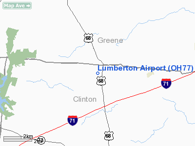
Location & QuickFacts
| FAA Information Effective: | 2008-09-25 |
| Airport Identifier: | OH77 |
| Airport Status: | Operational |
| Longitude/Latitude: | 083-51-17.7380W/39-33-11.2190N
-83.854927/39.553116 (Estimated) |
| Elevation: | 1008 ft / 307.24 m (Estimated) |
| Land: | 60 acres |
| From nearest city: | 8 nautical miles S of Wilmington, OH |
| Location: | Clinton County, OH |
| Magnetic Variation: | 04W (1985) |
Owner & Manager
| Ownership: | Privately owned |
| Owner: | Ron Schweller |
| Address: | 7006 Us 68 N
Wilmington, OH 45177 |
| Phone number: | 937-254-8444
OR 937-486-5686. |
| Manager: | Ron Schweller |
| Address: | 231 New Burlington Rd
Wilmington, OH 45177 |
| Phone number: | 937-486-2040 |
Airport Operations and Facilities
| Airport Use: | Private |
| Wind indicator: | Yes |
| Segmented Circle: | Yes |
| Control Tower: | No |
| Lighting Schedule: | RDO-CTL
ACTVT LIRL RY N/S - 121.8. |
| Beacon Color: | Clear-Green (lighted land airport) |
| Sectional chart: | Cincinnati |
| Region: | AGL - Great Lakes |
| Boundary ARTCC: | ZID - Indianapolis |
| Tie-in FSS: | DAY - Dayton |
| FSS Toll Free: | 1-800-WX-BRIEF |
Airport Communications
Airport Services
Runway Information
Runway 01/19
| Dimension: | 2800 x 32 ft / 853.4 x 9.8 m |
| Surface: | CONC, |
| Edge Lights: | Low |
| |
Runway 01 |
Runway 19 |
| Traffic Pattern: | Left | Right |
| Obstruction: | 40 ft trees, 1000.0 ft from runway | |
|
Radio Navigation Aids
| ID |
Type |
Name |
Ch |
Freq |
Var |
Dist |
| IL | NDB | Airbo | | 407.00 | 04W | 6.6 nm |
| XEN | NDB | Xenia | | 395.00 | 03W | 10.3 nm |
| HW | NDB | Cubla | | 299.00 | 04W | 12.0 nm |
| CCJ | NDB | Clark County | | 341.00 | 04W | 19.6 nm |
| CSS | NDB | Court House | | 414.00 | 05W | 21.7 nm |
| HOC | NDB | Hillsboro | | 278.00 | 05W | 26.5 nm |
| HKF | NDB | Hook Field | | 239.00 | 04W | 27.7 nm |
| UYF | NDB | London | | 263.00 | 06W | 29.1 nm |
| MDE | NDB | Madeira | | 379.00 | 04W | 30.6 nm |
| ISZ | NDB | Cincinnati-blue Ash | | 388.00 | 04W | 30.8 nm |
| LUK | NDB | Cincinnati | | 335.00 | 04W | 32.7 nm |
| PWF | NDB | Sportys | | 245.00 | 04W | 33.2 nm |
| BU | NDB | Boutn | | 230.00 | 05W | 34.1 nm |
| HAO | NDB | Hamilton | | 260.00 | 04W | 35.0 nm |
| RZT | NDB | Ross County | | 236.00 | 05W | 38.9 nm |
| CYO | NDB | Circleville | | 366.00 | 05W | 40.6 nm |
| OXD | NDB | Oxford | | 282.00 | 04W | 43.0 nm |
| OS | NDB | Fuler | | 515.00 | 05W | 43.6 nm |
| AMT | NDB | West Union | | 359.00 | 04W | 44.0 nm |
| PZO | NDB | Peebles | | 329.00 | 02W | 45.2 nm |
| MRT | NDB | Marysville | | 403.00 | 05W | 46.7 nm |
| CHC | NDB | Grens | | 272.00 | 04W | 47.0 nm |
| DKG | NDB | Don Scott | | 348.00 | 05W | 47.8 nm |
| EOP | NDB | Waverly | | 385.00 | 06W | 48.8 nm |
| EDJ | NDB | Bellefontaine | | 242.00 | 05W | 49.2 nm |
| VES | NDB | Versailles | | 356.00 | 04W | 49.9 nm |
| XSF | TACAN | Springfield | 065X | | 04W | 17.1 nm |
| FFO | TACAN | Patterson | 099X | | 04W | 18.5 nm |
| LCK | TACAN | Rickenbacker | 069X | | 05W | 45.5 nm |
| XUB | VOR | Yellow Bud | | 112.50 | 05W | 40.7 nm |
| MXQ | VOR/DME | Midwest | 076X | 112.90 | 04W | 7.8 nm |
| SGH | VOR/DME | Springfield | 079X | 113.20 | 04W | 17.0 nm |
| DQN | VOR/DME | Dayton | 092X | 114.50 | 01W | 37.4 nm |
| ROD | VORTAC | Rosewood | 122X | 117.50 | 05W | 45.0 nm |
| RID | VORTAC | Richmond | 043X | 110.60 | 03W | 47.1 nm |
| DAY | VOT | Dayton J M Cox-day | | 111.00 | | 26.9 nm |
| LUK | VOT | Cincinnati Muni/lunken | | 108.40 | | 36.5 nm |
Remarks
- OWNER DESIRES ARPT NOT BE CHARTED.
Images and information placed above are from
http://www.airport-data.com/airport/OH77/
We thank them for the data!
| General Info
|
| Country |
United States
|
| State |
OHIO
|
| FAA ID |
OH77
|
| Latitude |
39-33-11.219N
|
| Longitude |
083-51-17.738W
|
| Elevation |
1008 feet
|
| Near City |
WILMINGTON
|
We don't guarantee the information is fresh and accurate. The data may
be wrong or outdated.
For more up-to-date information please refer to other sources.
|
|


