 |
|
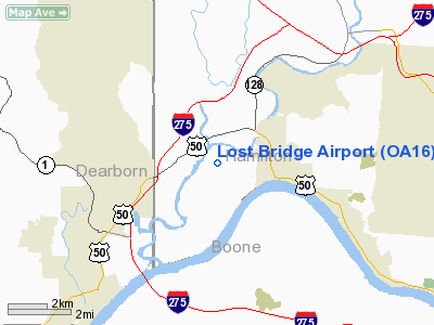
Location & QuickFacts
| FAA Information Effective: | 2008-09-25 |
| Airport Identifier: | OA16 |
| Airport Status: | Operational |
| Longitude/Latitude: | 084-46-54.0000W/39-09-22.0000N
-84.781667/39.156111 (Estimated) |
| Elevation: | 818 ft / 249.33 m (Estimated) |
| Land: | 10 acres |
| From nearest city: | 2 nautical miles W of North Bend, OH |
| Location: | Hamilton County, OH |
| Magnetic Variation: | () |
Owner & Manager
| Ownership: | Privately owned |
| Owner: | Thomas Ratterman |
| Address: | 10042 Mt. Nebo Rd.
North Bend, OH 45052 |
| Phone number: | 513-477-8848 |
| Manager: | Thomas Ratterman |
| Address: | 10042 Mt. Nebo Rd.
North Bend, OH 45052 |
| Phone number: | 513-941-3388 |
Airport Operations and Facilities
| Airport Use: | Private |
| Wind indicator: | Yes |
| Control Tower: | No |
| Sectional chart: | Cincinnati |
| Region: | AGL - Great Lakes |
| Boundary ARTCC: | ZID - Indianapolis |
| Tie-in FSS: | DAY - Dayton |
| FSS Toll Free: | 1-800-WX-BRIEF |
Runway Information
Runway 15/33
| Dimension: | 2500 x 50 ft / 762.0 x 15.2 m |
| Surface: | TURF, |
| |
Runway 15 |
Runway 33 |
| Traffic Pattern: | Left | Left |
|
Radio Navigation Aids
| ID |
Type |
Name |
Ch |
Freq |
Var |
Dist |
| UR | NDB | Burln | | 321.00 | 04W | 6.6 nm |
| HAO | NDB | Hamilton | | 260.00 | 04W | 16.3 nm |
| ISZ | NDB | Cincinnati-blue Ash | | 388.00 | 04W | 19.1 nm |
| MDE | NDB | Madeira | | 379.00 | 04W | 20.3 nm |
| LUK | NDB | Cincinnati | | 335.00 | 04W | 20.5 nm |
| OXD | NDB | Oxford | | 282.00 | 04W | 21.1 nm |
| HLB | NDB | Batesville | | 254.00 | 02W | 25.0 nm |
| HKF | NDB | Hook Field | | 239.00 | 04W | 25.8 nm |
| PWF | NDB | Sportys | | 245.00 | 04W | 26.8 nm |
| OVO | NDB | North Vernon | | 374.00 | 02W | 38.8 nm |
| IMS | NDB | Madison | | 404.00 | 03W | 39.6 nm |
| HW | NDB | Cubla | | 299.00 | 04W | 43.8 nm |
| BA | NDB | Clifs | | 410.00 | 03W | 49.3 nm |
| FLM | VOR/DME | Falmouth | 117X | 117.00 | 04W | 37.6 nm |
| MXQ | VOR/DME | Midwest | 076X | 112.90 | 04W | 48.5 nm |
| CVG | VORTAC | Cincinnati | 120X | 117.30 | 04W | 9.2 nm |
| RID | VORTAC | Richmond | 043X | 110.60 | 03W | 36.1 nm |
| LUK | VOT | Cincinnati Muni/lunken | | 108.40 | | 18.0 nm |
Remarks
- 237 FT CELL TWR 1/2 NM SE OF RY.
- PRVDD VFR OPNS, PVT USE, AREA IS MARKED WIND INDICATOR IS MAINTAINED.
Images and information placed above are from
http://www.airport-data.com/airport/OA16/
We thank them for the data!
|
|


