 |
|
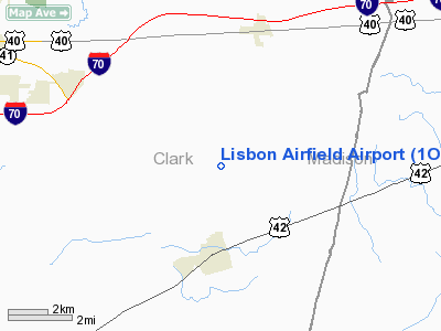
Location & QuickFacts
| FAA Information Effective: | 2008-09-25 |
| Airport Identifier: | 1OH8 |
| Airport Status: | Operational |
| Longitude/Latitude: | 083-37-59.7230W/39-52-00.2160N
-83.633256/39.866727 (Estimated) |
| Elevation: | 1160 ft / 353.57 m (Estimated) |
| Land: | 10 acres |
| From nearest city: | 3 nautical miles N of South Charleston, OH |
| Location: | Clark County, OH |
| Magnetic Variation: | 04W (1985) |
Owner & Manager
| Ownership: | Privately owned |
| Owner: | Mrs. Nola Minnick |
| Address: | 3241 S Urbana Lisbon Rd
South Carleston, OH 45368 |
| Phone number: | 937-462-8826 |
| Manager: | Charles Kimball
EASEMENT HOLDER |
| Address: | 3395 Lisbon/urbana Rd
South Charleston, OH 45368 |
| Phone number: | 937-462-8275 |
Airport Operations and Facilities
| Airport Use: | Private |
| Segmented Circle: | No |
| Control Tower: | No |
| Landing fee charge: | No |
| Sectional chart: | Cincinnati |
| Region: | AGL - Great Lakes |
| Boundary ARTCC: | ZID - Indianapolis |
| Tie-in FSS: | DAY - Dayton |
| FSS on Airport: | No |
| FSS Toll Free: | 1-800-WX-BRIEF
LOCAL CALL 937-462-8826 FOR MRS. MINNICK OR 937-462-8275 FOR CHARLES R. KIMBALL. |
Airport Services
| Airframe Repair: | NONE |
| Power Plant Repair: | NONE |
Runway Information
Runway 05/23
| Dimension: | 1800 x 75 ft / 548.6 x 22.9 m |
| Surface: | TURF, |
| |
Runway 05 |
Runway 23 |
| Traffic Pattern: | Left | Left |
|
Radio Navigation Aids
| ID |
Type |
Name |
Ch |
Freq |
Var |
Dist |
| CCJ | NDB | Clark County | | 341.00 | 04W | 6.7 nm |
| UYF | NDB | London | | 263.00 | 06W | 8.7 nm |
| XEN | NDB | Xenia | | 395.00 | 03W | 16.4 nm |
| CSS | NDB | Court House | | 414.00 | 05W | 19.5 nm |
| BU | NDB | Boutn | | 230.00 | 05W | 20.0 nm |
| IL | NDB | Airbo | | 407.00 | 04W | 23.0 nm |
| OS | NDB | Fuler | | 515.00 | 05W | 23.6 nm |
| MRT | NDB | Marysville | | 403.00 | 05W | 25.3 nm |
| DKG | NDB | Don Scott | | 348.00 | 05W | 28.6 nm |
| CHC | NDB | Grens | | 272.00 | 04W | 29.2 nm |
| EDJ | NDB | Bellefontaine | | 242.00 | 05W | 31.4 nm |
| HW | NDB | Cubla | | 299.00 | 04W | 32.8 nm |
| DLZ | NDB | Delaware | | 215.00 | 06W | 34.7 nm |
| RUV | NDB | Rushsylvania | | 326.00 | 05W | 35.6 nm |
| CYO | NDB | Circleville | | 366.00 | 05W | 36.6 nm |
| RZT | NDB | Ross County | | 236.00 | 05W | 38.0 nm |
| CM | NDB | Sumie | | 391.00 | 05W | 41.1 nm |
| HOC | NDB | Hillsboro | | 278.00 | 05W | 41.2 nm |
| HKF | NDB | Hook Field | | 239.00 | 04W | 43.7 nm |
| VES | NDB | Versailles | | 356.00 | 04W | 45.7 nm |
| XSF | TACAN | Springfield | 065X | | 04W | 9.7 nm |
| FFO | TACAN | Patterson | 099X | | 04W | 19.7 nm |
| LCK | TACAN | Rickenbacker | 069X | | 05W | 32.7 nm |
| XUB | VOR | Yellow Bud | | 112.50 | 05W | 36.5 nm |
| SGH | VOR/DME | Springfield | 079X | 113.20 | 04W | 9.9 nm |
| MXQ | VOR/DME | Midwest | 076X | 112.90 | 04W | 27.4 nm |
| DQN | VOR/DME | Dayton | 092X | 114.50 | 01W | 36.3 nm |
| ROD | VORTAC | Rosewood | 122X | 117.50 | 05W | 31.6 nm |
| DAY | VOT | Dayton J M Cox-day | | 111.00 | | 27.2 nm |
| CMH | VOT | Port Columbus | | 111.00 | | 35.3 nm |
Remarks
- (A52-5) BARN ADJ TO RGT OF RWY 05.
- VFR ONLY.
Images and information placed above are from
http://www.airport-data.com/airport/1OH8/
We thank them for the data!
| General Info
|
| Country |
United States
|
| State |
OHIO
|
| FAA ID |
1OH8
|
| Latitude |
39-52-00.216N
|
| Longitude |
083-37-59.723W
|
| Elevation |
1160 feet
|
| Near City |
SOUTH CHARLESTON
|
We don't guarantee the information is fresh and accurate. The data may
be wrong or outdated.
For more up-to-date information please refer to other sources.
|
|


