 |
|
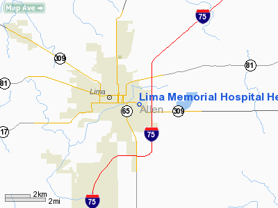
Lima Memorial Hospital Heliport |
Location & QuickFacts
| FAA Information Effective: | 2008-09-25 |
| Airport Identifier: | OH83 |
| Airport Status: | Operational |
| Longitude/Latitude: | 084-05-14.8090W/40-44-10.1830N
-84.087447/40.736162 (Estimated) |
| Elevation: | 880 ft / 268.22 m (Estimated) |
| Land: | 0 acres |
| From nearest city: | 0 nautical miles W of Lima, OH |
| Location: | Allen County, OH |
| Magnetic Variation: | 04W (1985) |
Owner & Manager
| Ownership: | Privately owned |
| Owner: | Lima Memorial Hospital |
| Address: | 1001 Bellefontaine Ave
Lima, OH 45804 |
| Phone number: | 419-228-3335 |
| Address: | 1001 Bellefontaine Ave
Lima, OH 45804 |
| Phone number: | 419-228-3335 |
Airport Operations and Facilities
| Airport Use: | Private
MEDICAL USE. |
| Wind indicator: | Yes |
| Segmented Circle: | No |
| Control Tower: | No |
| Beacon Color: | Clear-Yellow (lighted seaplan base) |
| Landing fee charge: | No |
| Sectional chart: | Detroit |
| Region: | AGL - Great Lakes |
| Boundary ARTCC: | ZID - Indianapolis |
| Tie-in FSS: | DAY - Dayton |
| FSS on Airport: | No |
| FSS Toll Free: | 1-800-WX-BRIEF |
Runway Information
Helipad H1
| Dimension: | 60 x 60 ft / 18.3 x 18.3 m |
| Surface: | CONC, |
| |
Runway H1 |
Runway |
| Traffic Pattern: | Left | Left |
|
Radio Navigation Aids
| ID |
Type |
Name |
Ch |
Freq |
Var |
Dist |
| LYL | NDB | Lima | | 362.00 | 04W | 3.5 nm |
| PDR | NDB | Ottawa | | 233.00 | 05W | 18.5 nm |
| VFU | NDB | Stanley | | 411.00 | 05W | 25.1 nm |
| EDJ | NDB | Bellefontaine | | 242.00 | 05W | 25.3 nm |
| RUV | NDB | Rushsylvania | | 326.00 | 05W | 25.4 nm |
| BNR | NDB | Benton Ridge | | 334.00 | 05W | 25.6 nm |
| CQA | NDB | Lakefield | | 205.00 | 04W | 26.6 nm |
| VES | NDB | Versailles | | 356.00 | 04W | 37.6 nm |
| DFI | NDB | Defiance | | 246.00 | 05W | 39.1 nm |
| FZI | NDB | Fostoria | | 379.00 | 05W | 41.5 nm |
| PLD | NDB | Portland | | 257.00 | 03W | 44.3 nm |
| TII | NDB | Tiffin | | 269.00 | 05W | 45.5 nm |
| MRT | NDB | Marysville | | 403.00 | 05W | 45.6 nm |
| MNN | NDB | Marion | | 201.00 | 05W | 46.9 nm |
| BYN | NDB | Bryan | | 260.00 | 04W | 47.9 nm |
| AOH | VOR | Allen County | | 108.40 | 04W | 5.7 nm |
| MAH | VOR | Marathon | | 114.90 | 05W | 25.5 nm |
| BUD | VOR | Buckeye | | 109.80 | 05W | 47.2 nm |
| DQN | VOR/DME | Dayton | 092X | 114.50 | 01W | 45.5 nm |
| VWV | VOR/DME | Waterville | 078X | 113.10 | 02W | 47.6 nm |
| FDY | VORTAC | Findlay | 019X | 108.20 | 02W | 20.0 nm |
| ROD | VORTAC | Rosewood | 122X | 117.50 | 05W | 27.0 nm |
Remarks
Images and information placed above are from
http://www.airport-data.com/airport/OH83/
We thank them for the data!
| General Info
|
| Country |
United States
|
| State |
OHIO
|
| FAA ID |
OH83
|
| Latitude |
40-44-10.183N
|
| Longitude |
084-05-14.809W
|
| Elevation |
880 feet
|
| Near City |
LIMA
|
We don't guarantee the information is fresh and accurate. The data may
be wrong or outdated.
For more up-to-date information please refer to other sources.
|
|


