 |
|
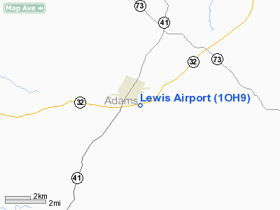
Location & QuickFacts
| FAA Information Effective: | 2008-09-25 |
| Airport Identifier: | 1OH9 |
| Airport Status: | Operational |
| Longitude/Latitude: | 083-23-57.6830W/38-56-06.2540N
-83.399356/38.935071 (Estimated) |
| Elevation: | 862 ft / 262.74 m (Estimated) |
| Land: | 8 acres |
| From nearest city: | 1 nautical miles SE of Peebles, OH |
| Location: | Adams County, OH |
| Magnetic Variation: | 04W (1985) |
Owner & Manager
| Ownership: | Privately owned |
| Owner: | Warren Lewis |
| Address: | 4833 Steam Furnace Rd
Peebles, OHIO 45660 |
| Phone number: | 513-587-2576 |
| Manager: | Warren P Lewis |
| Address: | 4833 Steam Furnace Road
Peebles, OHIO 45660 |
| Phone number: | 513-587-2576 |
Airport Operations and Facilities
| Airport Use: | Private
PERSONAL USE. |
| Wind indicator: | Yes |
| Segmented Circle: | No |
| Control Tower: | No |
| Sectional chart: | Cincinnati |
| Region: | AGL - Great Lakes |
| Boundary ARTCC: | ZID - Indianapolis |
| Tie-in FSS: | DAY - Dayton |
| FSS Toll Free: | 1-800-WX-BRIEF |
Runway Information
Runway 08/26
| Dimension: | 3200 x 80 ft / 975.4 x 24.4 m |
| Surface: | TURF, |
| |
Runway 08 |
Runway 26 |
| Traffic Pattern: | Left | Left |
| Displaced threshold: | 0.00 ft | 500.00 ft |
| Obstruction: | | 30 ft pline, 0.0 ft from runway |
|
Radio Navigation Aids
| ID |
Type |
Name |
Ch |
Freq |
Var |
Dist |
| AJY | FAN MARKER | Ashland | | | 03W | 36.3 nm |
| PZO | NDB | Peebles | | 329.00 | 02W | 3.5 nm |
| AMT | NDB | West Union | | 359.00 | 04W | 9.0 nm |
| HOC | NDB | Hillsboro | | 278.00 | 05W | 16.4 nm |
| XW | NDB | Flmng | | 400.00 | 05W | 24.6 nm |
| EOP | NDB | Waverly | | 385.00 | 06W | 25.9 nm |
| PMH | NDB | Portsmouth | | 373.00 | 04W | 27.5 nm |
| HW | NDB | Cubla | | 299.00 | 04W | 33.6 nm |
| RZT | NDB | Ross County | | 236.00 | 05W | 34.8 nm |
| IL | NDB | Airbo | | 407.00 | 04W | 37.0 nm |
| PWF | NDB | Sportys | | 245.00 | 04W | 39.1 nm |
| CSS | NDB | Court House | | 414.00 | 05W | 40.0 nm |
| CYO | NDB | Circleville | | 366.00 | 05W | 40.4 nm |
| LUK | NDB | Cincinnati | | 335.00 | 04W | 46.0 nm |
| MDE | NDB | Madeira | | 379.00 | 04W | 47.8 nm |
| ISZ | NDB | Cincinnati-blue Ash | | 388.00 | 04W | 49.9 nm |
| XUB | VOR | Yellow Bud | | 112.50 | 05W | 40.6 nm |
| MXQ | VOR/DME | Midwest | 076X | 112.90 | 04W | 35.1 nm |
| FLM | VOR/DME | Falmouth | 117X | 117.00 | 04W | 46.0 nm |
| YRK | VORTAC | York | 075X | 112.80 | 05W | 26.4 nm |
| LUK | VOT | Cincinnati Muni/lunken | | 108.40 | | 48.0 nm |
Remarks
- PROVIDED MINIMUM 20:1 APCH SFCS AND 7:1 TRANSITIONAL SFCS.
Images and information placed above are from
http://www.airport-data.com/airport/1OH9/
We thank them for the data!
| General Info
|
| Country |
United States
|
| State |
OHIO
|
| FAA ID |
1OH9
|
| Latitude |
38-56-06.254N
|
| Longitude |
083-23-57.683W
|
| Elevation |
862 feet
|
| Near City |
PEEBLES
|
We don't guarantee the information is fresh and accurate. The data may
be wrong or outdated.
For more up-to-date information please refer to other sources.
|
|


