 |
|
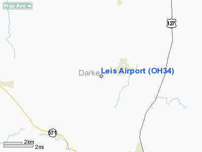
Location & QuickFacts
| FAA Information Effective: | 2008-09-25 |
| Airport Identifier: | OH34 |
| Airport Status: | Operational |
| Longitude/Latitude: | 084-39-41.8470W/40-12-21.1710N
-84.661624/40.205881 (Estimated) |
| Elevation: | 1015 ft / 309.37 m (Estimated) |
| Land: | 0 acres |
| From nearest city: | 1 nautical miles SW of Ansonia, OH |
| Location: | Darke County, OH |
| Magnetic Variation: | 04W (1985) |
Owner & Manager
| Ownership: | Privately owned |
| Owner: | John L. Leis |
| Address: | 3665 Elroy Ansonia Rd.
Ansonia, OH 45303 |
| Phone number: | 513-337-5941 |
| Address: |
|
Airport Operations and Facilities
| Airport Use: | Private |
| Wind indicator: | Yes |
| Segmented Circle: | No |
| Control Tower: | No |
| Landing fee charge: | No |
| Sectional chart: | Detroit |
| Region: | AGL - Great Lakes |
| Boundary ARTCC: | ZID - Indianapolis |
| Tie-in FSS: | DAY - Dayton |
| FSS Toll Free: | 1-800-WX-BRIEF |
Runway Information
Runway E/W
| Dimension: | 2800 x 70 ft / 853.4 x 21.3 m |
| Surface: | TURF, |
| |
Runway E |
Runway W |
| Traffic Pattern: | Left | Left |
| Obstruction: | 25 ft pline | |
|
Radio Navigation Aids
| ID |
Type |
Name |
Ch |
Freq |
Var |
Dist |
| VES | NDB | Versailles | | 356.00 | 04W | 6.4 nm |
| CQA | NDB | Lakefield | | 205.00 | 04W | 17.2 nm |
| PLD | NDB | Portland | | 257.00 | 03W | 21.0 nm |
| UWL | NDB | New Castle | | 385.00 | 02W | 36.0 nm |
| VFU | NDB | Stanley | | 411.00 | 05W | 39.5 nm |
| AI | NDB | Video | | 371.00 | 03W | 39.9 nm |
| EDJ | NDB | Bellefontaine | | 242.00 | 05W | 40.1 nm |
| LYL | NDB | Lima | | 362.00 | 04W | 41.8 nm |
| OXD | NDB | Oxford | | 282.00 | 04W | 42.3 nm |
| HKF | NDB | Hook Field | | 239.00 | 04W | 43.6 nm |
| XEN | NDB | Xenia | | 395.00 | 03W | 44.8 nm |
| CCJ | NDB | Clark County | | 341.00 | 04W | 45.3 nm |
| RUV | NDB | Rushsylvania | | 326.00 | 05W | 48.0 nm |
| FFO | TACAN | Patterson | 099X | | 04W | 36.3 nm |
| XSF | TACAN | Springfield | 065X | | 04W | 43.8 nm |
| AOH | VOR | Allen County | | 108.40 | 04W | 43.7 nm |
| DQN | VOR/DME | Dayton | 092X | 114.50 | 01W | 16.7 nm |
| MIE | VOR/DME | Muncie | 091X | 114.40 | 03W | 33.7 nm |
| SGH | VOR/DME | Springfield | 079X | 113.20 | 04W | 43.7 nm |
| MZZ | VOR/DME | Marion | 023X | 108.60 | 03W | 49.7 nm |
| RID | VORTAC | Richmond | 043X | 110.60 | 03W | 28.3 nm |
| ROD | VORTAC | Rosewood | 122X | 117.50 | 05W | 28.8 nm |
| DAY | VOT | Dayton J M Cox-day | | 111.00 | | 27.3 nm |
Remarks
Images and information placed above are from
http://www.airport-data.com/airport/OH34/
We thank them for the data!
| General Info
|
| Country |
United States
|
| State |
OHIO
|
| FAA ID |
OH34
|
| Latitude |
40-12-21.171N
|
| Longitude |
084-39-41.847W
|
| Elevation |
1015 feet
|
| Near City |
ANSONIA
|
We don't guarantee the information is fresh and accurate. The data may
be wrong or outdated.
For more up-to-date information please refer to other sources.
|
|


