 |
|
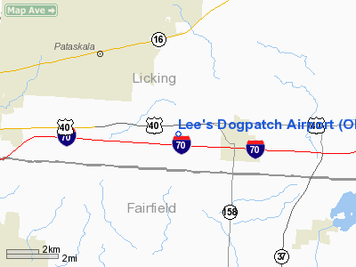
Location & QuickFacts
| FAA Information Effective: | 2008-09-25 |
| Airport Identifier: | OI56 |
| Airport Status: | Operational |
| Longitude/Latitude: | 082-38-26.4000W/39-57-11.4000N
-82.640667/39.953167 (Estimated) |
| Elevation: | 1055 ft / 321.56 m (Estimated) |
| Land: | 5 acres |
| From nearest city: | 2 nautical miles W of Kirkersville, OH |
| Location: | Licking County, OH |
| Magnetic Variation: | () |
Owner & Manager
| Ownership: | Privately owned |
| Owner: | Jim R Lee |
| Address: | 9631 Watkins Rd Sw
Pataskala, OH 43062 |
| Phone number: | 740-927-2950 |
| Manager: | Jim R Lee |
| Address: | 9631 Watkins Rd Sw
Pataskala, OH 43062 |
| Phone number: | 740-927-2950 |
Airport Operations and Facilities
| Airport Use: | Private |
| Wind indicator: | Yes |
| Control Tower: | No |
| Sectional chart: | Cincinnati |
| Region: | AGL - Great Lakes |
| Boundary ARTCC: | ZID - Indianapolis |
| Tie-in FSS: | DAY - Dayton |
| FSS Toll Free: | 1-800-WX-BRIEF |
Runway Information
Runway 09/27
| Dimension: | 1280 x 40 ft / 390.1 x 12.2 m |
| Surface: | TURF, |
| |
Runway 09 |
Runway 27 |
| Traffic Pattern: | Left | Left |
| Obstruction: | 30 ft trees, 60.0 ft from runway | 30 ft trees, 60.0 ft from runway |
|
Radio Navigation Aids
| ID |
Type |
Name |
Ch |
Freq |
Var |
Dist |
| CM | NDB | Sumie | | 391.00 | 05W | 5.6 nm |
| HEH | NDB | Newark | | 524.00 | 06W | 9.3 nm |
| CHC | NDB | Grens | | 272.00 | 04W | 18.2 nm |
| DKG | NDB | Don Scott | | 348.00 | 05W | 21.6 nm |
| OS | NDB | Fuler | | 515.00 | 05W | 26.7 nm |
| BU | NDB | Boutn | | 230.00 | 05W | 27.2 nm |
| DLZ | NDB | Delaware | | 215.00 | 06W | 28.8 nm |
| CYO | NDB | Circleville | | 366.00 | 05W | 30.2 nm |
| HRA | NDB | Zanesville | | 204.00 | 06W | 33.4 nm |
| RZT | NDB | Ross County | | 236.00 | 05W | 35.8 nm |
| MRT | NDB | Marysville | | 403.00 | 05W | 36.5 nm |
| UYF | NDB | London | | 263.00 | 06W | 38.1 nm |
| CSS | NDB | Court House | | 414.00 | 05W | 40.6 nm |
| MNN | NDB | Marion | | 201.00 | 05W | 44.5 nm |
| UGS | NDB | University | | 250.00 | 06W | 48.1 nm |
| EOP | NDB | Waverly | | 385.00 | 06W | 49.2 nm |
| MF | NDB | Manns | | 372.00 | 06W | 49.7 nm |
| MLR | NDB | Millersburg/dcmsnd | | 382.00 | 06W | 49.9 nm |
| LCK | TACAN | Rickenbacker | 069X | | 05W | 15.9 nm |
| XUB | VOR | Yellow Bud | | 112.50 | 05W | 30.0 nm |
| BUD | VOR | Buckeye | | 109.80 | 05W | 44.3 nm |
| ZZV | VOR/DME | Zanesville | 051X | 111.40 | 06W | 34.5 nm |
| TVT | VOR/DME | Tiverton | 112X | 116.50 | 03W | 38.4 nm |
| APE | VORTAC | Appleton | 114X | 116.70 | 06W | 12.1 nm |
| CMH | VOT | Port Columbus | | 111.00 | | 11.5 nm |
Remarks
- 60 FT WATER TWR 1 NM E OF ARPT.
Images and information placed above are from
http://www.airport-data.com/airport/OI56/
We thank them for the data!
|
|


