 |
|
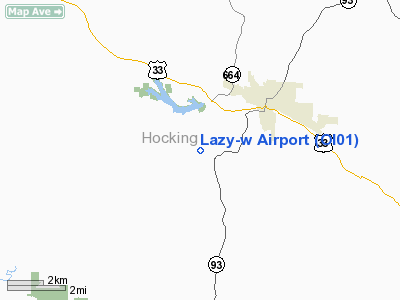
Location & QuickFacts
| FAA Information Effective: | 2008-09-25 |
| Airport Identifier: | OI01 |
| Airport Status: | Operational |
| Longitude/Latitude: | 082-26-56.5590W/39-30-49.2400N
-82.449044/39.513678 (Estimated) |
| Elevation: | 750 ft / 228.60 m (Estimated) |
| Land: | 0 acres |
| From nearest city: | 3 nautical miles SW of Logan, OH |
| Location: | Hocking County, OH |
| Magnetic Variation: | 05W (1985) |
Owner & Manager
| Ownership: | Privately owned |
| Owner: | Dale C. Walker |
| Address: | 14630 Sauer Krout Road
Logan, OH 43138 |
| Phone number: | 614-385-7290 |
| Manager: | Dale C. Walker |
| Address: | 14630 Sauer Krout Road
Logan, OH 43138 |
| Phone number: | 614-385-7290 |
Airport Operations and Facilities
| Airport Use: | Private |
| Wind indicator: | No |
| Segmented Circle: | No |
| Control Tower: | No |
| Landing fee charge: | No |
| Sectional chart: | Cincinnati |
| Region: | AGL - Great Lakes |
| Boundary ARTCC: | ZID - Indianapolis |
| Tie-in FSS: | DAY - Dayton |
| FSS on Airport: | No |
| FSS Toll Free: | 1-800-WX-BRIEF |
Runway Information
Runway E/W
| Dimension: | 1800 x 50 ft / 548.6 x 15.2 m |
| Surface: | TURF, |
| |
Runway E |
Runway W |
| Traffic Pattern: | Left | Left |
|
Radio Navigation Aids
| ID |
Type |
Name |
Ch |
Freq |
Var |
Dist |
| PKB | FAN MARKER | Marietta Ohio | | | 03W | 48.6 nm |
| UGS | NDB | University | | 250.00 | 06W | 21.5 nm |
| CYO | NDB | Circleville | | 366.00 | 05W | 24.6 nm |
| RZT | NDB | Ross County | | 236.00 | 05W | 27.3 nm |
| EOP | NDB | Waverly | | 385.00 | 06W | 30.6 nm |
| HEH | NDB | Newark | | 524.00 | 06W | 30.8 nm |
| CM | NDB | Sumie | | 391.00 | 05W | 31.7 nm |
| HRA | NDB | Zanesville | | 204.00 | 06W | 34.0 nm |
| BU | NDB | Boutn | | 230.00 | 05W | 39.5 nm |
| CHC | NDB | Grens | | 272.00 | 04W | 40.1 nm |
| GAS | NDB | Gallipolis | | 420.00 | 07W | 43.0 nm |
| CSS | NDB | Court House | | 414.00 | 05W | 44.0 nm |
| DKG | NDB | Don Scott | | 348.00 | 05W | 44.8 nm |
| PMH | NDB | Portsmouth | | 373.00 | 04W | 47.7 nm |
| OS | NDB | Fuler | | 515.00 | 05W | 48.3 nm |
| LCK | TACAN | Rickenbacker | 069X | | 05W | 28.4 nm |
| XUB | VOR | Yellow Bud | | 112.50 | 05W | 24.5 nm |
| ZZV | VOR/DME | Zanesville | 051X | 111.40 | 06W | 36.3 nm |
| APE | VORTAC | Appleton | 114X | 116.70 | 06W | 38.8 nm |
| HNN | VORTAC | Henderson | 106X | 115.90 | 03W | 49.7 nm |
| CMH | VOT | Port Columbus | | 111.00 | | 35.2 nm |
Images and information placed above are from
http://www.airport-data.com/airport/OI01/
We thank them for the data!
| General Info
|
| Country |
United States
|
| State |
OHIO
|
| FAA ID |
OI01
|
| Latitude |
39-30-49.240N
|
| Longitude |
082-26-56.559W
|
| Elevation |
750 feet
|
| Near City |
LOGAN
|
We don't guarantee the information is fresh and accurate. The data may
be wrong or outdated.
For more up-to-date information please refer to other sources.
|
|


