 |
|
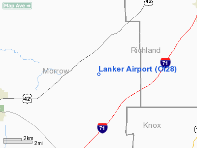
Location & QuickFacts
| FAA Information Effective: | 2008-09-25 |
| Airport Identifier: | OI28 |
| Airport Status: | Operational |
| Longitude/Latitude: | 082-40-45.6250W/40-35-02.2130N
-82.679340/40.583948 (Estimated) |
| Elevation: | 1440 ft / 438.91 m (Surveyed) |
| Land: | 0 acres |
| From nearest city: | 8 nautical miles NE of Mount Gilead, OH |
| Location: | Morrow County, OH |
| Magnetic Variation: | 05W (1985) |
Owner & Manager
| Ownership: | Privately owned |
| Owner: | Darryl Lanker |
| Address: | 6814 Perry Road 90
Mt Gilead, OH 43338 |
| Phone number: | 419-362-3869 |
| Manager: | Darryl Lanker |
| Address: | 6814 Perry Road 90
Mt Gilead, OH 43338 |
| Phone number: | 419-362-3869 |
Airport Operations and Facilities
| Airport Use: | Private |
| Wind indicator: | No |
| Segmented Circle: | No |
| Control Tower: | No |
| Landing fee charge: | No |
| Sectional chart: | Detroit |
| Region: | AGL - Great Lakes |
| Boundary ARTCC: | ZOB - Cleveland |
| Tie-in FSS: | CLE - Cleveland |
| FSS on Airport: | No |
| FSS Toll Free: | 1-800-WX-BRIEF |
Runway Information
Runway NE/SW
| Dimension: | 1500 x 50 ft / 457.2 x 15.2 m |
| Surface: | TURF, |
| |
Runway NE |
Runway SW |
| Traffic Pattern: | Left | Left |
|
Radio Navigation Aids
| ID |
Type |
Name |
Ch |
Freq |
Var |
Dist |
| MF | NDB | Manns | | 372.00 | 06W | 15.3 nm |
| MNN | NDB | Marion | | 201.00 | 05W | 17.9 nm |
| DLZ | NDB | Delaware | | 215.00 | 06W | 26.8 nm |
| AAU | NDB | Ashland | | 329.00 | 07W | 29.9 nm |
| HEH | NDB | Newark | | 524.00 | 06W | 35.0 nm |
| DKG | NDB | Don Scott | | 348.00 | 05W | 35.4 nm |
| CM | NDB | Sumie | | 391.00 | 05W | 36.1 nm |
| MLR | NDB | Millersburg/dcmsnd | | 382.00 | 06W | 36.9 nm |
| MRT | NDB | Marysville | | 403.00 | 05W | 37.4 nm |
| CHC | NDB | Grens | | 272.00 | 04W | 38.0 nm |
| OS | NDB | Fuler | | 515.00 | 05W | 38.8 nm |
| TII | NDB | Tiffin | | 269.00 | 05W | 39.1 nm |
| RUV | NDB | Rushsylvania | | 326.00 | 05W | 45.8 nm |
| FZI | NDB | Fostoria | | 379.00 | 05W | 48.8 nm |
| LCK | TACAN | Rickenbacker | 069X | | 05W | 48.0 nm |
| BUD | VOR | Buckeye | | 109.80 | 05W | 17.7 nm |
| TVT | VOR/DME | Tiverton | 112X | 116.50 | 03W | 26.4 nm |
| MFD | VORTAC | Mansfield | 025X | 108.80 | 03W | 17.6 nm |
| APE | VORTAC | Appleton | 114X | 116.70 | 06W | 26.4 nm |
| CMH | VOT | Port Columbus | | 111.00 | | 36.7 nm |
Remarks
- OWNER DESIRES ARPT TO BE CHARTED.
Images and information placed above are from
http://www.airport-data.com/airport/OI28/
We thank them for the data!
| General Info
|
| Country |
United States
|
| State |
OHIO
|
| FAA ID |
OI28
|
| Latitude |
40-35-02.213N
|
| Longitude |
082-40-45.625W
|
| Elevation |
1440 feet
|
| Near City |
MOUNT GILEAD
|
We don't guarantee the information is fresh and accurate. The data may
be wrong or outdated.
For more up-to-date information please refer to other sources.
|
|


