 |
|
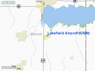
Location & QuickFacts
| FAA Information Effective: | 2008-09-25 |
| Airport Identifier: | CQA |
| Airport Status: | Operational |
| Longitude/Latitude: | 084-33-36.4000W/40-29-02.7000N
-84.560111/40.484083 (Estimated) |
| Elevation: | 894 ft / 272.49 m (Surveyed) |
| Land: | 122 acres |
| From nearest city: | 6 nautical miles SE of Celina, OH |
| Location: | Mercer County, OH |
| Magnetic Variation: | 04W (1995) |
Owner & Manager
| Ownership: | Publicly owned |
| Owner: | Lakefield Arpt Auth |
| Address: | Co Comm Off Co Courthouse,
Celina, OH 45822 |
| Phone number: | 419-586-3178 |
| Manager: | Michael Mccorkle |
| Address: | Box 6177 St Rt 219
Celina, OH 45822 |
| Phone number: | 419-268-2190 |
Airport Operations and Facilities
| Airport Use: | Open to public |
| Wind indicator: | Yes |
| Segmented Circle: | No |
| Control Tower: | No |
| Lighting Schedule: | DUSK-DAWN
ACTVT MIRL RY 08/26; REIL RYS 08 & 26 - 123.3 |
| Beacon Color: | Clear-Green (lighted land airport) |
| Landing fee charge: | No |
| Sectional chart: | Detroit |
| Region: | AGL - Great Lakes |
| Boundary ARTCC: | ZID - Indianapolis |
| Tie-in FSS: | DAY - Dayton |
| FSS on Airport: | No |
| FSS Toll Free: | 1-800-WX-BRIEF |
| NOTAMs Facility: | DAY (NOTAM-d service avaliable) |
| Federal Agreements: | NGY |
Airport Communications
| CTAF: | 122.800 |
| Unicom: | 122.800 |
Airport Services
| Fuel available: | 100LLA1+
100LL FUEL 24 HOUR WITH CREDIT CARD SELF SERVICE. |
| Airframe Repair: | MAJOR |
| Power Plant Repair: | MAJOR |
Runway Information
Runway 08/26
| Dimension: | 3795 x 75 ft / 1156.7 x 22.9 m |
| Surface: | ASPH, Good Condition |
| Weight Limit: | Single wheel: 30000 lbs. |
| Edge Lights: | Medium |
| |
Runway 08 |
Runway 26 |
| Longitude: | 084-34-00.7280W | 084-33-12.0270W |
| Latitude: | 40-29-00.2970N | 40-29-05.0970N |
| Elevation: | 894.00 ft | 888.00 ft |
| Alignment: | 83 | 127 |
| Traffic Pattern: | Left | Left |
| Markings: | Non-precision instrument, Good Condition | Non-precision instrument, Good Condition |
| VASI: | 4-light PAPI on left side | |
| Runway End Identifier: | Yes | Yes |
| Centerline Lights: | No | No |
| Touchdown Lights: | No | No |
| Obstruction: | 35 ft pline, 598.0 ft from runway, 309 ft left of centerline, 11:1 slope to clear | 87 ft tree, 1957.0 ft from runway, 519 ft left of centerline, 20:1 slope to clear |
|
Radio Navigation Aids
| ID |
Type |
Name |
Ch |
Freq |
Var |
Dist |
| CQA | NDB | Lakefield | | 205.00 | 04W | 0.2 nm |
| VES | NDB | Versailles | | 356.00 | 04W | 16.8 nm |
| PLD | NDB | Portland | | 257.00 | 03W | 19.5 nm |
| VFU | NDB | Stanley | | 411.00 | 05W | 22.9 nm |
| LYL | NDB | Lima | | 362.00 | 04W | 27.9 nm |
| EDJ | NDB | Bellefontaine | | 242.00 | 05W | 34.8 nm |
| RUV | NDB | Rushsylvania | | 326.00 | 05W | 40.8 nm |
| PDR | NDB | Ottawa | | 233.00 | 05W | 42.3 nm |
| HHG | NDB | Huntington | | 417.00 | 03W | 46.9 nm |
| FFO | TACAN | Patterson | 099X | | 04W | 46.2 nm |
| AOH | VOR | Allen County | | 108.40 | 04W | 30.2 nm |
| DQN | VOR/DME | Dayton | 092X | 114.50 | 01W | 29.1 nm |
| MIE | VOR/DME | Muncie | 091X | 114.40 | 03W | 41.0 nm |
| ROD | VORTAC | Rosewood | 122X | 117.50 | 05W | 26.4 nm |
| FWA | VORTAC | Fort Wayne | 125X | 117.80 | 00E | 41.3 nm |
| RID | VORTAC | Richmond | 043X | 110.60 | 03W | 45.7 nm |
| FDY | VORTAC | Findlay | 019X | 108.20 | 02W | 46.3 nm |
| DAY | VOT | Dayton J M Cox-day | | 111.00 | | 38.3 nm |
| FWA | VOT | Fort Wayne Baer | | 111.00 | | 41.3 nm |
Images and information placed above are from
http://www.airport-data.com/airport/CQA/
We thank them for the data!
| General Info
|
| Country |
United States
|
| State |
OHIO
|
| FAA ID |
CQA
|
| Latitude |
40-29-02.700N
|
| Longitude |
084-33-36.400W
|
| Elevation |
894 feet
|
| Near City |
CELINA
|
We don't guarantee the information is fresh and accurate. The data may
be wrong or outdated.
For more up-to-date information please refer to other sources.
|
|


