 |
|
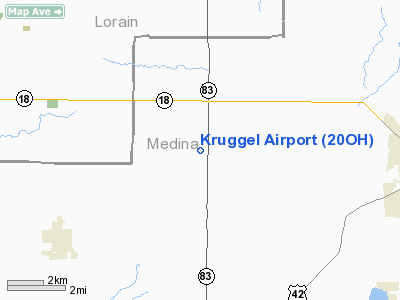
Location & QuickFacts
| FAA Information Effective: | 2008-09-25 |
| Airport Identifier: | 20OH |
| Airport Status: | Operational |
| Longitude/Latitude: | 082-01-42.5210W/41-08-35.1960N
-82.028478/41.143110 (Estimated) |
| Elevation: | 1055 ft / 321.56 m (Estimated) |
| Land: | 425 acres |
| From nearest city: | 2 nautical miles S of Litchfield, OH |
| Location: | Medina County, OH |
| Magnetic Variation: | 06W (1985) |
Owner & Manager
| Ownership: | Privately owned |
| Address: |
|
| Manager: | John P. Kruggel |
| Address: | 4700 Avon Lake Rd
Litchfield, OH 44253 |
| Phone number: | 216-667-2534 |
Airport Operations and Facilities
| Airport Use: | Private |
| Wind indicator: | No |
| Segmented Circle: | No |
| Control Tower: | No |
| Landing fee charge: | No |
| Sectional chart: | Detroit |
| Region: | AGL - Great Lakes |
| Boundary ARTCC: | ZOB - Cleveland |
| Tie-in FSS: | CLE - Cleveland |
| FSS on Airport: | No |
| FSS Toll Free: | 1-800-WX-BRIEF |
Airport Services
| Airframe Repair: | NONE |
| Power Plant Repair: | NONE |
Runway Information
Runway 09/27
| Dimension: | 2240 x 50 ft / 682.8 x 15.2 m
FULL LENGTH AVBL LNDG TO EAST; 1540' AVBL LNDG TO WEST. |
| Surface: | TURF, |
| |
Runway 09 |
Runway 27 |
| Traffic Pattern: | Left | Left |
| Displaced threshold: | 0.00 ft | 700.00 ft |
|
Radio Navigation Aids
| ID |
Type |
Name |
Ch |
Freq |
Var |
Dist |
| CL | NDB | Harri | | 344.00 | 07W | 12.1 nm |
| AAU | NDB | Ashland | | 329.00 | 07W | 14.9 nm |
| EZE | NDB | Engel | | 226.00 | 07W | 24.9 nm |
| BKL | NDB | Burke Lakefront | | 416.00 | 07W | 28.4 nm |
| AK | NDB | Akron | | 362.00 | 07W | 29.4 nm |
| MF | NDB | Manns | | 372.00 | 06W | 29.5 nm |
| MLR | NDB | Millersburg/dcmsnd | | 382.00 | 06W | 36.8 nm |
| LQL | NDB | Lakeland | | 263.00 | 08W | 43.7 nm |
| PCW | NDB | Port Clinton | | 423.00 | 06W | 44.1 nm |
| PT | NDB | Pelee Island | | 283.00 | 05W | 47.9 nm |
| DJB | VOR/DME | Dryer | 083X | 113.60 | 05W | 14.3 nm |
| SKY | VOR/DME | Sandusky | 029X | 109.20 | 04W | 33.3 nm |
| BSV | VOR/DME | Briggs | 071X | 112.40 | 04W | 36.3 nm |
| ACO | VOR/DME | Akron | 091X | 114.40 | 04W | 37.5 nm |
| TVT | VOR/DME | Tiverton | 112X | 116.50 | 03W | 41.4 nm |
| LNN | VOR/DME | Lost Nation | 039X | 110.20 | 08W | 43.5 nm |
| CXR | VOR/DME | Chardon | 074X | 112.70 | 05W | 45.1 nm |
| MFD | VORTAC | Mansfield | 025X | 108.80 | 03W | 30.4 nm |
| CLE | VOT | Cleveland | | 110.40 | | 18.0 nm |
| CAK | VOT | Akron/canton Regional | | 110.60 | | 29.9 nm |
Remarks
- RWY SURFACE ROLLING.
- VFR CONDITIONS ONLY.
Images and information placed above are from
http://www.airport-data.com/airport/20OH/
We thank them for the data!
| General Info
|
| Country |
United States
|
| State |
OHIO
|
| FAA ID |
20OH
|
| Latitude |
41-08-35.196N
|
| Longitude |
082-01-42.521W
|
| Elevation |
1055 feet
|
| Near City |
LITCHFIELD
|
We don't guarantee the information is fresh and accurate. The data may
be wrong or outdated.
For more up-to-date information please refer to other sources.
|
|


