 |
|
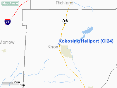
Location & QuickFacts
| FAA Information Effective: | 2008-09-25 |
| Airport Identifier: | OI24 |
| Airport Status: | Operational |
| Longitude/Latitude: | 082-33-38.6000W/40-29-28.2190N
-82.560722/40.491172 (Estimated) |
| Elevation: | 1095 ft / 333.76 m (Surveyed) |
| Land: | 0 acres |
| From nearest city: | 1 nautical miles NW of Fredericktown, OH |
| Location: | Knox County, OH |
| Magnetic Variation: | 05W (1985) |
Owner & Manager
| Ownership: | Privately owned |
| Owner: | Kokosing Construction Co. Inc |
| Address: | 17531 Waterford Road
Fredericktown, OH 43019 |
| Phone number: | 740-694-6315 |
| Manager: | Mark Fields |
| Address: | Kokosing Construction Company, 17531 Waterford Road
Fredericktown, OH 43019 |
| Phone number: | 740-694-6315
EXT 246. |
Airport Operations and Facilities
| Airport Use: | Private |
| Wind indicator: | Yes |
| Segmented Circle: | No |
| Control Tower: | No |
| Lighting Schedule: | RDO-CTL
FOR ROTG BCN - 123.050. PERIMETER LGHTS ON 40X40 TOUCHDOWN PAD. |
| Beacon Color: | Clear-Green-Yellow (heliport) |
| Landing fee charge: | No |
| Sectional chart: | Detroit |
| Region: | AGL - Great Lakes |
| Boundary ARTCC: | ZID - Indianapolis |
| Tie-in FSS: | CLE - Cleveland |
| FSS on Airport: | No |
| FSS Toll Free: | 1-800-WX-BRIEF |
Airport Communications
Airport Services
Runway Information
Helipad H1
| Dimension: | 80 x 40 ft / 24.4 x 12.2 m |
| Surface: | CONC, |
| |
Runway H1 |
Runway |
| Traffic Pattern: | Left | Left |
|
Radio Navigation Aids
| ID |
Type |
Name |
Ch |
Freq |
Var |
Dist |
| MF | NDB | Manns | | 372.00 | 06W | 17.3 nm |
| MNN | NDB | Marion | | 201.00 | 05W | 24.5 nm |
| DLZ | NDB | Delaware | | 215.00 | 06W | 28.0 nm |
| HEH | NDB | Newark | | 524.00 | 06W | 28.3 nm |
| MLR | NDB | Millersburg/dcmsnd | | 382.00 | 06W | 31.6 nm |
| CM | NDB | Sumie | | 391.00 | 05W | 31.6 nm |
| AAU | NDB | Ashland | | 329.00 | 07W | 31.6 nm |
| DKG | NDB | Don Scott | | 348.00 | 05W | 34.3 nm |
| CHC | NDB | Grens | | 272.00 | 04W | 36.0 nm |
| OS | NDB | Fuler | | 515.00 | 05W | 38.5 nm |
| MRT | NDB | Marysville | | 403.00 | 05W | 39.5 nm |
| HRA | NDB | Zanesville | | 204.00 | 06W | 45.9 nm |
| TII | NDB | Tiffin | | 269.00 | 05W | 46.9 nm |
| LCK | TACAN | Rickenbacker | 069X | | 05W | 44.4 nm |
| BUD | VOR | Buckeye | | 109.80 | 05W | 24.2 nm |
| TVT | VOR/DME | Tiverton | 112X | 116.50 | 03W | 19.9 nm |
| ZZV | VOR/DME | Zanesville | 051X | 111.40 | 06W | 45.1 nm |
| APE | VORTAC | Appleton | 114X | 116.70 | 06W | 20.5 nm |
| MFD | VORTAC | Mansfield | 025X | 108.80 | 03W | 22.7 nm |
| CMH | VOT | Port Columbus | | 111.00 | | 33.4 nm |
Remarks
- (E111-2) HELIPAD IDENTIFICATION BEACON INSTALLED AND ANTENNA NORTH OF LANDING AREA IS MARKED AND LIGHTED.
- ALL APCH/DEPARTURE OPNS ARE CONDUCTED IN AN AREA 090 DEG CLOCKWISE TO 270 DEG; HELIPAD MARKED IN ACCORDANCE WITH AC150/5390-1. NON-OBSTRUCTING WIND INDICATOR IS MAINTAINED; NO NIGHT OPNS UNLESS TAKEOFF/LANDING AREA & WIND INDICATOR ARE LIGHTED.
Images and information placed above are from
http://www.airport-data.com/airport/OI24/
We thank them for the data!
| General Info
|
| Country |
United States
|
| State |
OHIO
|
| FAA ID |
OI24
|
| Latitude |
40-29-28.219N
|
| Longitude |
082-33-38.600W
|
| Elevation |
1095 feet
|
| Near City |
FREDERICKTOWN
|
We don't guarantee the information is fresh and accurate. The data may
be wrong or outdated.
For more up-to-date information please refer to other sources.
|
|


