 |
|
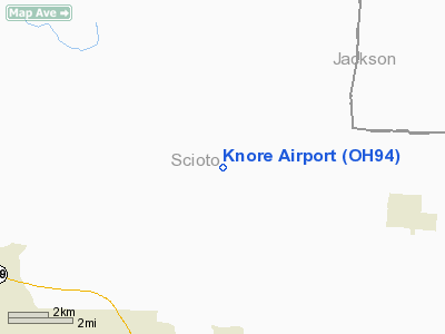
Location & QuickFacts
| FAA Information Effective: | 2008-09-25 |
| Airport Identifier: | OH94 |
| Airport Status: | Operational |
| Longitude/Latitude: | 082-50-05.6120W/38-50-15.2710N
-82.834892/38.837575 (Estimated) |
| Elevation: | 674 ft / 205.44 m (Estimated) |
| Land: | 40 acres |
| From nearest city: | 2 nautical miles SE of Minford, OH |
| Location: | Scioto County, OH |
| Magnetic Variation: | 05W (1985) |
Owner & Manager
| Ownership: | Privately owned |
| Owner: | Gordon Knore |
| Address: | 140 Glades Road
Minford, OH 45653 |
| Phone number: | 614-820-2894 |
| Manager: | Gerald Knore |
| Address: | 109 Glades Road
Minford, OH 45653 |
| Phone number: | 614-820-2861 |
Airport Operations and Facilities
| Airport Use: | Private |
| Wind indicator: | Yes |
| Segmented Circle: | No |
| Control Tower: | No |
| Landing fee charge: | No |
| Sectional chart: | Cincinnati |
| Region: | AGL - Great Lakes |
| Boundary ARTCC: | ZID - Indianapolis |
| Tie-in FSS: | DAY - Dayton |
| FSS on Airport: | No |
| FSS Toll Free: | 1-800-WX-BRIEF |
Airport Services
| Airframe Repair: | MAJOR |
| Power Plant Repair: | MAJOR |
Runway Information
Runway 15/33
| Dimension: | 2400 x 100 ft / 731.5 x 30.5 m |
| Surface: | TURF, |
| |
Runway 15 |
Runway 33 |
| Traffic Pattern: | Left | Right |
| Obstruction: | , 400.0 ft from runway | 45 ft trees, 100.0 ft from runway |
|
Runway 17/35
| Dimension: | 1250 x 110 ft / 381.0 x 33.5 m |
| Surface: | TURF, |
| |
Runway 17 |
Runway 35 |
| Traffic Pattern: | Left | Right |
|
Radio Navigation Aids
| ID |
Type |
Name |
Ch |
Freq |
Var |
Dist |
| AJY | FAN MARKER | Ashland | | | 03W | 16.9 nm |
| PMH | NDB | Portsmouth | | 373.00 | 04W | 3.4 nm |
| EOP | NDB | Waverly | | 385.00 | 06W | 20.3 nm |
| PZO | NDB | Peebles | | 329.00 | 02W | 23.6 nm |
| GAS | NDB | Gallipolis | | 420.00 | 07W | 31.5 nm |
| AMT | NDB | West Union | | 359.00 | 04W | 34.1 nm |
| RZT | NDB | Ross County | | 236.00 | 05W | 37.2 nm |
| HOC | NDB | Hillsboro | | 278.00 | 05W | 39.1 nm |
| XW | NDB | Flmng | | 400.00 | 05W | 41.3 nm |
| UGS | NDB | University | | 250.00 | 06W | 41.6 nm |
| CYO | NDB | Circleville | | 366.00 | 05W | 41.8 nm |
| XUB | VOR | Yellow Bud | | 112.50 | 05W | 42.0 nm |
| YRK | VORTAC | York | 075X | 112.80 | 05W | 13.4 nm |
| HNN | VORTAC | Henderson | 106X | 115.90 | 03W | 38.2 nm |
| ECB | VORTAC | Newcombe | 041X | 110.40 | 02W | 41.0 nm |
Remarks
-
- VFR ONLY, RTP R/WS 33& 35.
Images and information placed above are from
http://www.airport-data.com/airport/OH94/
We thank them for the data!
| General Info
|
| Country |
United States
|
| State |
OHIO
|
| FAA ID |
OH94
|
| Latitude |
38-50-15.271N
|
| Longitude |
082-50-05.612W
|
| Elevation |
674 feet
|
| Near City |
MINFORD
|
We don't guarantee the information is fresh and accurate. The data may
be wrong or outdated.
For more up-to-date information please refer to other sources.
|
|


