 |
|
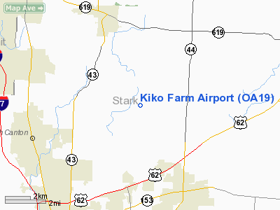
Location & QuickFacts
| FAA Information Effective: | 2008-09-25 |
| Airport Identifier: | OA19 |
| Airport Status: | Operational |
| Longitude/Latitude: | 081-18-00.0000W/40-53-56.0000N
-81.300000/40.898889 (Estimated) |
| Elevation: | 1170 ft / 356.62 m (Estimated) |
| Land: | 0 acres |
| From nearest city: | 1 nautical miles E of North Canton, OH |
| Location: | Stark County, OH |
| Magnetic Variation: | () |
Owner & Manager
| Ownership: | Privately owned |
| Owner: | Richard T. Kiko Sr. |
| Address: | 3656 Werner Church Rd. Ne
North Canton, OH 44721 |
| Phone number: | 330-494-8541 |
| Manager: | Richard T. Kiko Sr. |
| Address: | 3656 Werner Church Rd. Ne
North Canton, OH 44721 |
| Phone number: | 330-495-0932 |
Airport Operations and Facilities
| Airport Use: | Private |
| Wind indicator: | Yes |
| Control Tower: | No |
| Lighting Schedule: | PHONE REQ
FOR LIRL RY 03/21 CALL 330-494-8541 OR 330-495-0932. |
| Sectional chart: | Detroit |
| Region: | AGL - Great Lakes |
| Boundary ARTCC: | ZOB - Cleveland |
| Tie-in FSS: | CLE - Cleveland |
| FSS Toll Free: | 1-800-WX-BRIEF |
Runway Information
Runway 03/21
| Dimension: | 1800 x 80 ft / 548.6 x 24.4 m |
| Surface: | TURF, |
| |
Runway 03 |
Runway 21 |
| Traffic Pattern: | Right | Left |
|
Radio Navigation Aids
| ID |
Type |
Name |
Ch |
Freq |
Var |
Dist |
| AK | NDB | Akron | | 362.00 | 07W | 11.0 nm |
| TSO | NDB | Tolson | | 395.00 | 07W | 22.6 nm |
| MLR | NDB | Millersburg/dcmsnd | | 382.00 | 06W | 33.8 nm |
| HBD | NDB | Hubbard | | 408.00 | 08W | 38.0 nm |
| CL | NDB | Harri | | 344.00 | 07W | 40.1 nm |
| EZE | NDB | Engel | | 226.00 | 07W | 40.3 nm |
| UCP | NDB | Castle | | 272.00 | 09W | 40.8 nm |
| BKL | NDB | Burke Lakefront | | 416.00 | 07W | 41.3 nm |
| CFX | NDB | Cadiz | | 239.00 | 07W | 41.9 nm |
| AAU | NDB | Ashland | | 329.00 | 07W | 43.5 nm |
| LQL | NDB | Lakeland | | 263.00 | 08W | 47.2 nm |
| BSV | VOR/DME | Briggs | 071X | 112.40 | 04W | 11.3 nm |
| ACO | VOR/DME | Akron | 091X | 114.40 | 04W | 13.3 nm |
| CXR | VOR/DME | Chardon | 074X | 112.70 | 05W | 37.7 nm |
| CTW | VOR/DME | Newcomerstown | 055X | 111.80 | 07W | 41.1 nm |
| TVT | VOR/DME | Tiverton | 112X | 116.50 | 03W | 46.1 nm |
| LNN | VOR/DME | Lost Nation | 039X | 110.20 | 08W | 47.4 nm |
| DJB | VOR/DME | Dryer | 083X | 113.60 | 05W | 47.8 nm |
| YNG | VORTAC | Youngstown | 027X | 109.00 | 05W | 38.4 nm |
| EWC | VORTAC | Ellwood City | 105X | 115.80 | 08W | 49.7 nm |
| CAK | VOT | Akron/canton Regional | | 110.60 | | 6.5 nm |
| CLE | VOT | Cleveland | | 110.40 | | 39.5 nm |
Remarks
- THREE RADIO TWRS NW OF ARPT.
- SEE AIRSPACE CASE 2005-AGL-996-NRA.
Images and information placed above are from
http://www.airport-data.com/airport/OA19/
We thank them for the data!
|
|


