 |
|
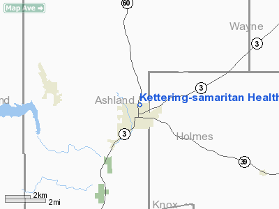
Kettering-samaritan Health Center Heliport |
Location & QuickFacts
| FAA Information Effective: | 2008-09-25 |
| Airport Identifier: | 23OH |
| Airport Status: | Operational |
| Longitude/Latitude: | 082-13-43.5700W/40-38-40.2160N
-82.228769/40.644504 (Estimated) |
| Elevation: | 1100 ft / 335.28 m (Estimated) |
| Land: | 0 acres |
| From nearest city: | 0 nautical miles N of Loudonville, OH |
| Location: | Ashland County, OH |
| Magnetic Variation: | 06W (1985) |
Owner & Manager
| Ownership: | Privately owned |
| Owner: | Kettering-samaritan Hth Ctr |
| Address: | Kettering-samaritan Hth Ctr
Loudonville, OH 44842 |
| Manager: | Barbara Bull |
| Address: | Kettering-samaritan Hth Ctr
Loudonville, OH 44842 |
| Phone number: | 419-994-4121 |
Airport Operations and Facilities
| Airport Use: | Private
MEDICAL USE. |
| Wind indicator: | Yes |
| Segmented Circle: | No |
| Control Tower: | No |
| Landing fee charge: | No |
| Sectional chart: | Detroit |
| Region: | AGL - Great Lakes |
| Boundary ARTCC: | ZOB - Cleveland |
| Tie-in FSS: | CLE - Cleveland |
| FSS on Airport: | No |
| FSS Toll Free: | 1-800-WX-BRIEF |
Airport Services
| Airframe Repair: | NONE |
| Power Plant Repair: | NONE |
Runway Information
Helipad H1
| Dimension: | 20 x 20 ft / 6.1 x 6.1 m |
| Surface: | CONC, |
| |
Runway H1 |
Runway |
| Traffic Pattern: | Left | Left |
| Obstruction: | 60 ft bldg | |
|
Radio Navigation Aids
| ID |
Type |
Name |
Ch |
Freq |
Var |
Dist |
| MF | NDB | Manns | | 372.00 | 06W | 12.3 nm |
| MLR | NDB | Millersburg/dcmsnd | | 382.00 | 06W | 17.4 nm |
| AAU | NDB | Ashland | | 329.00 | 07W | 19.2 nm |
| MNN | NDB | Marion | | 201.00 | 05W | 38.4 nm |
| HEH | NDB | Newark | | 524.00 | 06W | 38.7 nm |
| CL | NDB | Harri | | 344.00 | 07W | 43.4 nm |
| DLZ | NDB | Delaware | | 215.00 | 06W | 45.7 nm |
| AK | NDB | Akron | | 362.00 | 07W | 46.0 nm |
| CM | NDB | Sumie | | 391.00 | 05W | 46.3 nm |
| HRA | NDB | Zanesville | | 204.00 | 06W | 46.6 nm |
| BUD | VOR | Buckeye | | 109.80 | 05W | 38.1 nm |
| TVT | VOR/DME | Tiverton | 112X | 116.50 | 03W | 12.1 nm |
| BSV | VOR/DME | Briggs | 071X | 112.40 | 04W | 36.8 nm |
| CTW | VOR/DME | Newcomerstown | 055X | 111.80 | 07W | 42.5 nm |
| DJB | VOR/DME | Dryer | 083X | 113.60 | 05W | 43.0 nm |
| ZZV | VOR/DME | Zanesville | 051X | 111.40 | 06W | 45.0 nm |
| MFD | VORTAC | Mansfield | 025X | 108.80 | 03W | 21.3 nm |
| APE | VORTAC | Appleton | 114X | 116.70 | 06W | 33.9 nm |
| CAK | VOT | Akron/canton Regional | | 110.60 | | 39.4 nm |
| CLE | VOT | Cleveland | | 110.40 | | 49.2 nm |
| CMH | VOT | Port Columbus | | 111.00 | | 49.3 nm |
Remarks
Images and information placed above are from
http://www.airport-data.com/airport/23OH/
We thank them for the data!
| General Info
|
| Country |
United States
|
| State |
OHIO
|
| FAA ID |
23OH
|
| Latitude |
40-38-40.216N
|
| Longitude |
082-13-43.570W
|
| Elevation |
1100 feet
|
| Near City |
LOUDONVILLE
|
We don't guarantee the information is fresh and accurate. The data may
be wrong or outdated.
For more up-to-date information please refer to other sources.
|
|


