 |
|
Location & QuickFacts
| FAA Information Effective: | 2008-09-25 |
| Airport Identifier: | 08OH |
| Airport Status: | Operational |
| Longitude/Latitude: | 080-33-49.2620W/41-17-30.2000N
-80.563684/41.291722 (Estimated) |
| Elevation: | 1230 ft / 374.90 m (Estimated) |
| Land: | 0 acres |
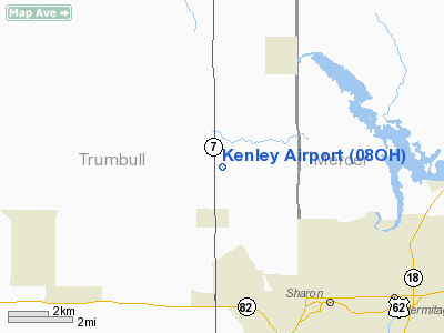
| From nearest city: | 1 nautical miles S of Hartford, OH |
| Location: | Trumbull County, OH |
| Magnetic Variation: | 07W (1985) |
Owner & Manager
| Ownership: | Privately owned |
| Owner: | Frank Kenley |
| Address: | Box 1
Hartford, OH 44424 |
| Phone number: | 216-772-4825 |
| Address: |
|
Airport Operations and Facilities
| Airport Use: | Private |
| Wind indicator: | Yes |
| Segmented Circle: | No |
| Control Tower: | No |
| Landing fee charge: | No |
| Sectional chart: | Detroit |
| Region: | AGL - Great Lakes |
| Boundary ARTCC: | ZOB - Cleveland |
| Tie-in FSS: | CLE - Cleveland |
| FSS on Airport: | No |
| FSS Toll Free: | 1-800-WX-BRIEF |
Airport Services
| Airframe Repair: | NONE |
| Power Plant Repair: | NONE |
Runway Information
Runway E/W
| Dimension: | 3000 x 50 ft / 914.4 x 15.2 m |
| Surface: | TURF, |
| |
Runway E |
Runway W |
| Traffic Pattern: | Left | Left |
| Obstruction: | 30 ft pline, 75.0 ft from runway | 30 ft trees, 100.0 ft from runway |
|
Radio Navigation Aids
| ID |
Type |
Name |
Ch |
Freq |
Var |
Dist |
| HBD | NDB | Hubbard | | 408.00 | 08W | 8.5 nm |
| UCP | NDB | Castle | | 272.00 | 09W | 17.5 nm |
| AK | NDB | Akron | | 362.00 | 07W | 39.6 nm |
| LQL | NDB | Lakeland | | 263.00 | 08W | 43.6 nm |
| TSO | NDB | Tolson | | 395.00 | 07W | 49.7 nm |
| FKL | VOR | Franklin | | 109.60 | 06W | 33.1 nm |
| JFN | VOR/DME | Jefferson | 099X | 115.20 | 05W | 29.4 nm |
| CXR | VOR/DME | Chardon | 074X | 112.70 | 05W | 30.2 nm |
| ACO | VOR/DME | Akron | 091X | 114.40 | 04W | 30.9 nm |
| LNN | VOR/DME | Lost Nation | 039X | 110.20 | 08W | 44.0 nm |
| YNG | VORTAC | Youngstown | 027X | 109.00 | 05W | 5.5 nm |
| EWC | VORTAC | Ellwood City | 105X | 115.80 | 08W | 32.3 nm |
| ERI | VORTAC | Erie | 031X | 109.40 | 06W | 45.3 nm |
| CAK | VOT | Akron/canton Regional | | 110.60 | | 45.7 nm |
Remarks
- VFR WEATHER CONDITIONS ONLY.
Images and information placed above are from
http://www.airport-data.com/airport/08OH/
We thank them for the data!
| General Info
|
| Country |
United States
|
| State |
OHIO
|
| FAA ID |
08OH
|
| Latitude |
41-17-30.200N
|
| Longitude |
080-33-49.262W
|
| Elevation |
1230 feet
|
| Near City |
HARTFORD
|
We don't guarantee the information is fresh and accurate. The data may
be wrong or outdated.
For more up-to-date information please refer to other sources.
|
|


