 |
|
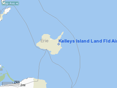
Kelleys Island Land Fld Airport |
Location & QuickFacts
| FAA Information Effective: | 2008-09-25 |
| Airport Identifier: | 89D |
| Airport Status: | Operational |
| Longitude/Latitude: | 082-41-04.6500W/41-36-10.1730N
-82.684625/41.602826 (Estimated) |
| Elevation: | 598 ft / 182.27 m (Surveyed) |
| Land: | 17 acres |
| From nearest city: | 1 nautical miles NE of Kelleys Island, OH |
| Location: | Erie County, OH |
| Magnetic Variation: | 07W (2000) |
Owner & Manager
| Ownership: | Publicly owned |
| Owner: | Village Of Kelleys Island |
| Address: | 121 Addison St.
Kelleys Island, OH 43438 |
| Phone number: | 419-746-1123 |
| Manager: | Bob Quinn |
| Address: | P.o. Box 523.
Kelleys Island, OH 43438 |
| Phone number: | 419-746-1123 |
Airport Operations and Facilities
| Airport Use: | Open to public |
| Wind indicator: | Yes |
| Segmented Circle: | No |
| Control Tower: | No |
| Lighting Schedule: | DUSK-DAWN |
| Landing fee charge: | Yes |
| Sectional chart: | Detroit |
| Region: | AGL - Great Lakes |
| Boundary ARTCC: | ZOB - Cleveland |
| Tie-in FSS: | CLE - Cleveland |
| FSS on Airport: | No |
| FSS Toll Free: | 1-800-WX-BRIEF |
| NOTAMs Facility: | CLE (NOTAM-d service avaliable) |
| Federal Agreements: | N |
Airport Communications
Airport Services
| Airframe Repair: | NONE |
| Power Plant Repair: | NONE |
| Bottled Oxygen: | NONE |
| Bulk Oxygen: | NONE |
Runway Information
Runway 09/27
| Dimension: | 2203 x 50 ft / 671.5 x 15.2 m |
| Surface: | ASPH, Poor Condition
RWY 09/27 PAVEMENT POOR - WEATHERED WITH CRACKS. |
| Edge Lights: | Low |
| |
Runway 09 |
Runway 27 |
| Longitude: | 082-41-15.2900W | 082-40-45.9300W |
| Latitude: | 41-36-11.5000N | 41-36-11.5000N |
| Elevation: | 598.00 ft | 598.00 ft |
| Traffic Pattern: | Left | Left |
| Markings: | Basic, Good Condition
RWY 09 MARKINGS FADED. | Basic, Good Condition |
| Runway End Identifier: | No | No |
| Centerline Lights: | No | No |
| Touchdown Lights: | No | No |
| Obstruction: | 58 ft trees, 201.0 ft from runway, 112 ft right of centerline
RWY 09 +10 FT RD 12 FT FM RY END 125 FT L&R; +58 FT TREES 69-200 FT FM RY END 112 R FT - 125 FT R; +8 FT SIGN 5 FT FM RY END. | 42 ft tree, 260.0 ft from runway, 93 ft left of centerline, 1:1 slope to clear
RWY 27 +69 FT TREES 0-185 FT FM RY END 70-125 FT L; +64 FT TREES 130 FT FM RY END 70 FT R. |
|
Runway 18/36
| Dimension: | 2270 x 35 ft / 691.9 x 10.7 m |
| Surface: | ASPH, Fair Condition
RWY 09/27 PAVEMENT POOR - WEATHERED WITH CRACKS. |
| Edge Lights: | Low |
| |
Runway 18 |
Runway 36 |
| Longitude: | 082-41-08.3200W | 082-41-08.3200W |
| Latitude: | 41-36-19.0400N | 41-35-56.6100N |
| Elevation: | 598.00 ft | 598.00 ft |
| Alignment: | 127 | 0 |
| Traffic Pattern: | Left | Left |
| Markings: | Basic, Good Condition | Basic, Good Condition |
| Runway End Identifier: | No | No |
| Centerline Lights: | No | No |
| Touchdown Lights: | No | No |
| Obstruction: | 15 ft bldg, 201.0 ft from runway, 95 ft left of centerline
RWY 18 +40 FT TREE 0 FT FM 105 FT L; +10 FT ROAD 21 FT FM 125 L/R; +29 FT PP 45 FT FM 90 FT L; +15 BLD 156 FT FM 93 FT L. | 57 ft trees, 247.0 ft from runway, 121 ft right of centerline
RWY 36 +10 FT RD 0 FT FM RWY BOTH L AND R. |
|
Radio Navigation Aids
| ID |
Type |
Name |
Ch |
Freq |
Var |
Dist |
| PCW | NDB | Port Clinton | | 423.00 | 06W | 9.7 nm |
| PT | NDB | Pelee Island | | 283.00 | 05W | 10.6 nm |
| CL | NDB | Harri | | 344.00 | 07W | 36.1 nm |
| RYS | NDB | Grosse Ile | | 419.00 | 06W | 36.6 nm |
| TII | NDB | Tiffin | | 269.00 | 05W | 38.4 nm |
| FZI | NDB | Fostoria | | 379.00 | 05W | 40.6 nm |
| G | NDB | Golf | | 398.00 | 05W | 41.8 nm |
| AAU | NDB | Ashland | | 329.00 | 07W | 43.1 nm |
| QG | NDB | Windsor | | 353.00 | 06W | 43.5 nm |
| EZE | NDB | Engel | | 226.00 | 07W | 43.8 nm |
| BKL | NDB | Burke Lakefront | | 416.00 | 07W | 46.1 nm |
| VQ | NDB | Cargl | | 230.00 | 05W | 46.9 nm |
| SKY | VOR/DME | Sandusky | 029X | 109.20 | 04W | 10.2 nm |
| DJB | VOR/DME | Dryer | 083X | 113.60 | 05W | 27.8 nm |
| YQG | VOR/DME | Windsor | 085X | 113.80 | 06W | 39.4 nm |
| VWV | VOR/DME | Waterville | 078X | 113.10 | 02W | 43.9 nm |
| DXO | VOR/DME | Detroit | 081X | 113.40 | 06W | 47.7 nm |
| CRL | VORTAC | Carleton | 104X | 115.70 | 03W | 43.8 nm |
| MFD | VORTAC | Mansfield | 025X | 108.80 | 03W | 44.3 nm |
| CLE | VOT | Cleveland | | 110.40 | | 39.4 nm |
| DTW | VOT | Detroit Met Wayne | | 109.80 | | 48.3 nm |
Remarks
Images and information placed above are from
http://www.airport-data.com/airport/89D/
We thank them for the data!
| General Info
|
| Country |
United States
|
| State |
OHIO
|
| FAA ID |
89D
|
| Latitude |
41-36-10.173N
|
| Longitude |
082-41-04.650W
|
| Elevation |
598 feet
|
| Near City |
KELLEYS ISLAND
|
We don't guarantee the information is fresh and accurate. The data may
be wrong or outdated.
For more up-to-date information please refer to other sources.
|
|


