 |
|
Location & QuickFacts
| FAA Information Effective: | 2008-09-25 |
| Airport Identifier: | 7OH6 |
| Airport Status: | Operational |
| Longitude/Latitude: | 081-31-07.0000W/41-08-45.0000N
-81.518611/41.145833 (Estimated) |
| Elevation: | 1020 ft / 310.90 m (Estimated) |
| Land: | 0 acres |
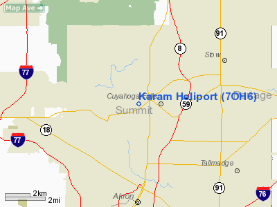
| From nearest city: | 8 nautical miles S of Cuyahoga Falls, OH |
| Location: | Summit County, OH |
| Magnetic Variation: | () |
Owner & Manager
| Ownership: | Privately owned |
| Owner: | Daniel E. Karam |
| Address: | 207 W Portage Trail
Cuyahoga Falls, OH 44223 |
| Phone number: | 330-571-0496 |
| Manager: | Daniel E. Karam |
| Address: | 207 W Portage Trail
Cuyahoga Falls, OH 44223 |
| Phone number: | 330-571-0496 |
Airport Operations and Facilities
| Airport Use: | Private |
| Wind indicator: | Yes |
| Control Tower: | No |
| Sectional chart: | Detroit |
| Region: | AGL - Great Lakes |
| Boundary ARTCC: | ZOB - Cleveland |
| Tie-in FSS: | CLE - Cleveland |
| FSS Toll Free: | 1-800-WX-BRIEF |
Runway Information
Helipad H1
| Dimension: | 40 x 20 ft / 12.2 x 6.1 m |
| Surface: | ASPH, |
| |
Runway H1 |
Runway |
| Traffic Pattern: | Left | Left |
|
Radio Navigation Aids
| ID |
Type |
Name |
Ch |
Freq |
Var |
Dist |
| AK | NDB | Akron | | 362.00 | 07W | 7.5 nm |
| EZE | NDB | Engel | | 226.00 | 07W | 22.6 nm |
| CL | NDB | Harri | | 344.00 | 07W | 23.2 nm |
| BKL | NDB | Burke Lakefront | | 416.00 | 07W | 23.9 nm |
| LQL | NDB | Lakeland | | 263.00 | 08W | 32.9 nm |
| AAU | NDB | Ashland | | 329.00 | 07W | 35.1 nm |
| MLR | NDB | Millersburg/dcmsnd | | 382.00 | 06W | 39.7 nm |
| TSO | NDB | Tolson | | 395.00 | 07W | 40.4 nm |
| HBD | NDB | Hubbard | | 408.00 | 08W | 44.7 nm |
| MF | NDB | Manns | | 372.00 | 06W | 47.8 nm |
| ACO | VOR/DME | Akron | 091X | 114.40 | 04W | 14.5 nm |
| BSV | VOR/DME | Briggs | 071X | 112.40 | 04W | 24.7 nm |
| CXR | VOR/DME | Chardon | 074X | 112.70 | 05W | 27.5 nm |
| DJB | VOR/DME | Dryer | 083X | 113.60 | 05W | 31.7 nm |
| LNN | VOR/DME | Lost Nation | 039X | 110.20 | 08W | 32.9 nm |
| TVT | VOR/DME | Tiverton | 112X | 116.50 | 03W | 49.7 nm |
| YNG | VORTAC | Youngstown | 027X | 109.00 | 05W | 39.7 nm |
| CAK | VOT | Akron/canton Regional | | 110.60 | | 14.2 nm |
| CLE | VOT | Cleveland | | 110.40 | | 21.8 nm |
Remarks
- PRVDD COORDINATE FUTURE PLANNING AND INSTALLATION OF NON-FED NAVAIDS WITH AGL AIRWAYS FACILITY.
Images and information placed above are from
http://www.airport-data.com/airport/7OH6/
We thank them for the data!
| General Info
|
| Country |
United States
|
| State |
OHIO
|
| FAA ID |
7OH6
|
| Latitude |
40-42-40.214N
|
| Longitude |
081-23-49.414W
|
| Elevation |
1079 feet
|
| Near City |
CANTON
|
We don't guarantee the information is fresh and accurate. The data may
be wrong or outdated.
For more up-to-date information please refer to other sources.
|
|


