 |
|
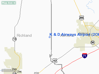
Location & QuickFacts
| FAA Information Effective: | 2008-09-25 |
| Airport Identifier: | 2OI8 |
| Airport Status: | Operational |
| Longitude/Latitude: | 082-25-14.0000W/40-51-50.0000N
-82.420556/40.863889 (Estimated) |
| Elevation: | 1248 ft / 380.39 m (Estimated) |
| Land: | 23 acres |
| From nearest city: | 6 nautical miles E of Mansfield, OH |
| Location: | Richland County, OH |
| Magnetic Variation: | () |
Owner & Manager
| Ownership: | Privately owned |
| Owner: | Tanya Davis |
| Address: | 4055 Faulk Rd
Ashland, OH 44805 |
| Phone number: | 419-589-8356 |
| Manager: | Tanya Davis |
| Address: | 4055 Faulk Rd
Ashland, OH 44805 |
| Phone number: | 419-589-8356 |
Airport Operations and Facilities
| Airport Use: | Private |
| Wind indicator: | Yes |
| Control Tower: | No |
| Sectional chart: | Detroit |
| Region: | AGL - Great Lakes |
| Boundary ARTCC: | ZOB - Cleveland |
| Tie-in FSS: | CLE - Cleveland |
| FSS Toll Free: | 1-800-WX-BRIEF |
Runway Information
Runway 18/36
| Dimension: | 2300 x 80 ft / 701.0 x 24.4 m |
| Surface: | TURF, |
| |
Runway 18 |
Runway 36 |
| Traffic Pattern: | Left | Left |
| Obstruction: | 30 ft trees, 200.0 ft from runway | 18 ft pline, 1000.0 ft from runway |
|
Radio Navigation Aids
| ID |
Type |
Name |
Ch |
Freq |
Var |
Dist |
| MF | NDB | Manns | | 372.00 | 06W | 6.0 nm |
| AAU | NDB | Ashland | | 329.00 | 07W | 9.7 nm |
| MLR | NDB | Millersburg/dcmsnd | | 382.00 | 06W | 31.6 nm |
| MNN | NDB | Marion | | 201.00 | 05W | 33.1 nm |
| CL | NDB | Harri | | 344.00 | 07W | 35.2 nm |
| TII | NDB | Tiffin | | 269.00 | 05W | 38.4 nm |
| PCW | NDB | Port Clinton | | 423.00 | 06W | 44.3 nm |
| DLZ | NDB | Delaware | | 215.00 | 06W | 47.1 nm |
| FZI | NDB | Fostoria | | 379.00 | 05W | 48.4 nm |
| AK | NDB | Akron | | 362.00 | 07W | 48.5 nm |
| EZE | NDB | Engel | | 226.00 | 07W | 49.1 nm |
| BUD | VOR | Buckeye | | 109.80 | 05W | 32.9 nm |
| TVT | VOR/DME | Tiverton | 112X | 116.50 | 03W | 27.8 nm |
| DJB | VOR/DME | Dryer | 083X | 113.60 | 05W | 31.9 nm |
| SKY | VOR/DME | Sandusky | 029X | 109.20 | 04W | 35.9 nm |
| BSV | VOR/DME | Briggs | 071X | 112.40 | 04W | 45.6 nm |
| MFD | VORTAC | Mansfield | 025X | 108.80 | 03W | 7.8 nm |
| APE | VORTAC | Appleton | 114X | 116.70 | 06W | 43.5 nm |
| CLE | VOT | Cleveland | | 110.40 | | 41.8 nm |
| CAK | VOT | Akron/canton Regional | | 110.60 | | 44.6 nm |
Remarks
- PRVDD CLEAR 20:1 APCHD, AIRFIELD IS LCTD WITHIN OR NEAR A MIL TRNG RT, BE ALERT FOR NEARBY ACTIVE CONNER ARPT.
Images and information placed above are from
http://www.airport-data.com/airport/2OI8/
We thank them for the data!
|
|


