 |
|
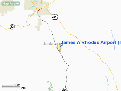
Location & QuickFacts
| FAA Information Effective: | 2008-09-25 |
| Airport Identifier: | I43 |
| Airport Status: | Operational |
| Longitude/Latitude: | 082-34-40.2610W/38-58-52.8966N
-82.577850/38.981360 (Estimated) |
| Elevation: | 726 ft / 221.28 m (Surveyed) |
| Land: | 91 acres |
| From nearest city: | 5 nautical miles SE of Jackson, OH |
| Location: | Jackson County, OH |
| Magnetic Variation: | 05W (1985) |
Owner & Manager
| Ownership: | Publicly owned |
| Owner: | Jackson Co Comm |
| Address: | 135 Broadway Street
Jackson, OH 45640 |
| Phone number: | 740-286-3522 |
| Manager: | William D. Freeland |
| Address: | 1800 Keystone Station Road
Jackson, OH 45640 |
| Phone number: | 740-286-0137 |
Airport Operations and Facilities
| Airport Use: | Open to public |
| Wind indicator: | Yes |
| Segmented Circle: | No |
| Control Tower: | No |
| Lighting Schedule: | DUSK-DAWN
MIRL RY 01/19 PRESET LOW INTST DUSK-DAWN, TO INCR INTST & ACTVT - CTAF. |
| Beacon Color: | Clear-Green (lighted land airport) |
| Landing fee charge: | No |
| Sectional chart: | Cincinnati |
| Region: | AGL - Great Lakes |
| Boundary ARTCC: | ZID - Indianapolis |
| Tie-in FSS: | DAY - Dayton |
| FSS on Airport: | No |
| FSS Toll Free: | 1-800-WX-BRIEF |
| NOTAMs Facility: | DAY (NOTAM-d service avaliable) |
| Federal Agreements: | N |
Airport Communications
| CTAF: | 122.700 |
| Unicom: | 122.700 |
Airport Services
| Fuel available: | 100LLA1+ |
| Airframe Repair: | MAJOR |
| Power Plant Repair: | MAJOR |
| Bottled Oxygen: | NONE |
| Bulk Oxygen: | NONE |
Runway Information
Runway 01/19
| Dimension: | 5201 x 75 ft / 1585.3 x 22.9 m |
| Surface: | ASPH, Fair Condition |
| Edge Lights: | Medium |
| |
Runway 01 |
Runway 19 |
| Longitude: | 082-34-43.1689W | 082-34-37.3525W |
| Latitude: | 38-58-27.2926N | 38-59-18.5006N |
| Elevation: | 722.00 ft | 726.00 ft |
| Alignment: | 5 | 127 |
| Traffic Pattern: | Left | Left |
| Markings: | Non-precision instrument, Good Condition | Non-precision instrument, Good Condition |
| Displaced threshold: | 331.00 ft | 0.00 ft |
| VASI: | | 2-box SAVASI on left side |
| Runway End Identifier: | No | Yes
REIL OTS INDEFLY. |
| Centerline Lights: | No | No |
| Touchdown Lights: | No | No |
| Obstruction: | 73 ft tree, 899.0 ft from runway, 195 ft right of centerline, 10:1 slope to clear
RWY 01 APCH RATIO 0:1 TO DSPLCD THLD DUE TO ADD. OBST. +88' TREES 0'FM. DIS. THR. 193'L. | 38 ft pline, 201.0 ft from runway, 213 ft right of centerline |
|
Radio Navigation Aids
| ID |
Type |
Name |
Ch |
Freq |
Var |
Dist |
| AJY | FAN MARKER | Ashland | | | 03W | 27.4 nm |
| PMH | NDB | Portsmouth | | 373.00 | 04W | 17.3 nm |
| EOP | NDB | Waverly | | 385.00 | 06W | 19.9 nm |
| GAS | NDB | Gallipolis | | 420.00 | 07W | 21.4 nm |
| UGS | NDB | University | | 250.00 | 06W | 26.8 nm |
| RZT | NDB | Ross County | | 236.00 | 05W | 34.6 nm |
| PZO | NDB | Peebles | | 329.00 | 02W | 35.2 nm |
| CYO | NDB | Circleville | | 366.00 | 05W | 37.6 nm |
| HOC | NDB | Hillsboro | | 278.00 | 05W | 46.7 nm |
| AMT | NDB | West Union | | 359.00 | 04W | 46.7 nm |
| XUB | VOR | Yellow Bud | | 112.50 | 05W | 37.7 nm |
| YRK | VORTAC | York | 075X | 112.80 | 05W | 27.6 nm |
| HNN | VORTAC | Henderson | 106X | 115.90 | 03W | 29.2 nm |
Remarks
Images and information placed above are from
http://www.airport-data.com/airport/I43/
We thank them for the data!
| General Info
|
| Country |
United States
|
| State |
OHIO
|
| FAA ID |
I43
|
| Latitude |
38-58-52.867N
|
| Longitude |
082-34-40.284W
|
| Elevation |
726 feet
|
| Near City |
JACKSON
|
We don't guarantee the information is fresh and accurate. The data may
be wrong or outdated.
For more up-to-date information please refer to other sources.
|
|


