 |
|
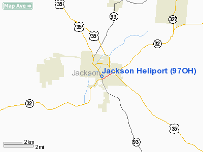
Location & QuickFacts
| FAA Information Effective: | 2008-09-25 |
| Airport Identifier: | 97OH |
| Airport Status: | Operational |
| Longitude/Latitude: | 082-37-40.5920W/39-02-29.2610N
-82.627942/39.041461 (Estimated) |
| Elevation: | 706 ft / 215.19 m (Estimated) |
| Land: | 0 acres |
| From nearest city: | 0 nautical miles N of Jackson, OH |
| Location: | Jackson County, OH |
| Magnetic Variation: | 05W (1990) |
Owner & Manager
| Ownership: | Publicly owned |
| Owner: | City Of Jackson |
| Address: | Memorial Building
Jackson, OH 45640 |
| Phone number: | 614-286-3224
ALSO CITY PHONE 614-286-2201. |
| Address: |
|
Airport Operations and Facilities
| Airport Use: | Private |
| Wind indicator: | Yes |
| Segmented Circle: | No |
| Control Tower: | No |
| Lighting Schedule: | RDO-CTL
ACTVT ARPT BCN - 123.05. |
| Beacon Color: | Clear-Green-Yellow (heliport) |
| Sectional chart: | Cincinnati |
| Region: | AGL - Great Lakes |
| Boundary ARTCC: | ZID - Indianapolis |
| Tie-in FSS: | DAY - Dayton |
| FSS Toll Free: | 1-800-WX-BRIEF |
Runway Information
Helipad H1
| Dimension: | 24 x 24 ft / 7.3 x 7.3 m |
| Surface: | CONC, |
| |
Runway H1 |
Runway |
| Traffic Pattern: | Left | Left |
|
Radio Navigation Aids
| ID |
Type |
Name |
Ch |
Freq |
Var |
Dist |
| AJY | FAN MARKER | Ashland | | | 03W | 30.1 nm |
| EOP | NDB | Waverly | | 385.00 | 06W | 16.1 nm |
| PMH | NDB | Portsmouth | | 373.00 | 04W | 18.6 nm |
| GAS | NDB | Gallipolis | | 420.00 | 07W | 25.1 nm |
| UGS | NDB | University | | 250.00 | 06W | 26.8 nm |
| RZT | NDB | Ross County | | 236.00 | 05W | 30.3 nm |
| CYO | NDB | Circleville | | 366.00 | 05W | 33.3 nm |
| PZO | NDB | Peebles | | 329.00 | 02W | 33.4 nm |
| HOC | NDB | Hillsboro | | 278.00 | 05W | 43.5 nm |
| AMT | NDB | West Union | | 359.00 | 04W | 45.1 nm |
| CSS | NDB | Court House | | 414.00 | 05W | 48.9 nm |
| LCK | TACAN | Rickenbacker | 069X | | 05W | 48.2 nm |
| XUB | VOR | Yellow Bud | | 112.50 | 05W | 33.4 nm |
| YRK | VORTAC | York | 075X | 112.80 | 05W | 29.0 nm |
| HNN | VORTAC | Henderson | 106X | 115.90 | 03W | 33.0 nm |
Remarks
- APCH/DEP OPNS ARE CONDUCTED FM 305 DEG TO 180 DEG; AREA IS MARKED; WIND INDICATOR IS MAINT.
Images and information placed above are from
http://www.airport-data.com/airport/97OH/
We thank them for the data!
| General Info
|
| Country |
United States
|
| State |
OHIO
|
| FAA ID |
97OH
|
| Latitude |
39-02-29.261N
|
| Longitude |
082-37-40.592W
|
| Elevation |
706 feet
|
| Near City |
JACKSON
|
We don't guarantee the information is fresh and accurate. The data may
be wrong or outdated.
For more up-to-date information please refer to other sources.
|
|


