 |
|
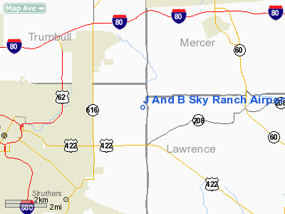
J And B Sky Ranch Airport |
Location & QuickFacts
| FAA Information Effective: | 2008-09-25 |
| Airport Identifier: | 8OH3 |
| Airport Status: | Operational |
| Longitude/Latitude: | 080-31-21.2530W/41-07-02.2080N
-80.522570/41.117280 (Estimated) |
| Elevation: | 1125 ft / 342.90 m (Estimated) |
| Land: | 0 acres |
| From nearest city: | 3 nautical miles NE of Coitsville, OH |
| Location: | Mahoning County, OH |
| Magnetic Variation: | 07W (1985) |
Owner & Manager
| Ownership: | Privately owned |
| Owner: | Dean Steiner |
| Address: | 6700 Johnson Rd
Lowellville, OH 44436 |
| Phone number: | 216-534-0766 |
| Manager: | Dean Steiner |
| Address: | 6700 Johnson Rd
Lowellville, OH 44436 |
Airport Operations and Facilities
| Airport Use: | Private |
| Wind indicator: | Yes |
| Segmented Circle: | No |
| Control Tower: | No |
| Landing fee charge: | No |
| Sectional chart: | Detroit |
| Region: | AGL - Great Lakes |
| Boundary ARTCC: | ZOB - Cleveland |
| Tie-in FSS: | CLE - Cleveland |
| FSS on Airport: | No |
| FSS Toll Free: | 1-800-WX-BRIEF |
Airport Services
| Airframe Repair: | NONE |
| Power Plant Repair: | NONE |
Runway Information
Runway N/S
| Dimension: | 1800 x 65 ft / 548.6 x 19.8 m |
| Surface: | TURF, |
| |
Runway N |
Runway S |
| Traffic Pattern: | Left | Right |
|
Radio Navigation Aids
| ID |
Type |
Name |
Ch |
Freq |
Var |
Dist |
| HBD | NDB | Hubbard | | 408.00 | 08W | 2.2 nm |
| UCP | NDB | Castle | | 272.00 | 09W | 7.4 nm |
| AK | NDB | Akron | | 362.00 | 07W | 39.3 nm |
| TSO | NDB | Tolson | | 395.00 | 07W | 41.8 nm |
| FKL | VOR | Franklin | | 109.60 | 06W | 35.7 nm |
| ACO | VOR/DME | Akron | 091X | 114.40 | 04W | 30.8 nm |
| CXR | VOR/DME | Chardon | 074X | 112.70 | 05W | 37.6 nm |
| JFN | VOR/DME | Jefferson | 099X | 115.20 | 05W | 40.0 nm |
| BSV | VOR/DME | Briggs | 071X | 112.40 | 04W | 47.1 nm |
| CIP | VOR/DME | Clarion | 076X | 112.90 | 06W | 48.2 nm |
| YNG | VORTAC | Youngstown | 027X | 109.00 | 05W | 14.6 nm |
| EWC | VORTAC | Ellwood City | 105X | 115.80 | 08W | 22.5 nm |
| MMJ | VORTAC | Montour | 057X | 112.00 | 08W | 40.7 nm |
| CAK | VOT | Akron/canton Regional | | 110.60 | | 43.4 nm |
Remarks
Images and information placed above are from
http://www.airport-data.com/airport/8OH3/
We thank them for the data!
| General Info
|
| Country |
United States
|
| State |
OHIO
|
| FAA ID |
8OH3
|
| Latitude |
41-07-02.208N
|
| Longitude |
080-31-21.253W
|
| Elevation |
1125 feet
|
| Near City |
COITSVILLE
|
We don't guarantee the information is fresh and accurate. The data may
be wrong or outdated.
For more up-to-date information please refer to other sources.
|
|


