 |
|
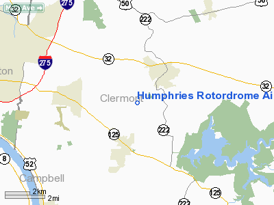
Humphries Rotordrome Airport |
Location & QuickFacts
| FAA Information Effective: | 2008-09-25 |
| Airport Identifier: | OH33 |
| Airport Status: | Operational |
| Longitude/Latitude: | 084-12-14.7680W/39-03-24.2260N
-84.204102/39.056729 (Estimated) |
| Elevation: | 840 ft / 256.03 m (Estimated) |
| Land: | 0 acres |
| From nearest city: | 2 nautical miles NE of Amelia, OH |
| Location: | Clermont County, OH |
| Magnetic Variation: | 04W (1985) |
Owner & Manager
| Ownership: | Privately owned |
| Owner: | H. Humphries |
| Address: | 486 Apple Rd
Amelia, OH 45102 |
| Phone number: | 513-732-1974 |
| Address: |
|
Airport Operations and Facilities
| Airport Use: | Private |
| Wind indicator: | Yes |
| Segmented Circle: | No |
| Control Tower: | No |
| Landing fee charge: | No |
| Sectional chart: | Cincinnati |
| Region: | AGL - Great Lakes |
| Boundary ARTCC: | ZID - Indianapolis |
| Tie-in FSS: | DAY - Dayton |
| FSS Toll Free: | 1-800-WX-BRIEF |
Airport Services
| Airframe Repair: | NONE |
| Power Plant Repair: | NONE |
Runway Information
Runway 17/35
| Dimension: | 2150 x 65 ft / 655.3 x 19.8 m |
| Surface: | TURF, |
| |
Runway 17 |
Runway 35 |
| Traffic Pattern: | Right | Right |
|
Radio Navigation Aids
| ID |
Type |
Name |
Ch |
Freq |
Var |
Dist |
| PWF | NDB | Sportys | | 245.00 | 04W | 1.3 nm |
| LUK | NDB | Cincinnati | | 335.00 | 04W | 8.9 nm |
| MDE | NDB | Madeira | | 379.00 | 04W | 12.2 nm |
| ISZ | NDB | Cincinnati-blue Ash | | 388.00 | 04W | 14.4 nm |
| HW | NDB | Cubla | | 299.00 | 04W | 23.5 nm |
| HAO | NDB | Hamilton | | 260.00 | 04W | 25.6 nm |
| UR | NDB | Burln | | 321.00 | 04W | 26.6 nm |
| HKF | NDB | Hook Field | | 239.00 | 04W | 28.9 nm |
| HOC | NDB | Hillsboro | | 278.00 | 05W | 31.8 nm |
| AMT | NDB | West Union | | 359.00 | 04W | 32.3 nm |
| IL | NDB | Airbo | | 407.00 | 04W | 34.0 nm |
| OXD | NDB | Oxford | | 282.00 | 04W | 38.1 nm |
| XW | NDB | Flmng | | 400.00 | 05W | 39.0 nm |
| XEN | NDB | Xenia | | 395.00 | 03W | 41.6 nm |
| PZO | NDB | Peebles | | 329.00 | 02W | 41.8 nm |
| CSS | NDB | Court House | | 414.00 | 05W | 50.0 nm |
| FFO | TACAN | Patterson | 099X | | 04W | 46.3 nm |
| XSF | TACAN | Springfield | 065X | | 04W | 49.9 nm |
| FLM | VOR/DME | Falmouth | 117X | 117.00 | 04W | 25.0 nm |
| MXQ | VOR/DME | Midwest | 076X | 112.90 | 04W | 29.2 nm |
| SGH | VOR/DME | Springfield | 079X | 113.20 | 04W | 49.7 nm |
| CVG | VORTAC | Cincinnati | 120X | 117.30 | 04W | 23.4 nm |
| LUK | VOT | Cincinnati Muni/lunken | | 108.40 | | 9.8 nm |
Remarks
- VFR WEATHER CONDITIONS ONLY.
Images and information placed above are from
http://www.airport-data.com/airport/OH33/
We thank them for the data!
| General Info
|
| Country |
United States
|
| State |
OHIO
|
| FAA ID |
OH33
|
| Latitude |
39-03-24.226N
|
| Longitude |
084-12-14.768W
|
| Elevation |
840 feet
|
| Near City |
AMELIA
|
We don't guarantee the information is fresh and accurate. The data may
be wrong or outdated.
For more up-to-date information please refer to other sources.
|
|


