 |
|
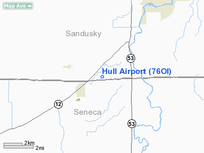
Location & QuickFacts
| FAA Information Effective: | 2008-09-25 |
| Airport Identifier: | 76OI |
| Airport Status: | Operational |
| Longitude/Latitude: | 083-12-21.7150W/41-15-26.1920N
-83.206032/41.257276 (Estimated) |
| Elevation: | 687 ft / 209.40 m (Estimated) |
| Land: | 3 acres |
| From nearest city: | 2 nautical miles SE of Bettsville, OH |
| Location: | Sandusky County, OH |
| Magnetic Variation: | 05W (1985) |
Owner & Manager
| Ownership: | Privately owned |
| Owner: | James R. Hull |
| Address: | 6966 N Twp Rd 156
Kansas, OH 44841 |
| Phone number: | 419-986-5646 |
| Manager: | James R. Hull |
| Address: | 2087 Cr 7
Fremont, OH 43420 |
| Phone number: | 419-986-5154 |
Airport Operations and Facilities
| Airport Use: | Private |
| Wind indicator: | Yes |
| Segmented Circle: | No |
| Control Tower: | No |
| Sectional chart: | Detroit |
| Region: | AGL - Great Lakes |
| Boundary ARTCC: | ZOB - Cleveland |
| Tie-in FSS: | CLE - Cleveland |
| FSS Toll Free: | 1-800-WX-BRIEF |
Runway Information
Runway 18/36
| Dimension: | 2400 x 50 ft / 731.5 x 15.2 m |
| Surface: | TURF, |
| |
Runway 18 |
Runway 36 |
| Traffic Pattern: | Left | Left |
|
Radio Navigation Aids
| ID |
Type |
Name |
Ch |
Freq |
Var |
Dist |
| FZI | NDB | Fostoria | | 379.00 | 05W | 9.5 nm |
| TII | NDB | Tiffin | | 269.00 | 05W | 9.6 nm |
| PCW | NDB | Port Clinton | | 423.00 | 06W | 21.9 nm |
| BNR | NDB | Benton Ridge | | 334.00 | 05W | 25.3 nm |
| PDR | NDB | Ottawa | | 233.00 | 05W | 37.4 nm |
| MNN | NDB | Marion | | 201.00 | 05W | 39.0 nm |
| PT | NDB | Pelee Island | | 283.00 | 05W | 39.6 nm |
| MF | NDB | Manns | | 372.00 | 06W | 45.4 nm |
| AAU | NDB | Ashland | | 329.00 | 07W | 46.6 nm |
| USE | NDB | Fulton | | 375.00 | 05W | 46.8 nm |
| LYL | NDB | Lima | | 362.00 | 04W | 49.8 nm |
| TOL | TACAN | Toledo | 072X | | 05W | 33.5 nm |
| MAH | VOR | Marathon | | 114.90 | 05W | 25.4 nm |
| BUD | VOR | Buckeye | | 109.80 | 05W | 39.0 nm |
| AOH | VOR | Allen County | | 108.40 | 04W | 47.8 nm |
| VWV | VOR/DME | Waterville | 078X | 113.10 | 02W | 22.7 nm |
| SKY | VOR/DME | Sandusky | 029X | 109.20 | 04W | 27.1 nm |
| DJB | VOR/DME | Dryer | 083X | 113.60 | 05W | 47.5 nm |
| FDY | VORTAC | Findlay | 019X | 108.20 | 02W | 30.8 nm |
| MFD | VORTAC | Mansfield | 025X | 108.80 | 03W | 36.4 nm |
| CRL | VORTAC | Carleton | 104X | 115.70 | 03W | 48.9 nm |
Images and information placed above are from
http://www.airport-data.com/airport/76OI/
We thank them for the data!
| General Info
|
| Country |
United States
|
| State |
OHIO
|
| FAA ID |
76OI
|
| Latitude |
41-15-26.192N
|
| Longitude |
083-12-21.715W
|
| Elevation |
687 feet
|
| Near City |
BETTSVILLE
|
We don't guarantee the information is fresh and accurate. The data may
be wrong or outdated.
For more up-to-date information please refer to other sources.
|
|


