 |
|
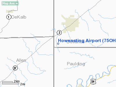
Location & QuickFacts
| FAA Information Effective: | 2008-09-25 |
| Airport Identifier: | 75OH |
| Airport Status: | Operational |
| Longitude/Latitude: | 084-47-36.8570W/41-15-33.1810N
-84.793571/41.259217 (Estimated) |
| Elevation: | 740 ft / 225.55 m (Estimated) |
| Land: | 0 acres |
| From nearest city: | 2 nautical miles SW of Hicksville, OH |
| Location: | Defiance County, OH |
| Magnetic Variation: | 04W (1990) |
Owner & Manager
| Ownership: | Privately owned |
| Owner: | Thomas C. Howensting |
| Address: | 12520 Casebeer Road
Hicksville, OH 43526 |
| Phone number: | 419-542-8921 |
| Manager: | Thomas C. Howensting |
| Address: | 12520 Casebeer Road
Hicksville, OH 43526 |
| Phone number: | 419-542-8921 |
Airport Operations and Facilities
| Airport Use: | Private |
| Segmented Circle: | No |
| Control Tower: | No |
| Sectional chart: | Cincinnati |
| Region: | AGL - Great Lakes |
| Boundary ARTCC: | ZAU - Chicago |
| Tie-in FSS: | CLE - Cleveland |
| FSS on Airport: | No |
| FSS Toll Free: | 1-800-WX-BRIEF |
Runway Information
Runway 09/27
| Dimension: | 2600 x 70 ft / 792.5 x 21.3 m |
| Surface: | TURF, |
| |
Runway 09 |
Runway 27 |
| Traffic Pattern: | Left | Left |
| Obstruction: | | 50 ft pline, 1000.0 ft from runway |
|
Radio Navigation Aids
| ID |
Type |
Name |
Ch |
Freq |
Var |
Dist |
| DFI | NDB | Defiance | | 246.00 | 05W | 17.2 nm |
| BYN | NDB | Bryan | | 260.00 | 04W | 19.8 nm |
| VFU | NDB | Stanley | | 411.00 | 05W | 25.2 nm |
| ANQ | NDB | Angola | | 347.00 | 05W | 26.4 nm |
| USE | NDB | Fulton | | 375.00 | 05W | 36.5 nm |
| HHG | NDB | Huntington | | 417.00 | 03W | 38.9 nm |
| PDR | NDB | Ottawa | | 233.00 | 05W | 39.5 nm |
| IRS | NDB | Sturgis | | 382.00 | 04W | 44.0 nm |
| CQA | NDB | Lakefield | | 205.00 | 04W | 47.9 nm |
| LYL | NDB | Lima | | 362.00 | 04W | 48.3 nm |
| ADG | NDB | Adrian | | 278.00 | 06W | 48.8 nm |
| PLD | NDB | Portland | | 257.00 | 03W | 49.2 nm |
| TOL | TACAN | Toledo | 072X | | 05W | 49.1 nm |
| OLK | VOR | Wolf Lake | | 110.40 | 03W | 31.8 nm |
| LFD | VOR/DME | Litchfield | 049X | 111.20 | 05W | 48.3 nm |
| FWA | VORTAC | Fort Wayne | 125X | 117.80 | 00E | 24.5 nm |
| FWA | VOT | Fort Wayne Baer | | 111.00 | | 24.7 nm |
Remarks
- INSUFFICIENT AIRSPACE FOR SIMULTANEOUS OPNS WITH HOOK FIELD.
Images and information placed above are from
http://www.airport-data.com/airport/75OH/
We thank them for the data!
| General Info
|
| Country |
United States
|
| State |
OHIO
|
| FAA ID |
75OH
|
| Latitude |
41-15-33.181N
|
| Longitude |
084-47-36.857W
|
| Elevation |
740 feet
|
| Near City |
HICKSVILLE
|
We don't guarantee the information is fresh and accurate. The data may
be wrong or outdated.
For more up-to-date information please refer to other sources.
|
|


