 |
|
Location & QuickFacts
| FAA Information Effective: | 2008-09-25 |
| Airport Identifier: | 8OH2 |
| Airport Status: | Operational |
| Longitude/Latitude: | 083-30-14.7300W/40-16-51.2000N
-83.504092/40.280889 (Estimated) |
| Elevation: | 1080 ft / 329.18 m (Estimated) |
| Land: | 0 acres |
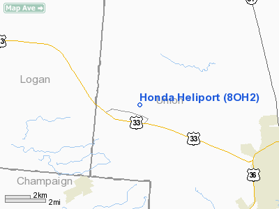
| From nearest city: | 7 nautical miles NW of Marysville, OH |
| Location: | Union County, OH |
| Magnetic Variation: | 05W (1990) |
Owner & Manager
| Ownership: | Privately owned |
| Owner: | Honda Of America |
| Address: | Honda Parkway
Marysville, OH 43040 |
| Phone number: | 513-642-5000 |
| Manager: | Robert C. Simcox |
| Address: | Honda Parkway
Marysville, OH 43040 |
| Phone number: | 513-642-5000 |
Airport Operations and Facilities
| Airport Use: | Private |
| Segmented Circle: | No |
| Control Tower: | No |
| Sectional chart: | Detroit |
| Region: | AGL - Great Lakes |
| Boundary ARTCC: | ZID - Indianapolis |
| Tie-in FSS: | DAY - Dayton |
| FSS Toll Free: | 1-800-WX-BRIEF |
Runway Information
Helipad H1
| Dimension: | 250 x 150 ft / 76.2 x 45.7 m |
| Surface: | ASPH, |
| |
Runway H1 |
Runway |
| Traffic Pattern: | Left | Left |
|
Radio Navigation Aids
| ID |
Type |
Name |
Ch |
Freq |
Var |
Dist |
| MRT | NDB | Marysville | | 403.00 | 05W | 7.8 nm |
| RUV | NDB | Rushsylvania | | 326.00 | 05W | 13.1 nm |
| EDJ | NDB | Bellefontaine | | 242.00 | 05W | 15.2 nm |
| DLZ | NDB | Delaware | | 215.00 | 06W | 18.4 nm |
| OS | NDB | Fuler | | 515.00 | 05W | 18.8 nm |
| UYF | NDB | London | | 263.00 | 06W | 20.9 nm |
| DKG | NDB | Don Scott | | 348.00 | 05W | 22.9 nm |
| CHC | NDB | Grens | | 272.00 | 04W | 27.2 nm |
| CCJ | NDB | Clark County | | 341.00 | 04W | 27.6 nm |
| MNN | NDB | Marion | | 201.00 | 05W | 28.3 nm |
| BU | NDB | Boutn | | 230.00 | 05W | 31.0 nm |
| LYL | NDB | Lima | | 362.00 | 04W | 34.8 nm |
| CM | NDB | Sumie | | 391.00 | 05W | 38.7 nm |
| XEN | NDB | Xenia | | 395.00 | 03W | 39.2 nm |
| CSS | NDB | Court House | | 414.00 | 05W | 41.2 nm |
| BNR | NDB | Benton Ridge | | 334.00 | 05W | 45.1 nm |
| VES | NDB | Versailles | | 356.00 | 04W | 47.0 nm |
| IL | NDB | Airbo | | 407.00 | 04W | 48.6 nm |
| PDR | NDB | Ottawa | | 233.00 | 05W | 50.0 nm |
| XSF | TACAN | Springfield | 065X | | 04W | 30.8 nm |
| FFO | TACAN | Patterson | 099X | | 04W | 37.6 nm |
| LCK | TACAN | Rickenbacker | 069X | | 05W | 38.8 nm |
| BUD | VOR | Buckeye | | 109.80 | 05W | 28.5 nm |
| AOH | VOR | Allen County | | 108.40 | 04W | 33.3 nm |
| MAH | VOR | Marathon | | 114.90 | 05W | 44.7 nm |
| SGH | VOR/DME | Springfield | 079X | 113.20 | 04W | 31.0 nm |
| DQN | VOR/DME | Dayton | 092X | 114.50 | 01W | 44.0 nm |
| ROD | VORTAC | Rosewood | 122X | 117.50 | 05W | 24.7 nm |
| FDY | VORTAC | Findlay | 019X | 108.20 | 02W | 42.1 nm |
| APE | VORTAC | Appleton | 114X | 116.70 | 06W | 42.8 nm |
| CMH | VOT | Port Columbus | | 111.00 | | 33.2 nm |
| DAY | VOT | Dayton J M Cox-day | | 111.00 | | 40.0 nm |
Remarks
- PRVDD LANDING/TAKEOFF AREA IS MARKED; WIND INDICATOR IS MAINTAINED.
Images and information placed above are from
http://www.airport-data.com/airport/8OH2/
We thank them for the data!
| General Info
|
| Country |
United States
|
| State |
OHIO
|
| FAA ID |
8OH2
|
| Latitude |
40-16-51.200N
|
| Longitude |
083-30-14.730W
|
| Elevation |
1080 feet
|
| Near City |
MARYSVILLE
|
We don't guarantee the information is fresh and accurate. The data may
be wrong or outdated.
For more up-to-date information please refer to other sources.
|
|


