 |
|
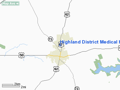
Highland District Medical Heliport |
Location & QuickFacts
| FAA Information Effective: | 2008-09-25 |
| Airport Identifier: | OH69 |
| Airport Status: | Operational |
| Longitude/Latitude: | 083-36-38.7130W/39-13-16.2300N
-83.610754/39.221175 (Estimated) |
| Elevation: | 988 ft / 301.14 m (Estimated) |
| Land: | 0 acres |
| From nearest city: | 2 nautical miles N of Hillsboro, OH |
| Location: | Highland County, OH |
| Magnetic Variation: | 04W (1985) |
Owner & Manager
| Ownership: | Privately owned |
| Owner: | Highland District Hospital |
| Address: |
Hillsboro, OH 45132 |
| Phone number: | 513-393-6100 |
| Manager: | Hospital Administrator |
| Address: |
Hillsboro, OH 45132 |
| Phone number: | 513-393-6100 |
Airport Operations and Facilities
| Airport Use: | Private
MEDICAL USE. |
| Wind indicator: | Yes |
| Segmented Circle: | No |
| Control Tower: | No |
| Landing fee charge: | No |
| Sectional chart: | Cincinnati |
| Region: | AGL - Great Lakes |
| Boundary ARTCC: | ZID - Indianapolis |
| Tie-in FSS: | DAY - Dayton |
| FSS on Airport: | No |
| FSS Toll Free: | 1-800-WX-BRIEF |
Airport Services
| Airframe Repair: | NONE |
| Power Plant Repair: | NONE |
Runway Information
Helipad H1
| Dimension: | 100 x 100 ft / 30.5 x 30.5 m |
| Surface: | ASPH, |
| |
Runway H1 |
Runway |
| Traffic Pattern: | Left | Left |
|
Radio Navigation Aids
| ID |
Type |
Name |
Ch |
Freq |
Var |
Dist |
| HOC | NDB | Hillsboro | | 278.00 | 05W | 3.8 nm |
| HW | NDB | Cubla | | 299.00 | 04W | 14.7 nm |
| IL | NDB | Airbo | | 407.00 | 04W | 17.3 nm |
| AMT | NDB | West Union | | 359.00 | 04W | 22.1 nm |
| PZO | NDB | Peebles | | 329.00 | 02W | 22.4 nm |
| CSS | NDB | Court House | | 414.00 | 05W | 25.0 nm |
| PWF | NDB | Sportys | | 245.00 | 04W | 29.5 nm |
| RZT | NDB | Ross County | | 236.00 | 05W | 30.0 nm |
| EOP | NDB | Waverly | | 385.00 | 06W | 31.8 nm |
| XEN | NDB | Xenia | | 395.00 | 03W | 33.2 nm |
| LUK | NDB | Cincinnati | | 335.00 | 04W | 34.2 nm |
| CYO | NDB | Circleville | | 366.00 | 05W | 34.5 nm |
| MDE | NDB | Madeira | | 379.00 | 04W | 34.7 nm |
| ISZ | NDB | Cincinnati-blue Ash | | 388.00 | 04W | 36.3 nm |
| XW | NDB | Flmng | | 400.00 | 05W | 39.0 nm |
| CCJ | NDB | Clark County | | 341.00 | 04W | 40.0 nm |
| BU | NDB | Boutn | | 230.00 | 05W | 40.6 nm |
| HKF | NDB | Hook Field | | 239.00 | 04W | 42.3 nm |
| UYF | NDB | London | | 263.00 | 06W | 43.4 nm |
| PMH | NDB | Portsmouth | | 373.00 | 04W | 44.5 nm |
| HAO | NDB | Hamilton | | 260.00 | 04W | 45.6 nm |
| XSF | TACAN | Springfield | 065X | | 04W | 38.6 nm |
| FFO | TACAN | Patterson | 099X | | 04W | 41.4 nm |
| LCK | TACAN | Rickenbacker | 069X | | 05W | 47.4 nm |
| XUB | VOR | Yellow Bud | | 112.50 | 05W | 34.7 nm |
| MXQ | VOR/DME | Midwest | 076X | 112.90 | 04W | 15.3 nm |
| SGH | VOR/DME | Springfield | 079X | 113.20 | 04W | 38.5 nm |
| FLM | VOR/DME | Falmouth | 117X | 117.00 | 04W | 47.5 nm |
| YRK | VORTAC | York | 075X | 112.80 | 05W | 45.6 nm |
| LUK | VOT | Cincinnati Muni/lunken | | 108.40 | | 37.3 nm |
| DAY | VOT | Dayton J M Cox-day | | 111.00 | | 49.7 nm |
Remarks
- VFR WEATHER CONDITIONS ONLY.
Images and information placed above are from
http://www.airport-data.com/airport/OH69/
We thank them for the data!
| General Info
|
| Country |
United States
|
| State |
OHIO
|
| FAA ID |
OH69
|
| Latitude |
39-13-16.230N
|
| Longitude |
083-36-38.713W
|
| Elevation |
988 feet
|
| Near City |
HILLSBORO
|
We don't guarantee the information is fresh and accurate. The data may
be wrong or outdated.
For more up-to-date information please refer to other sources.
|
|


