|
|
 |
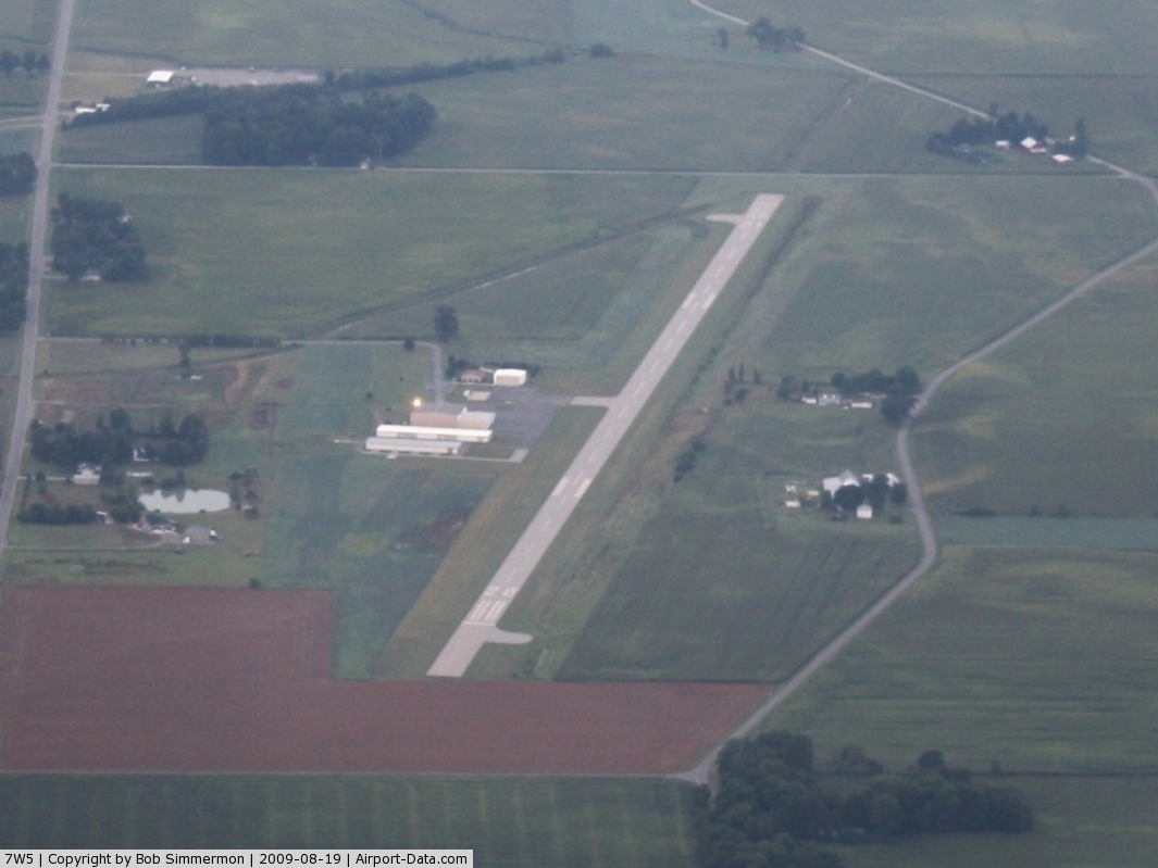
(Click on the photo to enlarge) |
 |
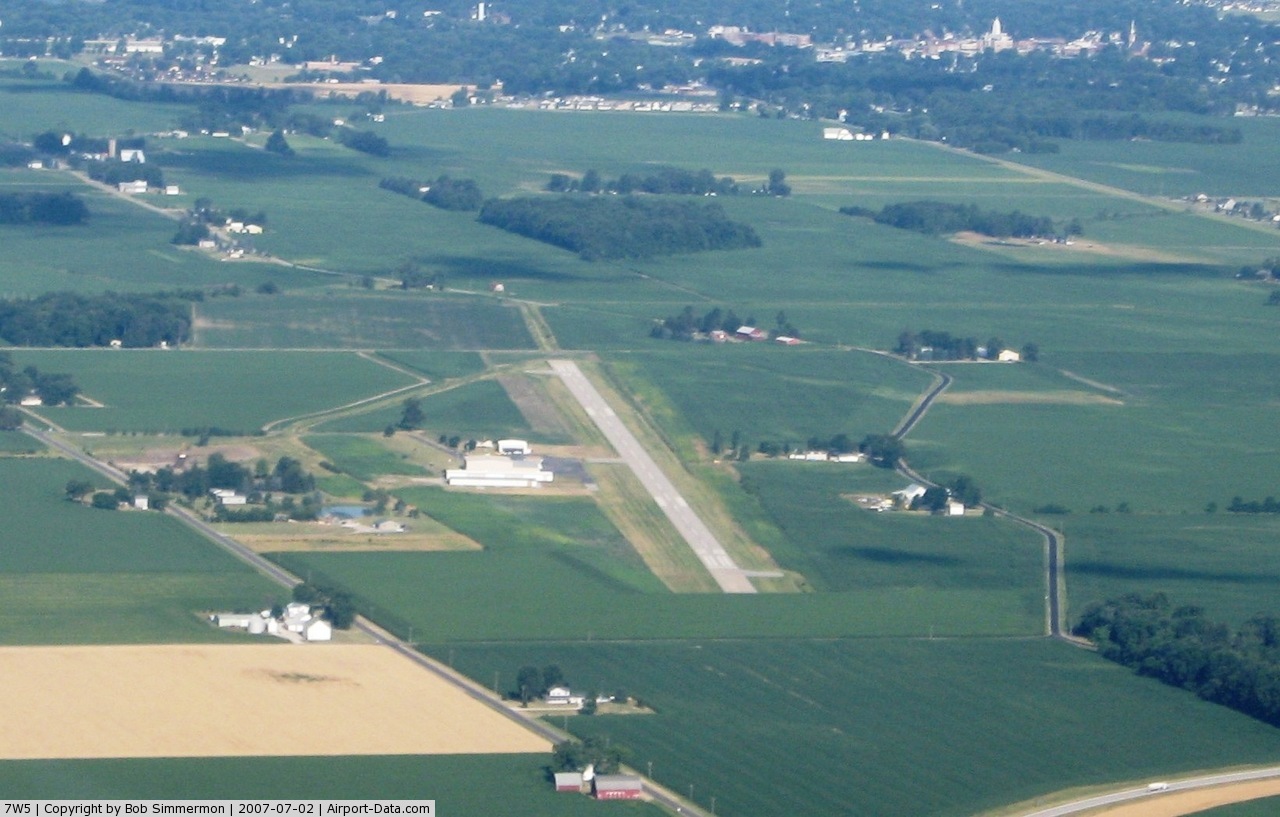
(Click on the photo to enlarge) |
Location & QuickFacts
| FAA Information Effective: | 2008-09-25 |
| Airport Identifier: | 7W5 |
| Airport Status: | Operational |
| Longitude/Latitude: | 084-04-04.5000W/41-22-27.4000N
-84.067917/41.374278 (Estimated) |
| Elevation: | 683 ft / 208.18 m (Surveyed) |
| Land: | 47 acres |
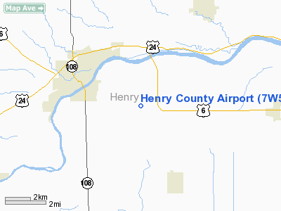
| From nearest city: | 3 nautical miles E of Napoleon, OH |
| Location: | Henry County, OH |
| Magnetic Variation: | 05W (1985) |
Owner & Manager
| Ownership: | Publicly owned |
| Owner: | Henry Co. Arpt Auth. |
| Address: | 10-646 County Rd O
Napoleon, OH 43545 |
| Phone number: | 419-592-4008 |
| Manager: | Randy E. Ames |
| Address: | 14094 County Road K
Napoleon, OH 43567 |
| Phone number: | 419-599-6494 |
Airport Operations and Facilities
| Airport Use: | Open to public |
| Wind indicator: | Yes |
| Segmented Circle: | No |
| Control Tower: | No |
| Lighting Schedule: | DUSK-DAWN
ACTVT MIRL RY 10/28; REIL RY 28; SAVASI RYS 10 & 28 - CTAF. |
| Beacon Color: | Clear-Green (lighted land airport) |
| Landing fee charge: | No |
| Sectional chart: | Detroit |
| Region: | AGL - Great Lakes |
| Boundary ARTCC: | ZOB - Cleveland |
| Tie-in FSS: | CLE - Cleveland |
| FSS on Airport: | No |
| FSS Toll Free: | 1-800-WX-BRIEF |
| NOTAMs Facility: | CLE (NOTAM-d service avaliable) |
| Federal Agreements: | N |
Airport Communications
| CTAF: | 123.000 |
| Unicom: | 123.000 |
Airport Services
| Fuel available: | 100LLA |
| Airframe Repair: | MINOR |
| Power Plant Repair: | MINOR |
Runway Information
Runway 10/28
| Dimension: | 3956 x 65 ft / 1205.8 x 19.8 m |
| Surface: | ASPH, Good Condition |
| Edge Lights: | Medium |
| |
Runway 10 |
Runway 28 |
| Longitude: | 084-04-31.9681W | 084-03-41.0040W |
| Latitude: | 41-22-31.3359N | 41-22-24.0150N |
| Elevation: | 680.00 ft | 682.00 ft |
| Alignment: | 101 | 127 |
| Traffic Pattern: | Left | Left |
| Markings: | Non-precision instrument, Good Condition | Non-precision instrument, Good Condition |
| VASI: | 2-box SAVASI on left side
RWY 10 AND RWY 28 VASI OTS INDEFLY. | 2-box SAVASI on left side
RY 28 VASI OTS INDEFLY. |
| Runway End Identifier: | | Yes
RY 28 REIL OTS INDEFLY. |
| Obstruction: | 15 ft road, 305.0 ft from runway, 265 ft right of centerline, 7:1 slope to clear | 69 ft trees, 1850.0 ft from runway, 480 ft left of centerline, 23:1 slope to clear |
|
Radio Navigation Aids
| ID |
Type |
Name |
Ch |
Freq |
Var |
Dist |
| USE | NDB | Fulton | | 375.00 | 05W | 14.4 nm |
| DFI | NDB | Defiance | | 246.00 | 05W | 16.4 nm |
| BYN | NDB | Bryan | | 260.00 | 04W | 19.0 nm |
| PDR | NDB | Ottawa | | 233.00 | 05W | 21.0 nm |
| BNR | NDB | Benton Ridge | | 334.00 | 05W | 27.9 nm |
| ADG | NDB | Adrian | | 278.00 | 06W | 29.8 nm |
| FZI | NDB | Fostoria | | 379.00 | 05W | 32.3 nm |
| VFU | NDB | Stanley | | 411.00 | 05W | 39.5 nm |
| LYL | NDB | Lima | | 362.00 | 04W | 40.3 nm |
| TCU | NDB | Tecumseh | | 239.00 | 04W | 40.7 nm |
| TII | NDB | Tiffin | | 269.00 | 05W | 42.3 nm |
| ANQ | NDB | Angola | | 347.00 | 05W | 48.6 nm |
| TOL | TACAN | Toledo | 072X | | 05W | 17.9 nm |
| MAH | VOR | Marathon | | 114.90 | 05W | 28.3 nm |
| AOH | VOR | Allen County | | 108.40 | 04W | 40.4 nm |
| VWV | VOR/DME | Waterville | 078X | 113.10 | 02W | 19.9 nm |
| FDY | VORTAC | Findlay | 019X | 108.20 | 02W | 28.9 nm |
| CRL | VORTAC | Carleton | 104X | 115.70 | 03W | 48.9 nm |
Images and information placed above are from
http://www.airport-data.com/airport/7W5/
We thank them for the data!
| General Info
|
| Country |
United States
|
| State |
OHIO
|
| FAA ID |
7W5
|
| Latitude |
41-22-27.400N
|
| Longitude |
084-04-04.500W
|
| Elevation |
683 feet
|
| Near City |
NAPOLEON
|
We don't guarantee the information is fresh and accurate. The data may
be wrong or outdated.
For more up-to-date information please refer to other sources.
|
|