 |
|
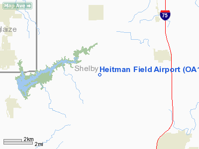
Location & QuickFacts
| FAA Information Effective: | 2008-09-25 |
| Airport Identifier: | OA11 |
| Airport Status: | Operational |
| Longitude/Latitude: | 084-15-18.0000W/40-22-34.0000N
-84.255000/40.376111 (Estimated) |
| Elevation: | 998 ft / 304.19 m (Estimated) |
| Land: | 0 acres |
| From nearest city: | 5 nautical miles E of Anna, OH |
| Location: | Shelby County, OH |
| Magnetic Variation: | 05W (1995) |
Owner & Manager
| Ownership: | Privately owned |
| Owner: | David J. Heitman |
| Address: | 9176 Turtle Creek Road
Anna, OH 45302 |
| Phone number: | 513-394-7265 |
| Manager: | David J. Heitman |
| Address: | 9176 Turtle Creek Road
Anna, OH 45302 |
| Phone number: | 513-394-7265 |
Airport Operations and Facilities
| Airport Use: | Private |
| Segmented Circle: | No |
| Control Tower: | No |
| Sectional chart: | Detroit |
| Region: | AGL - Great Lakes |
| Boundary ARTCC: | ZID - Indianapolis |
| Tie-in FSS: | DAY - Dayton |
| FSS on Airport: | No |
| FSS Toll Free: | 1-800-WX-BRIEF |
Runway Information
Runway 18/36
| Dimension: | 2600 x 60 ft / 792.5 x 18.3 m |
| Surface: | TURF, |
| |
Runway 18 |
Runway 36 |
| Traffic Pattern: | Left | Left |
| Obstruction: | 25 ft pline | 25 ft pline, 25.0 ft from runway |
|
Radio Navigation Aids
| ID |
Type |
Name |
Ch |
Freq |
Var |
Dist |
| CQA | NDB | Lakefield | | 205.00 | 04W | 15.5 nm |
| VES | NDB | Versailles | | 356.00 | 04W | 16.0 nm |
| EDJ | NDB | Bellefontaine | | 242.00 | 05W | 20.2 nm |
| LYL | NDB | Lima | | 362.00 | 04W | 22.4 nm |
| RUV | NDB | Rushsylvania | | 326.00 | 05W | 27.3 nm |
| VFU | NDB | Stanley | | 411.00 | 05W | 33.5 nm |
| PLD | NDB | Portland | | 257.00 | 03W | 33.7 nm |
| CCJ | NDB | Clark County | | 341.00 | 04W | 37.3 nm |
| PDR | NDB | Ottawa | | 233.00 | 05W | 41.4 nm |
| XEN | NDB | Xenia | | 395.00 | 03W | 42.4 nm |
| MRT | NDB | Marysville | | 403.00 | 05W | 42.5 nm |
| UYF | NDB | London | | 263.00 | 06W | 44.9 nm |
| BNR | NDB | Benton Ridge | | 334.00 | 05W | 47.1 nm |
| FFO | TACAN | Patterson | 099X | | 04W | 34.7 nm |
| XSF | TACAN | Springfield | 065X | | 04W | 37.5 nm |
| AOH | VOR | Allen County | | 108.40 | 04W | 23.8 nm |
| MAH | VOR | Marathon | | 114.90 | 05W | 46.9 nm |
| DQN | VOR/DME | Dayton | 092X | 114.50 | 01W | 22.6 nm |
| SGH | VOR/DME | Springfield | 079X | 113.20 | 04W | 37.5 nm |
| ROD | VORTAC | Rosewood | 122X | 117.50 | 05W | 11.1 nm |
| FDY | VORTAC | Findlay | 019X | 108.20 | 02W | 41.6 nm |
| RID | VORTAC | Richmond | 043X | 110.60 | 03W | 46.0 nm |
| DAY | VOT | Dayton J M Cox-day | | 111.00 | | 28.6 nm |
Remarks
- PRVDD 125 FT EITHER SIDE OF RY & 200 FT OFF RY END IS CLEAR OF OBSTNS; AREA 60 FT EITHER SIDE OF RY & 240 FT OFF RY END IS CLEARED & GRADED & HAS NO RUTS; HUMPS; DEPRESSIONS OR OTHER SFC VARIATIONS.
Images and information placed above are from
http://www.airport-data.com/airport/OA11/
We thank them for the data!
| General Info
|
| Country |
United States
|
| State |
OHIO
|
| FAA ID |
OA11
|
| Latitude |
40-22-34.000N
|
| Longitude |
084-15-18.000W
|
| Elevation |
998 feet
|
| Near City |
ANNA
|
We don't guarantee the information is fresh and accurate. The data may
be wrong or outdated.
For more up-to-date information please refer to other sources.
|
|


