 |
|
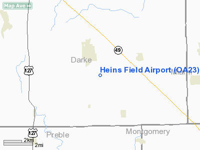
Location & QuickFacts
| FAA Information Effective: | 2008-09-25 |
| Airport Identifier: | OA23 |
| Airport Status: | Operational |
| Longitude/Latitude: | 084-32-20.4000W/39-58-07.2000N
-84.539000/39.968667 (Estimated) |
| Elevation: | 1040 ft / 316.99 m (Estimated) |
| Land: | 0 acres |
| From nearest city: | 1 nautical miles SE of Arcanum, OH |
| Location: | Darke County, OH |
| Magnetic Variation: | () |
Owner & Manager
| Ownership: | Privately owned |
| Owner: | Pete Heins |
| Address: | 7111 Dull Rd.
Arcanum, OH 45304 |
| Phone number: | 937-692-5368 |
| Manager: | Pete Heins |
| Address: | 7111 Dull Rd.
Arcanum, OH 45304 |
| Phone number: | 937-692-5368 |
Airport Operations and Facilities
| Airport Use: | Private |
| Control Tower: | No |
| Sectional chart: | Cincinnati |
| Region: | AGL - Great Lakes |
| Boundary ARTCC: | ZID - Indianapolis |
| Tie-in FSS: | DAY - Dayton |
| FSS Toll Free: | 1-800-WX-BRIEF |
Runway Information
Runway 15/33
| Dimension: | 2600 x 120 ft / 792.5 x 36.6 m |
| Surface: | TURF, |
| |
Runway 15 |
Runway 33 |
| Traffic Pattern: | Left | Left |
|
Radio Navigation Aids
| ID |
Type |
Name |
Ch |
Freq |
Var |
Dist |
| VES | NDB | Versailles | | 356.00 | 04W | 14.3 nm |
| HKF | NDB | Hook Field | | 239.00 | 04W | 28.6 nm |
| OXD | NDB | Oxford | | 282.00 | 04W | 29.9 nm |
| CQA | NDB | Lakefield | | 205.00 | 04W | 30.9 nm |
| XEN | NDB | Xenia | | 395.00 | 03W | 32.0 nm |
| CCJ | NDB | Clark County | | 341.00 | 04W | 35.5 nm |
| PLD | NDB | Portland | | 257.00 | 03W | 35.6 nm |
| HAO | NDB | Hamilton | | 260.00 | 04W | 35.8 nm |
| UWL | NDB | New Castle | | 385.00 | 02W | 36.3 nm |
| EDJ | NDB | Bellefontaine | | 242.00 | 05W | 41.2 nm |
| ISZ | NDB | Cincinnati-blue Ash | | 388.00 | 04W | 43.8 nm |
| AI | NDB | Video | | 371.00 | 03W | 45.1 nm |
| MDE | NDB | Madeira | | 379.00 | 04W | 45.6 nm |
| IL | NDB | Airbo | | 407.00 | 04W | 46.9 nm |
| HW | NDB | Cubla | | 299.00 | 04W | 48.1 nm |
| UYF | NDB | London | | 263.00 | 06W | 49.5 nm |
| LUK | NDB | Cincinnati | | 335.00 | 04W | 49.5 nm |
| RUV | NDB | Rushsylvania | | 326.00 | 05W | 49.7 nm |
| HLB | NDB | Batesville | | 254.00 | 02W | 49.9 nm |
| FFO | TACAN | Patterson | 099X | | 04W | 24.0 nm |
| XSF | TACAN | Springfield | 065X | | 04W | 33.1 nm |
| DQN | VOR/DME | Dayton | 092X | 114.50 | 01W | 7.1 nm |
| SGH | VOR/DME | Springfield | 079X | 113.20 | 04W | 33.0 nm |
| MIE | VOR/DME | Muncie | 091X | 114.40 | 03W | 42.5 nm |
| MXQ | VOR/DME | Midwest | 076X | 112.90 | 04W | 47.0 nm |
| RID | VORTAC | Richmond | 043X | 110.60 | 03W | 18.9 nm |
| ROD | VORTAC | Rosewood | 122X | 117.50 | 05W | 29.8 nm |
| DAY | VOT | Dayton J M Cox-day | | 111.00 | | 15.2 nm |
Remarks
- 250 FT CELL TWR 0.5 NM NW & 250 FT CELL TWR 1 NM NE OF ARPT.
- PRVDD CLEAR 20:1 APCHS AND CLEAR OBSTACLE FREE ZONE.
Images and information placed above are from
http://www.airport-data.com/airport/OA23/
We thank them for the data!
|
|


