 |
|
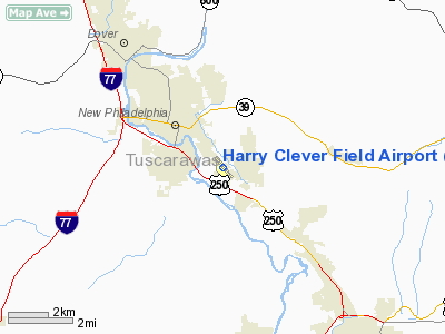
Harry Clever Field Airport |
Location & QuickFacts
| FAA Information Effective: | 2008-09-25 |
| Airport Identifier: | PHD |
| Airport Status: | Operational |
| Longitude/Latitude: | 081-25-11.1000W/40-28-15.3000N
-81.419750/40.470917 (Estimated) |
| Elevation: | 894 ft / 272.49 m (Surveyed) |
| Land: | 160 acres |
| From nearest city: | 3 nautical miles SE of New Philadelphia, OH |
| Location: | Tuscarawas County, OH |
| Magnetic Variation: | 08W (2000) |
Owner & Manager
| Ownership: | Publicly owned |
| Owner: | City Of New Philadelphia |
| Address: | Svc Direct, City Bldg
New Philadelphia, OH 44663 |
| Phone number: | 330-364-4491 |
| Manager: | Eric Hubbard |
| Address: | 1834 E High Ave
New Philadelphia, OH 44663 |
| Phone number: | 330-339-6078 |
Airport Operations and Facilities
| Airport Use: | Open to public |
| Wind indicator: | Yes |
| Segmented Circle: | No |
| Control Tower: | No |
| Lighting Schedule: | DUSK-DAWN
ACTIVATE MIRL RWY 14/32-123.3. |
| Beacon Color: | Clear-Green (lighted land airport) |
| Landing fee charge: | No |
| Sectional chart: | Detroit |
| Region: | AGL - Great Lakes |
| Boundary ARTCC: | ZOB - Cleveland |
| Tie-in FSS: | CLE - Cleveland |
| FSS on Airport: | No |
| FSS Toll Free: | 1-800-WX-BRIEF |
| NOTAMs Facility: | PHD (NOTAM-d service avaliable) |
| Federal Agreements: | NGY |
Airport Communications
| CTAF: | 122.800 |
| Unicom: | 122.800 |
Airport Services
| Fuel available: | 100LLA+ |
| Airframe Repair: | MAJOR |
| Power Plant Repair: | MAJOR |
| Bottled Oxygen: | NONE |
| Bulk Oxygen: | NONE |
Runway Information
Runway 11/29
| Dimension: | 2050 x 100 ft / 624.8 x 30.5 m |
| Surface: | TURF, Fair Condition |
| |
Runway 11 |
Runway 29 |
| Longitude: | 081-25-26.4100W | 081-25-00.4090W |
| Latitude: | 40-28-10.2340N | 40-28-04.2350N |
| Traffic Pattern: | Left | Left |
| Runway End Identifier: | No | No |
| Centerline Lights: | No | No |
| Touchdown Lights: | No | No |
| Obstruction: | 50 ft trees, 191.0 ft from runway, 105 ft left of centerline, 3:1 slope to clear | 76 ft trees, 610.0 ft from runway, 100 ft right of centerline, 8:1 slope to clear |
|
Runway 14/32
| Dimension: | 3950 x 100 ft / 1204.0 x 30.5 m |
| Surface: | ASPH, Good Condition |
| Weight Limit: | Single wheel: 52500 lbs.
Dual wheel: 67500 lbs.
Dual tandem wheel: 140000 lbs. |
| Edge Lights: | Medium |
| |
Runway 14 |
Runway 32 |
| Longitude: | 081-25-27.7560W | 081-24-54.4280W |
| Latitude: | 40-28-30.0480N | 40-28-00.4570N |
| Elevation: | 894.00 ft | 886.00 ft |
| Alignment: | 127 | 127 |
| Traffic Pattern: | Left | Left |
| Markings: | Non-precision instrument, Good Condition | Non-precision instrument, Good Condition |
| Crossing Height: | 30.00 ft | 54.00 ft |
| Displaced threshold: | 320.00 ft | 0.00 ft |
| VASI: | 4-light PAPI on right side | 4-light PAPI on left side |
| Visual Glide Angle: | 4.00° | 4.00° |
| Runway End Identifier: | Yes | Yes |
| Centerline Lights: | No | No |
| Touchdown Lights: | No | No |
| Obstruction: | 36 ft trees, 201.0 ft from runway, 240 ft left of centerline
APCH RATIO 0:1 TO DSPLCD THLD+57 FT TREE 0 FT
RWY 14 +15 FT ROAD AND +7 FT FENCE 0 FT FM RY END 115 FT R THRU 200 FT FM RY END 0B FT R; +16 FT BLDG 168 FM 237 FT L. | 10 ft road, 201.0 ft from runway, 188 ft left of centerline |
|
Radio Navigation Aids
| ID |
Type |
Name |
Ch |
Freq |
Var |
Dist |
| TSO | NDB | Tolson | | 395.00 | 07W | 16.6 nm |
| MLR | NDB | Millersburg/dcmsnd | | 382.00 | 06W | 21.1 nm |
| CFX | NDB | Cadiz | | 239.00 | 07W | 23.3 nm |
| AK | NDB | Akron | | 362.00 | 07W | 36.0 nm |
| HRA | NDB | Zanesville | | 204.00 | 06W | 41.0 nm |
| AAU | NDB | Ashland | | 329.00 | 07W | 48.1 nm |
| CTW | VOR/DME | Newcomerstown | 055X | 111.80 | 07W | 14.8 nm |
| BSV | VOR/DME | Briggs | 071X | 112.40 | 04W | 16.2 nm |
| TVT | VOR/DME | Tiverton | 112X | 116.50 | 03W | 32.3 nm |
| ZZV | VOR/DME | Zanesville | 051X | 111.40 | 06W | 38.6 nm |
| AIR | VOR/DME | Bellaire | 118X | 117.10 | 07W | 38.8 nm |
| ACO | VOR/DME | Akron | 091X | 114.40 | 04W | 39.6 nm |
| HLG | VOR/DME | Wheeling | 059X | 112.20 | 07W | 41.0 nm |
| CAK | VOT | Akron/canton Regional | | 110.60 | | 26.8 nm |
Remarks
- TWO 919 FT UNLGTD TOWERS 180 FT NE OF RY 14/32.
Images and information placed above are from
http://www.airport-data.com/airport/PHD/
We thank them for the data!
| General Info
|
| Country |
United States
|
| State |
OHIO
|
| FAA ID |
PHD
|
| Latitude |
40-28-15.300N
|
| Longitude |
081-25-11.100W
|
| Elevation |
894 feet
|
| Near City |
NEW PHILADELPHIA
|
We don't guarantee the information is fresh and accurate. The data may
be wrong or outdated.
For more up-to-date information please refer to other sources.
|
|


