 |
|
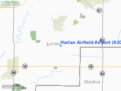
Location & QuickFacts
| FAA Information Effective: | 2008-09-25 |
| Airport Identifier: | 92D |
| Airport Status: | Operational |
| Longitude/Latitude: | 082-06-54.5390W/41-12-10.1920N
-82.115150/41.202831 (Estimated) |
| Elevation: | 843 ft / 256.95 m (Estimated) |
| Land: | 61 acres |
| From nearest city: | 2 nautical miles S of Lagrange, OH |
| Location: | Lorain County, OH |
| Magnetic Variation: | 06W (1985) |
Owner & Manager
| Ownership: | Privately owned |
| Owner: | Charles Jones |
| Address: | 19173 Rte 301
Lagrange, OH 44050 |
| Phone number: | 216-513-1229 |
| Manager: | Charles Jones |
| Address: | 19173 Rte 301
Lagrange, OH 44050 |
| Phone number: | 216-513-1229 |
Airport Operations and Facilities
| Airport Use: | Open to public |
| Wind indicator: | Yes |
| Segmented Circle: | No |
| Control Tower: | No |
| Landing fee charge: | No |
| Sectional chart: | Detroit |
| Region: | AGL - Great Lakes |
| Traffic Pattern Alt: | 1000 ft |
| Boundary ARTCC: | ZOB - Cleveland |
| Tie-in FSS: | CLE - Cleveland |
| FSS on Airport: | No |
| FSS Toll Free: | 1-800-WX-BRIEF |
| NOTAMs Facility: | CLE (NOTAM-d service avaliable) |
Airport Communications
Airport Services
| Airframe Repair: | NONE |
| Power Plant Repair: | NONE |
| Bottled Oxygen: | NONE |
| Bulk Oxygen: | NONE |
Runway Information
Runway 09/27
| Dimension: | 2670 x 95 ft / 813.8 x 29.0 m |
| Surface: | TURF, Good Condition |
| |
Runway 09 |
Runway 27 |
| Longitude: | 082-07-14.2900W | 082-06-39.2300W |
| Latitude: | 41-12-10.9400N | 41-12-10.9400N |
| Elevation: | 843.00 ft | 843.00 ft |
| Traffic Pattern: | Left | Left |
| Runway End Identifier: | No | No |
| Centerline Lights: | No | No |
| Touchdown Lights: | No | No |
| Obstruction: | 15 ft pline | 82 ft trees, 0.0 ft from runway |
|
Runway 18/36
| Dimension: | 1410 x 95 ft / 429.8 x 29.0 m |
| Surface: | TURF, Good Condition |
| |
Runway 18 |
Runway 36 |
| Longitude: | 082-06-52.8000W | 082-06-52.3200W |
| Latitude: | 41-12-02.3900N | 41-11-48.4600N |
| Elevation: | 843.00 ft | 843.00 ft |
| Traffic Pattern: | Left | Left |
| Obstruction: | 50 ft tree, 15.0 ft from runway, 65 ft left of centerline | 26 ft trees, 20.0 ft from runway, 125 ft left of centerline |
|
Radio Navigation Aids
| ID |
Type |
Name |
Ch |
Freq |
Var |
Dist |
| CL | NDB | Harri | | 344.00 | 07W | 10.6 nm |
| AAU | NDB | Ashland | | 329.00 | 07W | 15.7 nm |
| EZE | NDB | Engel | | 226.00 | 07W | 24.7 nm |
| BKL | NDB | Burke Lakefront | | 416.00 | 07W | 28.3 nm |
| MF | NDB | Manns | | 372.00 | 06W | 30.2 nm |
| AK | NDB | Akron | | 362.00 | 07W | 33.9 nm |
| PCW | NDB | Port Clinton | | 423.00 | 06W | 38.9 nm |
| MLR | NDB | Millersburg/dcmsnd | | 382.00 | 06W | 41.2 nm |
| PT | NDB | Pelee Island | | 283.00 | 05W | 42.7 nm |
| LQL | NDB | Lakeland | | 263.00 | 08W | 43.9 nm |
| TII | NDB | Tiffin | | 269.00 | 05W | 49.8 nm |
| DJB | VOR/DME | Dryer | 083X | 113.60 | 05W | 9.6 nm |
| SKY | VOR/DME | Sandusky | 029X | 109.20 | 04W | 28.1 nm |
| BSV | VOR/DME | Briggs | 071X | 112.40 | 04W | 41.6 nm |
| ACO | VOR/DME | Akron | 091X | 114.40 | 04W | 41.7 nm |
| LNN | VOR/DME | Lost Nation | 039X | 110.20 | 08W | 43.7 nm |
| TVT | VOR/DME | Tiverton | 112X | 116.50 | 03W | 44.8 nm |
| CXR | VOR/DME | Chardon | 074X | 112.70 | 05W | 46.9 nm |
| MFD | VORTAC | Mansfield | 025X | 108.80 | 03W | 29.5 nm |
| CLE | VOT | Cleveland | | 110.40 | | 17.3 nm |
| CAK | VOT | Akron/canton Regional | | 110.60 | | 35.0 nm |
Remarks
-
- ARPT OCNLY CLSD FOR RDO CTL MODEL FLYING.
- PARALLEL TWYS AVBL IN DRY WEATHER.
- RY 36 HAS NO LINE OF SIGHT WITH RY 09 & 27 RY ENDS.
- VFR ONLY
Images and information placed above are from
http://www.airport-data.com/airport/92D/
We thank them for the data!
| General Info
|
| Country |
United States
|
| State |
OHIO
|
| FAA ID |
92D
|
| Latitude |
41-12-10.192N
|
| Longitude |
082-06-54.539W
|
| Elevation |
843 feet
|
| Near City |
LAGRANGE
|
We don't guarantee the information is fresh and accurate. The data may
be wrong or outdated.
For more up-to-date information please refer to other sources.
|
|


