 |
|
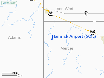
Location & QuickFacts
| FAA Information Effective: | 2008-09-25 |
| Airport Identifier: | 5OI5 |
| Airport Status: | Operational |
| Longitude/Latitude: | 084-46-49.8650W/40-41-36.1690N
-84.780518/40.693380 (Estimated) |
| Elevation: | 810 ft / 246.89 m (Estimated) |
| Land: | 4 acres |
| From nearest city: | 3 nautical miles N of Willshire, OH |
| Location: | Mercer County, OH |
| Magnetic Variation: | 04W (1985) |
Owner & Manager
| Ownership: | Privately owned |
| Owner: | H. H. Hamrick Farms Inc. |
| Address: | Rr 1, Box 128
Willshire, OH 45898 |
| Phone number: | 419-495-2366 |
| Manager: | Herman Hamrick |
| Address: | Rr 1, Box 128
Willshire, OH 45890 |
| Phone number: | 419-495-2871 |
Airport Operations and Facilities
| Airport Use: | Private |
| Wind indicator: | Yes |
| Segmented Circle: | No |
| Control Tower: | No |
| Landing fee charge: | No |
| Sectional chart: | Detroit |
| Region: | AGL - Great Lakes |
| Boundary ARTCC: | ZAU - Chicago |
| Tie-in FSS: | DAY - Dayton |
| FSS on Airport: | No |
| FSS Toll Free: | 1-800-WX-BRIEF |
Runway Information
Runway 09/27
| Dimension: | 2600 x 50 ft / 792.5 x 15.2 m |
| Surface: | TURF, |
| |
Runway 09 |
Runway 27 |
| Traffic Pattern: | Right | Left |
| Obstruction: | 35 ft pline, 100.0 ft from runway | |
|
Radio Navigation Aids
| ID |
Type |
Name |
Ch |
Freq |
Var |
Dist |
| VFU | NDB | Stanley | | 411.00 | 05W | 12.7 nm |
| CQA | NDB | Lakefield | | 205.00 | 04W | 16.1 nm |
| PLD | NDB | Portland | | 257.00 | 03W | 17.1 nm |
| VES | NDB | Versailles | | 356.00 | 04W | 31.6 nm |
| HHG | NDB | Huntington | | 417.00 | 03W | 32.6 nm |
| LYL | NDB | Lima | | 362.00 | 04W | 34.5 nm |
| DFI | NDB | Defiance | | 246.00 | 05W | 41.7 nm |
| PDR | NDB | Ottawa | | 233.00 | 05W | 41.9 nm |
| IWH | NDB | Wabash | | 329.00 | 03W | 46.5 nm |
| EDJ | NDB | Bellefontaine | | 242.00 | 05W | 48.2 nm |
| BYN | NDB | Bryan | | 260.00 | 04W | 49.4 nm |
| AOH | VOR | Allen County | | 108.40 | 04W | 37.0 nm |
| OLK | VOR | Wolf Lake | | 110.40 | 03W | 46.5 nm |
| MIE | VOR/DME | Muncie | 091X | 114.40 | 03W | 39.2 nm |
| MZZ | VOR/DME | Marion | 023X | 108.60 | 03W | 42.7 nm |
| DQN | VOR/DME | Dayton | 092X | 114.50 | 01W | 44.3 nm |
| FWA | VORTAC | Fort Wayne | 125X | 117.80 | 00E | 25.3 nm |
| ROD | VORTAC | Rosewood | 122X | 117.50 | 05W | 41.6 nm |
| FDY | VORTAC | Findlay | 019X | 108.20 | 02W | 49.2 nm |
| FWA | VOT | Fort Wayne Baer | | 111.00 | | 25.3 nm |
Remarks
- DUE TO LACK OF SUFFICIENT AVAILABLE AIRSPACE TO ESTABLISH AN AIRPORT TRAFFIC PATTERN AIRSPACE AREA AT THIS AIRPORT WHICH WOULD NOT CONFLICT WITH WINKLER APT TRAFFIC PATTERN AIRSPACE AREA.
Images and information placed above are from
http://www.airport-data.com/airport/5OI5/
We thank them for the data!
| General Info
|
| Country |
United States
|
| State |
OHIO
|
| FAA ID |
5OI5
|
| Latitude |
40-41-36.169N
|
| Longitude |
084-46-49.865W
|
| Elevation |
810 feet
|
| Near City |
WILLSHIRE
|
We don't guarantee the information is fresh and accurate. The data may
be wrong or outdated.
For more up-to-date information please refer to other sources.
|
|


