 |
|
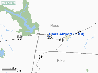
Location & QuickFacts
| FAA Information Effective: | 2008-09-25 |
| Airport Identifier: | 17OI |
| Airport Status: | Operational |
| Longitude/Latitude: | 083-19-03.6830W/39-13-36.2360N
-83.317690/39.226732 (Estimated) |
| Elevation: | 750 ft / 228.60 m (Estimated) |
| Land: | 5 acres |
| From nearest city: | 2 nautical miles W of Bainbridge, OH |
| Location: | Ross County, OH |
| Magnetic Variation: | 04W (1985) |
Owner & Manager
| Ownership: | Privately owned |
| Owner: | Virginia Haas |
| Address: | 1746 Us Highway 50
Bainbridge, OH 45612 |
| Phone number: | 614-634-2955 |
| Manager: | Virginia Haas |
| Address: | 1746 Us Highway 50
Bainbridge, OH 45612 |
| Phone number: | 614-634-2955
AMGR WINTER PHONE 614-634-3068 OR 407-220-2790. |
Airport Operations and Facilities
| Airport Use: | Private |
| Wind indicator: | Yes |
| Segmented Circle: | No |
| Control Tower: | No |
| Lighting Schedule: | PHONE REQ
FOR LIRL RY 13/31 CALL 614-634-2955 OR WINTER MONTHS CALL 614-634-3068 OR 407-220-2790. |
| Landing fee charge: | No |
| Sectional chart: | Cincinnati |
| Region: | AGL - Great Lakes |
| Boundary ARTCC: | ZID - Indianapolis |
| Tie-in FSS: | DAY - Dayton |
| FSS on Airport: | No |
| FSS Toll Free: | 1-800-WX-BRIEF |
Airport Services
| Airframe Repair: | MINOR |
| Power Plant Repair: | MINOR |
Runway Information
Runway 13/31
| Dimension: | 1920 x 90 ft / 585.2 x 27.4 m |
| Surface: | TURF, Good Condition |
| Edge Lights: | Non-standard lighting system
1710 FT OF RY UNUSBL AT NIGHT; RY 13 LGTD THLD RELOCATED 173 FT; RY 31 LGTD THLD RELOCATED 37 FT FOR NIGHT OPNS. NSTD LIRL; NOT FAA APPROVED L-800 SERIES. |
| |
Runway 13 |
Runway 31 |
| Traffic Pattern: | Left | Left |
| Obstruction: | 23 ft tree, 100 ft right of centerline | 20 ft road, 0.0 ft from runway, 90 ft right of centerline |
|
Radio Navigation Aids
| ID |
Type |
Name |
Ch |
Freq |
Var |
Dist |
| AJY | FAN MARKER | Ashland | | | 03W | 47.1 nm |
| HOC | NDB | Hillsboro | | 278.00 | 05W | 10.8 nm |
| EOP | NDB | Waverly | | 385.00 | 06W | 18.3 nm |
| PZO | NDB | Peebles | | 329.00 | 02W | 18.4 nm |
| RZT | NDB | Ross County | | 236.00 | 05W | 18.5 nm |
| CSS | NDB | Court House | | 414.00 | 05W | 22.7 nm |
| CYO | NDB | Circleville | | 366.00 | 05W | 23.7 nm |
| AMT | NDB | West Union | | 359.00 | 04W | 25.1 nm |
| IL | NDB | Airbo | | 407.00 | 04W | 25.2 nm |
| HW | NDB | Cubla | | 299.00 | 04W | 27.1 nm |
| PMH | NDB | Portsmouth | | 373.00 | 04W | 34.7 nm |
| BU | NDB | Boutn | | 230.00 | 05W | 36.0 nm |
| XEN | NDB | Xenia | | 395.00 | 03W | 40.9 nm |
| XW | NDB | Flmng | | 400.00 | 05W | 42.2 nm |
| PWF | NDB | Sportys | | 245.00 | 04W | 42.8 nm |
| UYF | NDB | London | | 263.00 | 06W | 43.1 nm |
| CCJ | NDB | Clark County | | 341.00 | 04W | 44.4 nm |
| LUK | NDB | Cincinnati | | 335.00 | 04W | 47.9 nm |
| MDE | NDB | Madeira | | 379.00 | 04W | 48.3 nm |
| CHC | NDB | Grens | | 272.00 | 04W | 48.9 nm |
| ISZ | NDB | Cincinnati-blue Ash | | 388.00 | 04W | 49.9 nm |
| LCK | TACAN | Rickenbacker | 069X | | 05W | 39.3 nm |
| XSF | TACAN | Springfield | 065X | | 04W | 44.0 nm |
| FFO | TACAN | Patterson | 099X | | 04W | 49.4 nm |
| XUB | VOR | Yellow Bud | | 112.50 | 05W | 24.0 nm |
| MXQ | VOR/DME | Midwest | 076X | 112.90 | 04W | 25.6 nm |
| SGH | VOR/DME | Springfield | 079X | 113.20 | 04W | 44.1 nm |
| YRK | VORTAC | York | 075X | 112.80 | 05W | 38.4 nm |
Remarks
Images and information placed above are from
http://www.airport-data.com/airport/17OI/
We thank them for the data!
| General Info
|
| Country |
United States
|
| State |
OHIO
|
| FAA ID |
17OI
|
| Latitude |
39-13-36.236N
|
| Longitude |
083-19-03.683W
|
| Elevation |
750 feet
|
| Near City |
BAINBRIDGE
|
We don't guarantee the information is fresh and accurate. The data may
be wrong or outdated.
For more up-to-date information please refer to other sources.
|
|


