 |
|
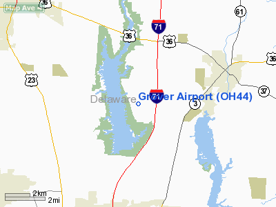
Location & QuickFacts
| FAA Information Effective: | 2008-09-25 |
| Airport Identifier: | OH44 |
| Airport Status: | Operational |
| Longitude/Latitude: | 082-56-46.6540W/40-13-14.2240N
-82.946293/40.220618 (Estimated) |
| Elevation: | 945 ft / 288.04 m (Estimated) |
| Land: | 0 acres |
| From nearest city: | 2 nautical miles SE of Cheshire, OH |
| Location: | Delaware County, OH |
| Magnetic Variation: | 05W (1985) |
Owner & Manager
| Ownership: | Privately owned |
| Owner: | Edgar T Grover |
| Address: | 3475 Africa Rd
Galena, OH 43201 |
| Phone number: | 614-548-5000 |
| Manager: | Edgar Grover |
| Address: | 3475 Africa Rd
Galena, OH 43021 |
| Phone number: | 614-548-5000 |
Airport Operations and Facilities
| Airport Use: | Private |
| Wind indicator: | Yes |
| Segmented Circle: | No |
| Control Tower: | No |
| Landing fee charge: | No |
| Sectional chart: | Detroit |
| Region: | AGL - Great Lakes |
| Boundary ARTCC: | ZID - Indianapolis |
| Tie-in FSS: | DAY - Dayton |
| FSS on Airport: | No |
| FSS Toll Free: | 1-800-WX-BRIEF |
Airport Services
| Airframe Repair: | NONE |
| Power Plant Repair: | NONE |
| Bottled Oxygen: | NONE |
| Bulk Oxygen: | NONE |
Runway Information
Runway 09/27
| Dimension: | 3545 x 110 ft / 1080.5 x 33.5 m |
| Surface: | TURF, |
| |
Runway 09 |
Runway 27 |
| Traffic Pattern: | Right | Left |
| Displaced threshold: | 500.00 ft | 500.00 ft |
| Obstruction: | 35 ft tree
40' TREES ON CNTRLN & 75' WEST OF THR. | 75 ft pline, 100.0 ft from runway
35' PLINE & 65' TREE ON CNTRLN 1/4 MILE EAST, 75' SOUTH OF CNTRLN; 60' TREES ENTIRE LENGTH OF RWY. |
|
Radio Navigation Aids
| ID |
Type |
Name |
Ch |
Freq |
Var |
Dist |
| DLZ | NDB | Delaware | | 215.00 | 06W | 8.0 nm |
| DKG | NDB | Don Scott | | 348.00 | 05W | 10.4 nm |
| CHC | NDB | Grens | | 272.00 | 04W | 13.2 nm |
| OS | NDB | Fuler | | 515.00 | 05W | 14.6 nm |
| CM | NDB | Sumie | | 391.00 | 05W | 16.6 nm |
| MRT | NDB | Marysville | | 403.00 | 05W | 18.5 nm |
| MNN | NDB | Marion | | 201.00 | 05W | 24.5 nm |
| HEH | NDB | Newark | | 524.00 | 06W | 25.1 nm |
| BU | NDB | Boutn | | 230.00 | 05W | 26.9 nm |
| UYF | NDB | London | | 263.00 | 06W | 29.5 nm |
| RUV | NDB | Rushsylvania | | 326.00 | 05W | 36.0 nm |
| MF | NDB | Manns | | 372.00 | 06W | 40.0 nm |
| EDJ | NDB | Bellefontaine | | 242.00 | 05W | 40.8 nm |
| CYO | NDB | Circleville | | 366.00 | 05W | 42.0 nm |
| CSS | NDB | Court House | | 414.00 | 05W | 42.5 nm |
| CCJ | NDB | Clark County | | 341.00 | 04W | 43.6 nm |
| RZT | NDB | Ross County | | 236.00 | 05W | 47.2 nm |
| LCK | TACAN | Rickenbacker | 069X | | 05W | 24.8 nm |
| XSF | TACAN | Springfield | 065X | | 04W | 47.1 nm |
| BUD | VOR | Buckeye | | 109.80 | 05W | 24.4 nm |
| XUB | VOR | Yellow Bud | | 112.50 | 05W | 41.7 nm |
| TVT | VOR/DME | Tiverton | 112X | 116.50 | 03W | 40.2 nm |
| SGH | VOR/DME | Springfield | 079X | 113.20 | 04W | 47.4 nm |
| APE | VORTAC | Appleton | 114X | 116.70 | 06W | 17.0 nm |
| MFD | VORTAC | Mansfield | 025X | 108.80 | 03W | 42.2 nm |
| CMH | VOT | Port Columbus | | 111.00 | | 13.9 nm |
Remarks
Images and information placed above are from
http://www.airport-data.com/airport/OH44/
We thank them for the data!
| General Info
|
| Country |
United States
|
| State |
OHIO
|
| FAA ID |
OH44
|
| Latitude |
40-13-14.224N
|
| Longitude |
082-56-46.654W
|
| Elevation |
945 feet
|
| Near City |
CHESHIRE
|
We don't guarantee the information is fresh and accurate. The data may
be wrong or outdated.
For more up-to-date information please refer to other sources.
|
|


