|
|
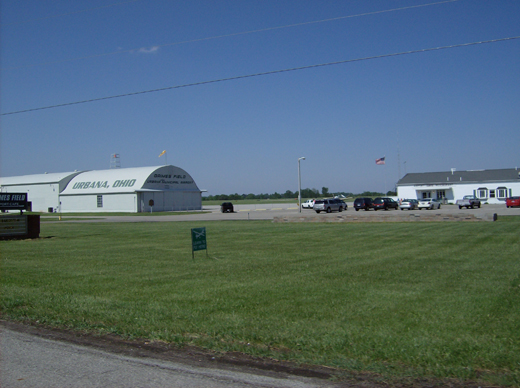
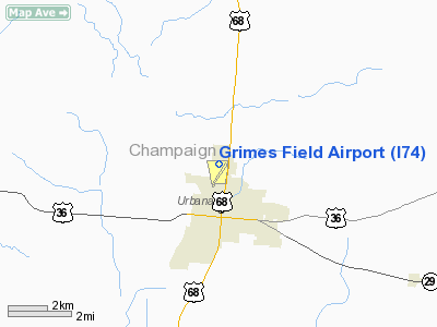
| Grimes Field |
 |
| IATA: none – ICAO: none – FAA LID: I74 |
| Summary |
| Airport type |
Public |
| Owner |
City of Urbana |
| Serves |
Urbana, Ohio |
| Elevation AMSL |
1,068 ft / 326 m |
| Coordinates |
40°07′57″N 083°45′13″W / 40.1325°N 83.75361°W / 40.1325; -83.75361 |
| Website |
www.GrimesField.com |
| Runways |
| Direction |
Length |
Surface |
| ft |
m |
| 2/20 |
4,400 |
1,341 |
Asphalt |
| Statistics (2007) |
| Aircraft operations |
23,480 |
| Based aircraft |
36 |
| Source: Federal Aviation Administration |
Grimes Field (FAA LID: I74) is a city-owned public-use airport located one nautical mile (1.85 km) north of the central business district of Urbana, a city in Champaign County, Ohio, United States. Named for Warren G. Grimes, it is also known as Urbana Municipal Airport and it serves general aviation traffic.
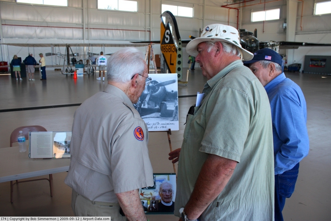
The airport is home to the Champaign Aviation Museum. It also houses project to rebuild a World War II era B-17 Medium Bomber called the Champaign Lady. The B-17 Project website shows the progress and has a live web camera in the hangar where the aircraft is stored. Volunteers work on it Monday through Saturday.
Facilities and aircraft
Grimes Field covers an area of 329 acres (133 ha) at an elevation of 1,068 feet (326 m) above mean sea level. It has one runway designated 2/20 with an asphalt surface measuring 4,400 by 100 feet (1,341 x 30 m).
For the 12-month period ending June 7, 2007, the airport had 23,480 aircraft operations, an average of 64 per day: 96% general aviation, 2% military and 2% air taxi, At that time there were 36 aircraft based at this airport: 72% single-engine, 11% multi-engine, 6% helicopter and 11% ultralight.
The above content comes from Wikipedia and is published under free licenses – click here to read more.
 |
(Click on the photo to enlarge) |
Location & QuickFacts
| FAA Information Effective: | 2008-09-25 |
| Airport Identifier: | I74 |
| Airport Status: | Operational |
| Longitude/Latitude: | 083-45-12.7000W/40-07-57.3000N
-83.753528/40.132583 (Estimated) |
| Elevation: | 1068 ft / 325.53 m (Surveyed) |
| Land: | 329 acres |
| From nearest city: | 1 nautical miles N of Urbana, OH |
| Location: | Champaign County, OH |
| Magnetic Variation: | 04W (1985) |
Owner & Manager
| Ownership: | Publicly owned |
| Owner: | City Of Urbana |
| Address: | 1636 N Main St
Urbana, OH 43078 |
| Phone number: | 937-652-4302 |
| Manager: | Carol Hall |
| Address: | 1636 N Main St.
Urbana, OH 43078 |
| Phone number: | 937-652-4319 |
Airport Operations and Facilities
| Airport Use: | Open to public |
| Wind indicator: | Yes |
| Segmented Circle: | No |
| Control Tower: | No |
| Lighting Schedule: | DUSK-DAWN
ACTVT MIRL RY 02/20, & REIL RYS 02 & 20 - CTAF. |
| Beacon Color: | Clear-Green (lighted land airport) |
| Landing fee charge: | No |
| Sectional chart: | Detroit |
| Region: | AGL - Great Lakes |
| Traffic Pattern Alt: | 800 ft |
| Boundary ARTCC: | ZID - Indianapolis |
| Tie-in FSS: | DAY - Dayton |
| FSS on Airport: | No |
| FSS Toll Free: | 1-800-WX-BRIEF |
| NOTAMs Facility: | DAY (NOTAM-d service avaliable) |
| Federal Agreements: | NGY |
Airport Communications
| CTAF: | 122.700 |
| Unicom: | 122.700 |
Airport Services
| Fuel available: | 100LLA |
| Airframe Repair: | MINOR |
| Power Plant Repair: | MINOR |
Runway Information
Runway 02/20
| Dimension: | 4400 x 100 ft / 1341.1 x 30.5 m |
| Surface: | ASPH, Good Condition |
| Edge Lights: | Medium |
| |
Runway 02 |
Runway 20 |
| Longitude: | 083-45-21.4302W | 083-45-04.0315W |
| Latitude: | 40-07-36.5647N | 40-08-17.9428N |
| Elevation: | 1058.00 ft | 1068.00 ft |
| Alignment: | 18 | 127 |
| Traffic Pattern: | Left | Left |
| Markings: | Non-precision instrument, Good Condition | Non-precision instrument, Good Condition |
| VASI: | 4-light PAPI on right side | 4-light PAPI on left side |
| Runway End Identifier: | Yes | Yes |
| Obstruction: | 54 ft tree, 1508.0 ft from runway, 285 ft left of centerline, 24:1 slope to clear | 71 ft tree, 2076.0 ft from runway, 329 ft right of centerline, 26:1 slope to clear |
|
Radio Navigation Aids
| ID |
Type |
Name |
Ch |
Freq |
Var |
Dist |
| EDJ | NDB | Bellefontaine | | 242.00 | 05W | 14.6 nm |
| CCJ | NDB | Clark County | | 341.00 | 04W | 15.6 nm |
| UYF | NDB | London | | 263.00 | 06W | 17.8 nm |
| MRT | NDB | Marysville | | 403.00 | 05W | 19.4 nm |
| RUV | NDB | Rushsylvania | | 326.00 | 05W | 20.0 nm |
| OS | NDB | Fuler | | 515.00 | 05W | 25.8 nm |
| XEN | NDB | Xenia | | 395.00 | 03W | 26.4 nm |
| DLZ | NDB | Delaware | | 215.00 | 06W | 31.1 nm |
| DKG | NDB | Don Scott | | 348.00 | 05W | 31.2 nm |
| BU | NDB | Boutn | | 230.00 | 05W | 31.5 nm |
| CHC | NDB | Grens | | 272.00 | 04W | 34.1 nm |
| VES | NDB | Versailles | | 356.00 | 04W | 35.6 nm |
| CSS | NDB | Court House | | 414.00 | 05W | 36.1 nm |
| LYL | NDB | Lima | | 362.00 | 04W | 36.5 nm |
| IL | NDB | Airbo | | 407.00 | 04W | 38.5 nm |
| CQA | NDB | Lakefield | | 205.00 | 04W | 42.7 nm |
| MNN | NDB | Marion | | 201.00 | 05W | 42.8 nm |
| CM | NDB | Sumie | | 391.00 | 05W | 46.8 nm |
| HW | NDB | Cubla | | 299.00 | 04W | 47.2 nm |
| HKF | NDB | Hook Field | | 239.00 | 04W | 49.8 nm |
| XSF | TACAN | Springfield | 065X | | 04W | 18.1 nm |
| FFO | TACAN | Patterson | 099X | | 04W | 23.4 nm |
| LCK | TACAN | Rickenbacker | 069X | | 05W | 42.7 nm |
| AOH | VOR | Allen County | | 108.40 | 04W | 35.9 nm |
| BUD | VOR | Buckeye | | 109.80 | 05W | 42.9 nm |
| SGH | VOR/DME | Springfield | 079X | 113.20 | 04W | 18.3 nm |
| DQN | VOR/DME | Dayton | 092X | 114.50 | 01W | 30.4 nm |
| MXQ | VOR/DME | Midwest | 076X | 112.90 | 04W | 42.3 nm |
| ROD | VORTAC | Rosewood | 122X | 117.50 | 05W | 16.2 nm |
| FDY | VORTAC | Findlay | 019X | 108.20 | 02W | 49.5 nm |
| DAY | VOT | Dayton J M Cox-day | | 111.00 | | 25.6 nm |
| CMH | VOT | Port Columbus | | 111.00 | | 40.8 nm |
Remarks
- DEER AND BIRDS ON AND INVOF ARPT.
- ESTB PRIOR TO 1959.
Images and information placed above are from
http://www.airport-data.com/airport/I74/
We thank them for the data!
| General Info
|
| Country |
United States
|
| State |
OHIO
|
| FAA ID |
I74
|
| Latitude |
40-07-45.419N
|
| Longitude |
083-45-17.559W
|
| Elevation |
1068 feet
|
| Near City |
URBANA
|
We don't guarantee the information is fresh and accurate. The data may
be wrong or outdated.
For more up-to-date information please refer to other sources.
|
|