|
|
Greene County-lewis A. Jackson Rgnl Airport |
| Greene County-Lewis A. Jackson Regional Airport |
| IATA: none – ICAO: none – FAA LID: I19 |
| Summary |
| Airport type |
Public |
| Owner |
Greene County Regional Airport Authority |
| Serves |
Dayton, Ohio |
| Location |
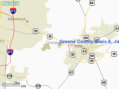
Xenia, Ohio |
| Elevation AMSL |
949 ft / 289 m |
| Coordinates |
39°41′28″N 083°59′31″W / 39.69111°N 83.99194°W / 39.69111; -83.99194 |
| Website |
www.i19airport.com |
| Runways |
| Direction |
Length |
Surface |
| ft |
m |
| 7/25 |
4,500 |
1,372 |
Asphalt |
| Statistics (2006) |
| Aircraft operations |
38,900 |
| Based aircraft |
70 |
| Sources: FAA and airport website |
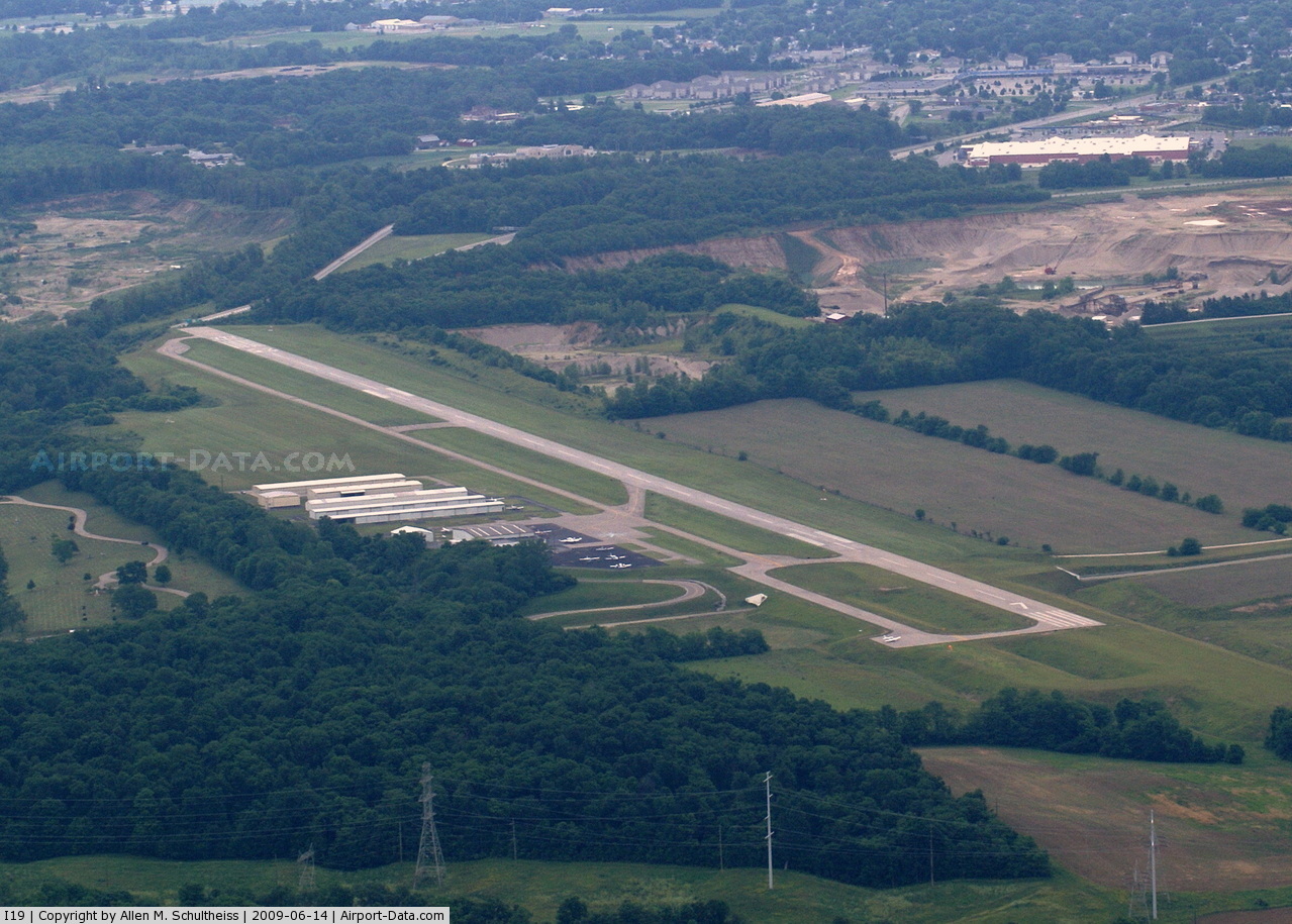
Greene County-Lewis A. Jackson Regional Airport (FAA LID: I19) is a public-use airport located in Xenia, a city in Greene County, Ohio, United States. It is 10 nautical miles (19 km) east of the central business district of the city of Dayton.
The airport is owned by the Greene County Regional Airport Authority. It underwent a significant expansion in 2005, adding runway and taxi length as well as service buildings and roads.
Facilities and aircraft
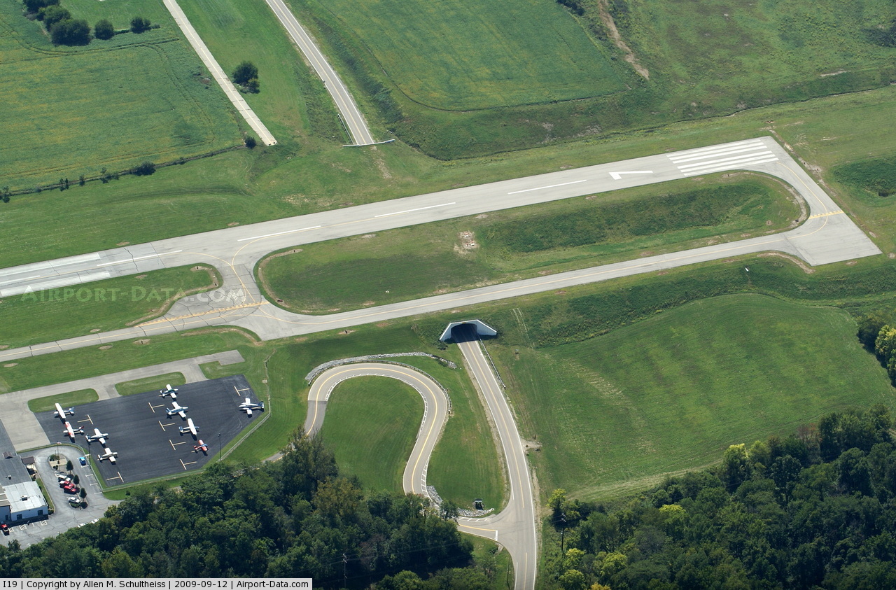
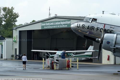
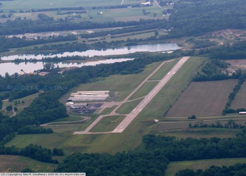
Greene County-Lewis A. Jackson Regional Airport covers an area of 180 acres (73 ha) at an elevation of 949 feet (289 m) above mean sea level. It has one runway designated 7/25 with a 4,500 by 75 ft (1,372 x 23 m) asphalt pavement.
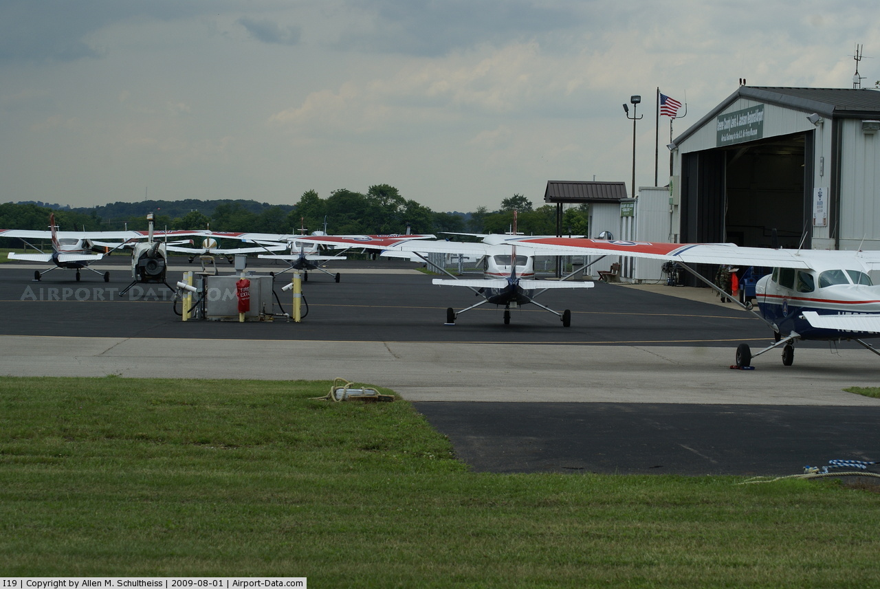
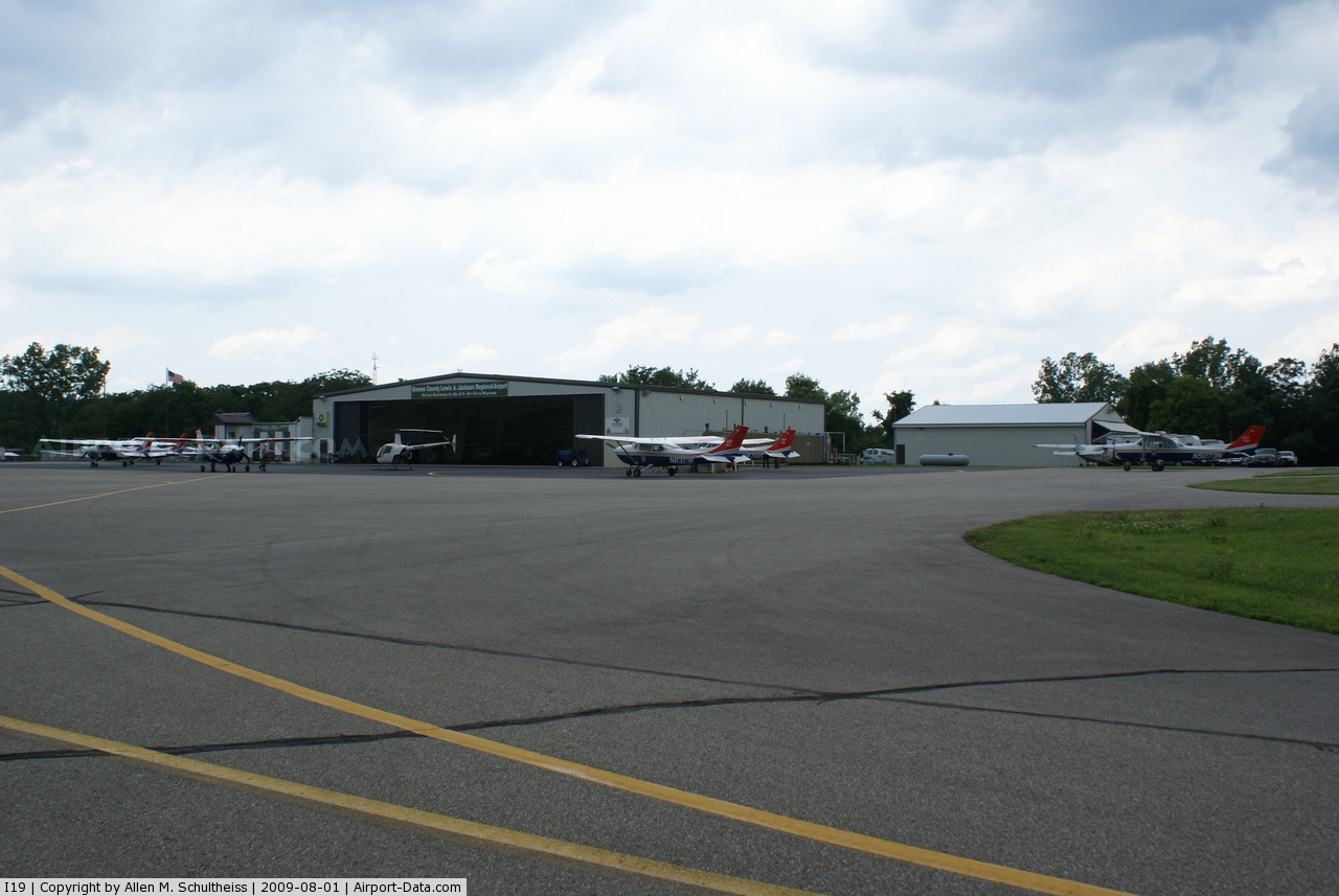
For the 12-month period ending December 15, 2006, the airport had 38,900 aircraft operations, an average of 106 per day, all of which were general aviation. At that time there were 70 aircraft based at this airport: 86% single-engine and 14% multi-engine.
The above content comes from Wikipedia and is published under free licenses – click here to read more.
 |
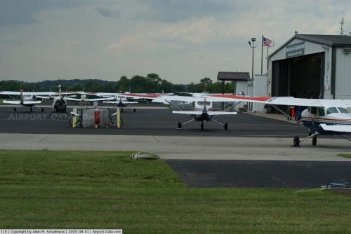
(Click on the photo to enlarge) |
 |
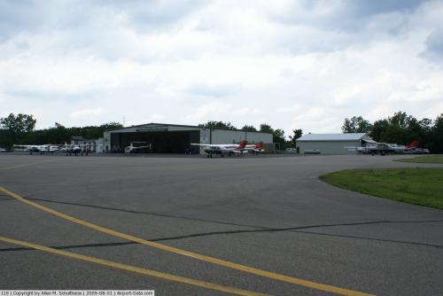
(Click on the photo to enlarge) |
 |
(Click on the photo to enlarge) |
 |
(Click on the photo to enlarge) |
 |
(Click on the photo to enlarge) |
 |
(Click on the photo to enlarge) |
 |
(Click on the photo to enlarge) |
Location & QuickFacts
| FAA Information Effective: | 2008-09-25 |
| Airport Identifier: | I19 |
| Airport Status: | Operational |
| Longitude/Latitude: | 083-59-31.1650W/39-41-27.7000N
-83.991990/39.691028 (Estimated) |
| Elevation: | 949 ft / 289.26 m (Surveyed) |
| Land: | 180 acres |
| From nearest city: | 10 nautical miles E of Dayton, OH |
| Location: | Greene County, OH |
| Magnetic Variation: | 05W (1995) |
Owner & Manager
| Ownership: | Publicly owned |
| Owner: | Greene County Regnl Arpt Auth |
| Address: | 140 N Valley Rd,
Xenia, OH 45385 |
| Phone number: | 937-376-8107 |
| Manager: | Don Smith |
| Address: | 140 N Valley Rd,
Xenia, OH 45385 |
| Phone number: | 937-376-8107 |
Airport Operations and Facilities
| Airport Use: | Open to public |
| Wind indicator: | Yes |
| Segmented Circle: | No |
| Control Tower: | No |
| Lighting Schedule: | DUSK-DAWN
ACTVT LIRL RY 07/25 PAPI RY 07/25 & REIL RYS 07 & 25 - CTAF. |
| Beacon Color: | Clear-Green (lighted land airport) |
| Landing fee charge: | No |
| Sectional chart: | Cincinnati |
| Region: | AGL - Great Lakes |
| Boundary ARTCC: | ZID - Indianapolis |
| Tie-in FSS: | DAY - Dayton |
| FSS on Airport: | No |
| FSS Toll Free: | 1-800-WX-BRIEF |
| NOTAMs Facility: | DAY (NOTAM-d service avaliable) |
| Federal Agreements: | NGY |
Airport Communications
| CTAF: | 122.700 |
| Unicom: | 122.700 |
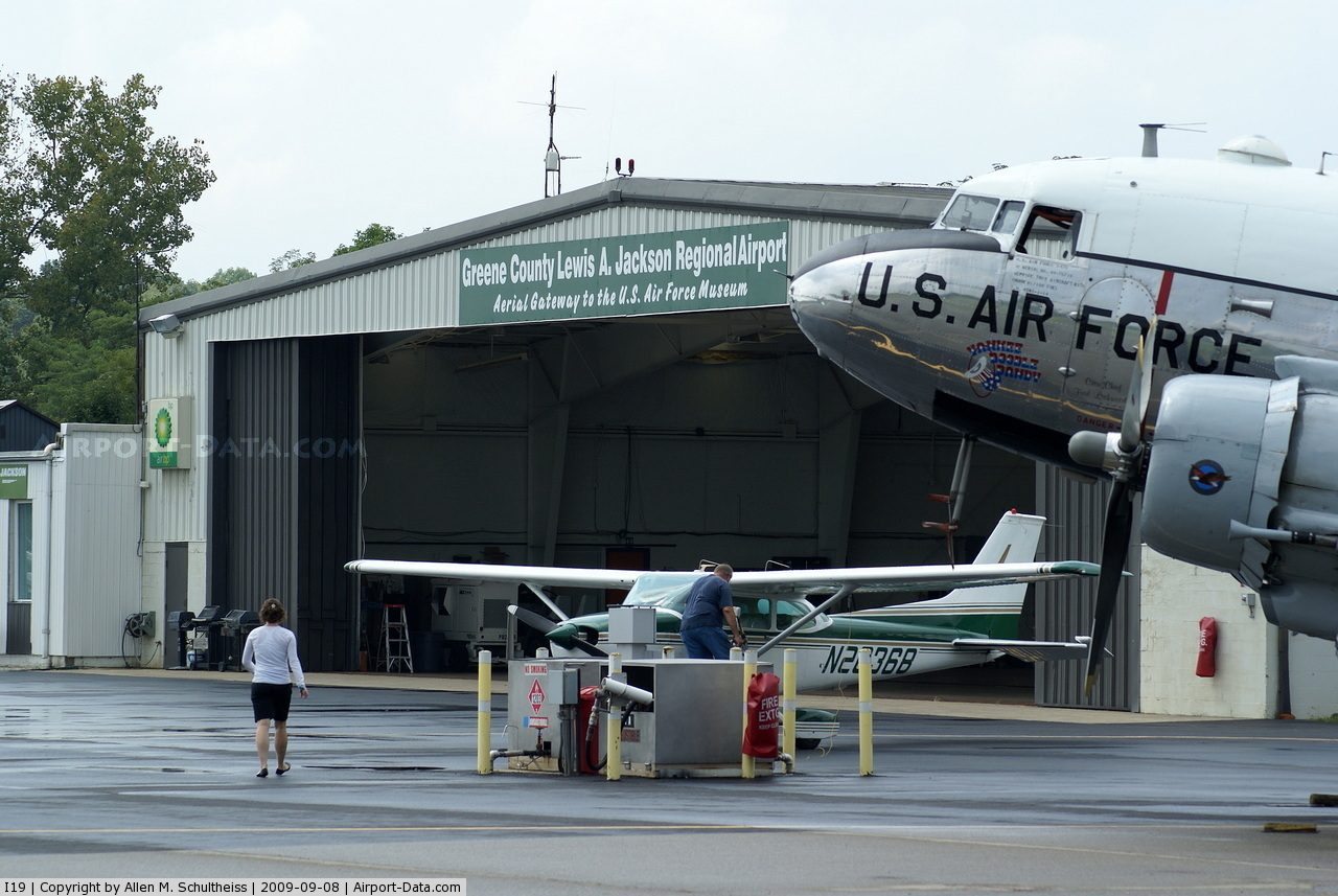
Airport Services
| Fuel available: | 100LLA+
FUEL AVBL 24 HRS WITH CREDIT CARD. |
| Airframe Repair: | MAJOR |
| Power Plant Repair: | MAJOR |
Runway Information
Runway 07/25
| Dimension: | 4500 x 75 ft / 1371.6 x 22.9 m |
| Surface: | ASPH, Good Condition |
| Weight Limit: | Single wheel: 30000 lbs. |
| Edge Lights: | Low |
| |
Runway 07 |
Runway 25 |
| Longitude: | 083-59-56.8300W | 083-59-05.5000W |
| Latitude: | 39-41-17.6300N | 39-41-37.7700N |
| Elevation: | 914.00 ft | 946.00 ft |
| Alignment: | 63 | 127 |
| Traffic Pattern: | Left | Left |
| Markings: | Non-precision instrument, Good Condition | Non-precision instrument, Good Condition |
| Crossing Height: | 34.00 ft | 0.00 ft |
| VASI: | 2-light PAPI on left side | 2-light PAPI on left side |
| Visual Glide Angle: | 4.00° | 0.00° |
| Runway End Identifier: | Yes | Yes
RY 25 REIL OTS INDEFLY. |
| Centerline Lights: | No | No |
| Touchdown Lights: | No | No |
| Obstruction: | 50 ft trees, 396.0 ft from runway, 250 ft right of centerline, 4:1 slope to clear | 16 ft trees, 549.0 ft from runway, 305 ft right of centerline, 21:1 slope to clear
APPROACH SLOPE TO DISPLACED THRESHOLD IS 41:1 |
|
Radio Navigation Aids
| ID |
Type |
Name |
Ch |
Freq |
Var |
Dist |
| XEN | NDB | Xenia | | 395.00 | 03W | 3.2 nm |
| CCJ | NDB | Clark County | | 341.00 | 04W | 14.7 nm |
| IL | NDB | Airbo | | 407.00 | 04W | 16.8 nm |
| HW | NDB | Cubla | | 299.00 | 04W | 21.0 nm |
| HKF | NDB | Hook Field | | 239.00 | 04W | 24.1 nm |
| CSS | NDB | Court House | | 414.00 | 05W | 28.3 nm |
| UYF | NDB | London | | 263.00 | 06W | 28.3 nm |
| ISZ | NDB | Cincinnati-blue Ash | | 388.00 | 04W | 32.4 nm |
| MDE | NDB | Madeira | | 379.00 | 04W | 32.8 nm |
| HAO | NDB | Hamilton | | 260.00 | 04W | 33.0 nm |
| LUK | NDB | Cincinnati | | 335.00 | 04W | 35.8 nm |
| HOC | NDB | Hillsboro | | 278.00 | 05W | 36.9 nm |
| BU | NDB | Boutn | | 230.00 | 05W | 37.2 nm |
| OXD | NDB | Oxford | | 282.00 | 04W | 38.2 nm |
| PWF | NDB | Sportys | | 245.00 | 04W | 38.4 nm |
| VES | NDB | Versailles | | 356.00 | 04W | 39.5 nm |
| EDJ | NDB | Bellefontaine | | 242.00 | 05W | 41.7 nm |
| OS | NDB | Fuler | | 515.00 | 05W | 43.2 nm |
| MRT | NDB | Marysville | | 403.00 | 05W | 43.7 nm |
| RZT | NDB | Ross County | | 236.00 | 05W | 47.1 nm |
| CYO | NDB | Circleville | | 366.00 | 05W | 48.0 nm |
| DKG | NDB | Don Scott | | 348.00 | 05W | 48.2 nm |
| CHC | NDB | Grens | | 272.00 | 04W | 48.4 nm |
| RUV | NDB | Rushsylvania | | 326.00 | 05W | 48.5 nm |
| FFO | TACAN | Patterson | 099X | | 04W | 8.2 nm |
| XSF | TACAN | Springfield | 065X | | 04W | 11.3 nm |
| LCK | TACAN | Rickenbacker | 069X | | 05W | 49.6 nm |
| XUB | VOR | Yellow Bud | | 112.50 | 05W | 48.0 nm |
| SGH | VOR/DME | Springfield | 079X | 113.20 | 04W | 11.1 nm |
| MXQ | VOR/DME | Midwest | 076X | 112.90 | 04W | 18.0 nm |
| DQN | VOR/DME | Dayton | 092X | 114.50 | 01W | 27.0 nm |
| ROD | VORTAC | Rosewood | 122X | 117.50 | 05W | 35.9 nm |
| RID | VORTAC | Richmond | 043X | 110.60 | 03W | 39.3 nm |
| DAY | VOT | Dayton J M Cox-day | | 111.00 | | 16.5 nm |
| LUK | VOT | Cincinnati Muni/lunken | | 108.40 | | 39.4 nm |
Remarks
- DEER ON & INVOF ARPT.
- GCO AVBL ON FREQ 121.725 THRU DAY CLEARANCE DELIVERY .
- PAEW ADJ RY 07 SR-SS.
Images and information placed above are from
http://www.airport-data.com/airport/I19/
We thank them for the data!
| General Info
|
| Country |
United States
|
| State |
OHIO
|
| FAA ID |
I19
|
| Latitude |
39-41-30.215N
|
| Longitude |
083-59-24.857W
|
| Elevation |
949 feet
|
| Near City |
DAYTON
|
We don't guarantee the information is fresh and accurate. The data may
be wrong or outdated.
For more up-to-date information please refer to other sources.
|
|