 |
|
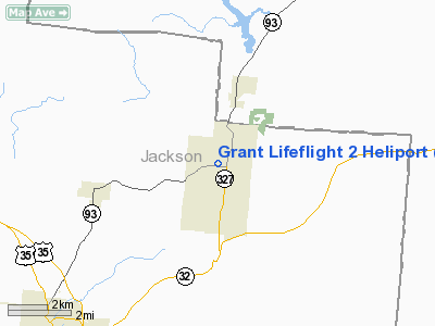
Grant Lifeflight 2 Heliport |
Location & QuickFacts
| FAA Information Effective: | 2008-09-25 |
| Airport Identifier: | 84OI |
| Airport Status: | Operational |
| Longitude/Latitude: | 082-32-17.5760W/39-07-30.2590N
-82.538216/39.125072 (Estimated) |
| Elevation: | 716 ft / 218.24 m (Estimated) |
| Land: | 2 acres |
| From nearest city: | 1 nautical miles E of Wellston, OH |
| Location: | Jackson County, OH |
| Magnetic Variation: | 05W (1985) |
Owner & Manager
| Ownership: | Privately owned |
| Owner: | Grant Medical Center |
| Address: | 111 S. Grant Ave.
Columbus, OH 43215 |
| Phone number: | 701-466-2253 |
| Manager: | Murry R Price/jim Mohney |
| Address: | 111 S. Grant Ave.
Columbus, OH 43215 |
| Phone number: | 614-384-2191 |
Airport Operations and Facilities
| Airport Use: | Private |
| Wind indicator: | Yes |
| Segmented Circle: | No |
| Control Tower: | No |
| Sectional chart: | Detroit |
| Region: | AGL - Great Lakes |
| Boundary ARTCC: | ZID - Indianapolis |
| Tie-in FSS: | DAY - Dayton |
| FSS Toll Free: | 1-800-WX-BRIEF |
Airport Services
Runway Information
Helipad H1
| Dimension: | 20 x 20 ft / 6.1 x 6.1 m |
| Surface: | CONC, |
| |
Runway H1 |
Runway |
| Traffic Pattern: | Left | Left |
|
Radio Navigation Aids
| ID |
Type |
Name |
Ch |
Freq |
Var |
Dist |
| AJY | FAN MARKER | Ashland | | | 03W | 36.2 nm |
| EOP | NDB | Waverly | | 385.00 | 06W | 18.5 nm |
| UGS | NDB | University | | 250.00 | 06W | 20.8 nm |
| GAS | NDB | Gallipolis | | 420.00 | 07W | 24.8 nm |
| PMH | NDB | Portsmouth | | 373.00 | 04W | 25.1 nm |
| RZT | NDB | Ross County | | 236.00 | 05W | 29.6 nm |
| CYO | NDB | Circleville | | 366.00 | 05W | 31.5 nm |
| PZO | NDB | Peebles | | 329.00 | 02W | 38.8 nm |
| HOC | NDB | Hillsboro | | 278.00 | 05W | 47.0 nm |
| CSS | NDB | Court House | | 414.00 | 05W | 48.9 nm |
| LCK | TACAN | Rickenbacker | 069X | | 05W | 44.9 nm |
| XUB | VOR | Yellow Bud | | 112.50 | 05W | 31.6 nm |
| HNN | VORTAC | Henderson | 106X | 115.90 | 03W | 32.7 nm |
| YRK | VORTAC | York | 075X | 112.80 | 05W | 35.5 nm |
Remarks
- PRVDD OPNS ARE FM 360 DEGREES TO 240 DEGREES; AREA MKD; WIND INDICATOR MAINTAINED.
Images and information placed above are from
http://www.airport-data.com/airport/84OI/
We thank them for the data!
| General Info
|
| Country |
United States
|
| State |
OHIO
|
| FAA ID |
84OI
|
| Latitude |
39-07-30.259N
|
| Longitude |
082-32-17.576W
|
| Elevation |
716 feet
|
| Near City |
WELLSTON
|
We don't guarantee the information is fresh and accurate. The data may
be wrong or outdated.
For more up-to-date information please refer to other sources.
|
|


