 |
|
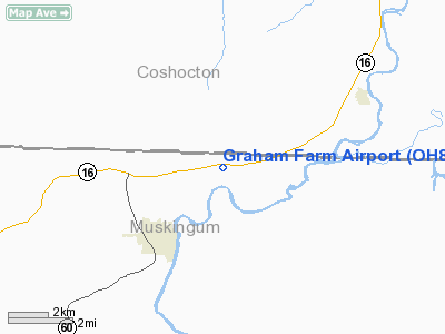
Location & QuickFacts
| FAA Information Effective: | 2008-09-25 |
| Airport Identifier: | OH82 |
| Airport Status: | Operational |
| Longitude/Latitude: | 081-58-24.4850W/40-09-12.2510N
-81.973468/40.153403 (Estimated) |
| Elevation: | 725 ft / 220.98 m (Estimated) |
| Land: | 7 acres |
| From nearest city: | 1 nautical miles W of Adams Mills, OH |
| Location: | Muskingum County, OH |
| Magnetic Variation: | 06W (1985) |
Owner & Manager
| Ownership: | Privately owned |
| Owner: | G. Richard Graham |
| Address: | Box 85
Adams Mills, OH 43821 |
| Phone number: | 614-754-2121
OR 754-1753. |
| Manager: | John R. Graham |
| Address: | Box 25
Adams Mills, OH 43821 |
| Phone number: | 614-754-2121 |
Airport Operations and Facilities
| Airport Use: | Private |
| Wind indicator: | Yes |
| Segmented Circle: | No |
| Control Tower: | No |
| Lighting Schedule: | PHONE REQ
FOR LIRL RY 08/26 CALL 614-754-1753. |
| Sectional chart: | Detroit |
| Region: | AGL - Great Lakes |
| Boundary ARTCC: | ZID - Indianapolis |
| Tie-in FSS: | CLE - Cleveland |
| FSS on Airport: | No |
| FSS Toll Free: | 1-800-WX-BRIEF |
Runway Information
Runway 08/26
| Dimension: | 2595 x 80 ft / 791.0 x 24.4 m |
| Surface: | TURF, |
| Edge Lights: | Low |
| |
Runway 08 |
Runway 26 |
| Traffic Pattern: | Left | Left |
|
Radio Navigation Aids
| ID |
Type |
Name |
Ch |
Freq |
Var |
Dist |
| HRA | NDB | Zanesville | | 204.00 | 06W | 15.1 nm |
| MLR | NDB | Millersburg/dcmsnd | | 382.00 | 06W | 23.8 nm |
| HEH | NDB | Newark | | 524.00 | 06W | 23.8 nm |
| CM | NDB | Sumie | | 391.00 | 05W | 37.3 nm |
| MF | NDB | Manns | | 372.00 | 06W | 42.7 nm |
| CFX | NDB | Cadiz | | 239.00 | 07W | 44.4 nm |
| TSO | NDB | Tolson | | 395.00 | 07W | 47.8 nm |
| CHC | NDB | Grens | | 272.00 | 04W | 49.3 nm |
| LCK | TACAN | Rickenbacker | 069X | | 05W | 48.6 nm |
| ZZV | VOR/DME | Zanesville | 051X | 111.40 | 06W | 13.3 nm |
| TVT | VOR/DME | Tiverton | 112X | 116.50 | 03W | 19.6 nm |
| CTW | VOR/DME | Newcomerstown | 055X | 111.80 | 07W | 23.3 nm |
| BSV | VOR/DME | Briggs | 071X | 112.40 | 04W | 43.1 nm |
| APE | VORTAC | Appleton | 114X | 116.70 | 06W | 28.2 nm |
| CMH | VOT | Port Columbus | | 111.00 | | 43.0 nm |
Images and information placed above are from
http://www.airport-data.com/airport/OH82/
We thank them for the data!
| General Info
|
| Country |
United States
|
| State |
OHIO
|
| FAA ID |
OH82
|
| Latitude |
40-09-12.251N
|
| Longitude |
081-58-24.485W
|
| Elevation |
725 feet
|
| Near City |
ADAMS MILLS
|
We don't guarantee the information is fresh and accurate. The data may
be wrong or outdated.
For more up-to-date information please refer to other sources.
|
|


