 |
|
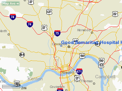
Good Samaritan Hospital Heliport |
Location & QuickFacts
| FAA Information Effective: | 2008-09-25 |
| Airport Identifier: | 92OI |
| Airport Status: | Operational |
| Longitude/Latitude: | 084-31-14.7950W/39-08-21.2130N
-84.520776/39.139226 (Estimated) |
| Elevation: | 825 ft / 251.46 m (Estimated) |
| Land: | 0 acres |
| From nearest city: | 3 nautical miles S of Cincinnati, OH |
| Location: | Hamilton County, OH |
| Magnetic Variation: | 03W (1985) |
Owner & Manager
| Ownership: | Privately owned |
| Owner: | Good Samaritan Hospital |
| Address: | 375 Dixmyth Ave
Cincinnati, OH 45220-2489 |
| Phone number: | 513-872-2892 |
| Manager: | Dennis Malone |
| Address: |
|
Airport Operations and Facilities
| Airport Use: | Private
MEDICAL USE. |
| Wind indicator: | Yes |
| Segmented Circle: | No |
| Control Tower: | No |
| Sectional chart: | Cincinnati |
| Region: | AGL - Great Lakes |
| Boundary ARTCC: | ZID - Indianapolis |
| Tie-in FSS: | DAY - Dayton |
| FSS Toll Free: | 1-800-WX-BRIEF
OR LOCAL CALL 871-8220. |
Runway Information
Helipad H1
| Dimension: | 45 x 41 ft / 13.7 x 12.5 m |
| Surface: | CONC,
ROOFTOP. |
| |
Runway H1 |
Runway |
| Traffic Pattern: | Left | Left |
|
Radio Navigation Aids
| ID |
Type |
Name |
Ch |
Freq |
Var |
Dist |
| LUK | NDB | Cincinnati | | 335.00 | 04W | 8.5 nm |
| ISZ | NDB | Cincinnati-blue Ash | | 388.00 | 04W | 9.0 nm |
| MDE | NDB | Madeira | | 379.00 | 04W | 9.2 nm |
| UR | NDB | Burln | | 321.00 | 04W | 13.0 nm |
| HAO | NDB | Hamilton | | 260.00 | 04W | 14.2 nm |
| PWF | NDB | Sportys | | 245.00 | 04W | 14.7 nm |
| HKF | NDB | Hook Field | | 239.00 | 04W | 21.9 nm |
| OXD | NDB | Oxford | | 282.00 | 04W | 25.2 nm |
| HW | NDB | Cubla | | 299.00 | 04W | 32.7 nm |
| HLB | NDB | Batesville | | 254.00 | 02W | 36.6 nm |
| IL | NDB | Airbo | | 407.00 | 04W | 42.2 nm |
| XEN | NDB | Xenia | | 395.00 | 03W | 44.2 nm |
| HOC | NDB | Hillsboro | | 278.00 | 05W | 45.7 nm |
| AMT | NDB | West Union | | 359.00 | 04W | 47.8 nm |
| IMS | NDB | Madison | | 404.00 | 03W | 49.5 nm |
| FFO | TACAN | Patterson | 099X | | 04W | 46.2 nm |
| FLM | VOR/DME | Falmouth | 117X | 117.00 | 04W | 31.0 nm |
| MXQ | VOR/DME | Midwest | 076X | 112.90 | 04W | 37.8 nm |
| CVG | VORTAC | Cincinnati | 120X | 117.30 | 04W | 11.3 nm |
| RID | VORTAC | Richmond | 043X | 110.60 | 03W | 39.8 nm |
| LUK | VOT | Cincinnati Muni/lunken | | 108.40 | | 5.8 nm |
| DAY | VOT | Dayton J M Cox-day | | 111.00 | | 47.9 nm |
Remarks
- OPERATIONS ARE CONDUCTED FROM 360 TO 260.
Images and information placed above are from
http://www.airport-data.com/airport/92OI/
We thank them for the data!
| General Info
|
| Country |
United States
|
| State |
OHIO
|
| FAA ID |
OH56
|
| Latitude |
39-47-16.209N
|
| Longitude |
084-14-03.791W
|
| Elevation |
914 feet
|
| Near City |
DAYTON
|
We don't guarantee the information is fresh and accurate. The data may
be wrong or outdated.
For more up-to-date information please refer to other sources.
|
|


