 |
|
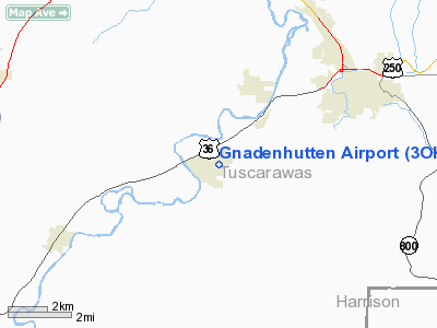
Location & QuickFacts
| FAA Information Effective: | 2008-09-25 |
| Airport Identifier: | 3OH8 |
| Airport Status: | Operational |
| Longitude/Latitude: | 081-25-24.0000W/40-21-39.0000N
-81.423333/40.360833 (Estimated) |
| Elevation: | 842 ft / 256.64 m (Estimated) |
| Land: | 5 acres |
| From nearest city: | 1 nautical miles EN of Gnadenhutten, OH |
| Location: | Tuscarawas County, OH |
| Magnetic Variation: | () |
Owner & Manager
| Ownership: | Privately owned |
| Owner: | Stocker Concrete Co. |
| Address: | Po Box 176
Gnadenhutten, OH 44629 |
| Phone number: | 740-254-9357 |
| Manager: | Bryan Stocker |
| Address: | 150 Delaware Dr
Gnadenhutten, OH 44629 |
Airport Operations and Facilities
| Airport Use: | Private |
| Wind indicator: | Yes |
| Control Tower: | No |
| Sectional chart: | Detroit |
| Region: | AGL - Great Lakes |
| Boundary ARTCC: | ZOB - Cleveland |
| Tie-in FSS: | CLE - Cleveland |
| FSS Toll Free: | 1-800-WX-BRIEF |
Runway Information
Runway 05/23
| Dimension: | 2300 x 100 ft / 701.0 x 30.5 m |
| Surface: | TURF, |
| |
Runway 05 |
Runway 23 |
| Traffic Pattern: | Left | Left |
| Obstruction: | | 42 ft pole, 150.0 ft from runway |
|
Radio Navigation Aids
| ID |
Type |
Name |
Ch |
Freq |
Var |
Dist |
| TSO | NDB | Tolson | | 395.00 | 07W | 19.9 nm |
| CFX | NDB | Cadiz | | 239.00 | 07W | 20.2 nm |
| MLR | NDB | Millersburg/dcmsnd | | 382.00 | 06W | 23.3 nm |
| HRA | NDB | Zanesville | | 204.00 | 06W | 35.6 nm |
| AK | NDB | Akron | | 362.00 | 07W | 42.6 nm |
| CTW | VOR/DME | Newcomerstown | 055X | 111.80 | 07W | 8.3 nm |
| BSV | VOR/DME | Briggs | 071X | 112.40 | 04W | 22.8 nm |
| TVT | VOR/DME | Tiverton | 112X | 116.50 | 03W | 32.7 nm |
| ZZV | VOR/DME | Zanesville | 051X | 111.40 | 06W | 33.2 nm |
| AIR | VOR/DME | Bellaire | 118X | 117.10 | 07W | 34.7 nm |
| HLG | VOR/DME | Wheeling | 059X | 112.20 | 07W | 39.6 nm |
| ACO | VOR/DME | Akron | 091X | 114.40 | 04W | 46.0 nm |
| CAK | VOT | Akron/canton Regional | | 110.60 | | 33.4 nm |
Remarks
- PRVDD YOU COORDINATE WITH AGL AF DIVISION FOR FUTURE PLANNING OF NON-FED NAVAIDS, AND YOU FOLLOW AC 150/5340-14 REGARDING THE DESIGN AND INSTALLATION OF NON-FED NAVAIDS.
Images and information placed above are from
http://www.airport-data.com/airport/3OH8/
We thank them for the data!
| General Info
|
| Country |
United States
|
| State |
OHIO
|
| FAA ID |
3OH8
|
| Latitude |
40-42-08.169N
|
| Longitude |
084-45-51.863W
|
| Elevation |
820 feet
|
| Near City |
WILLSHIRE
|
We don't guarantee the information is fresh and accurate. The data may
be wrong or outdated.
For more up-to-date information please refer to other sources.
|
|


