 |
|
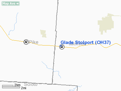
Location & QuickFacts
| FAA Information Effective: | 2008-09-25 |
| Airport Identifier: | OH37 |
| Airport Status: | Operational |
| Longitude/Latitude: | 082-47-18.6130W/39-00-42.2600N
-82.788504/39.011739 (Estimated) |
| Elevation: | 690 ft / 210.31 m (Estimated) |
| Land: | 0 acres |
| From nearest city: | 2 nautical miles SE of Beaver, OH |
| Location: | Jackson County, OH |
| Magnetic Variation: | 05W (1985) |
Owner & Manager
| Ownership: | Privately owned |
| Owner: | W.r. Fout |
| Address: | 7355 Marietta Rd
Chillicothe, OHIO 45601 |
| Phone number: | 614-772-6162 |
| Address: |
|
Airport Operations and Facilities
| Airport Use: | Private |
| Wind indicator: | No |
| Segmented Circle: | No |
| Control Tower: | No |
| Landing fee charge: | No |
| Sectional chart: | Cincinnati |
| Region: | AGL - Great Lakes |
| Boundary ARTCC: | ZID - Indianapolis |
| Tie-in FSS: | DAY - Dayton |
| FSS on Airport: | No |
| FSS Toll Free: | 1-800-WX-BRIEF |
Airport Services
| Airframe Repair: | NONE |
| Power Plant Repair: | NONE |
Runway Information
Runway 13/31
| Dimension: | 1000 x 40 ft / 304.8 x 12.2 m |
| Surface: | TURF,
RWY SOFT DURING WINTER MONTHS. |
| |
Runway 13 |
Runway 31 |
| Traffic Pattern: | Left | Left |
|
Radio Navigation Aids
| ID |
Type |
Name |
Ch |
Freq |
Var |
Dist |
| AJY | FAN MARKER | Ashland | | | 03W | 27.3 nm |
| EOP | NDB | Waverly | | 385.00 | 06W | 11.5 nm |
| PMH | NDB | Portsmouth | | 373.00 | 04W | 14.1 nm |
| PZO | NDB | Peebles | | 329.00 | 02W | 25.7 nm |
| RZT | NDB | Ross County | | 236.00 | 05W | 28.0 nm |
| GAS | NDB | Gallipolis | | 420.00 | 07W | 31.2 nm |
| CYO | NDB | Circleville | | 366.00 | 05W | 32.0 nm |
| UGS | NDB | University | | 250.00 | 06W | 34.2 nm |
| HOC | NDB | Hillsboro | | 278.00 | 05W | 36.7 nm |
| AMT | NDB | West Union | | 359.00 | 04W | 37.4 nm |
| CSS | NDB | Court House | | 414.00 | 05W | 45.2 nm |
| XW | NDB | Flmng | | 400.00 | 05W | 48.1 nm |
| LCK | TACAN | Rickenbacker | 069X | | 05W | 48.3 nm |
| XUB | VOR | Yellow Bud | | 112.50 | 05W | 32.2 nm |
| YRK | VORTAC | York | 075X | 112.80 | 05W | 23.8 nm |
| HNN | VORTAC | Henderson | 106X | 115.90 | 03W | 38.9 nm |
Remarks
- RWY PLOWED UP FOR FARMING; ARPT CLOSED UNTIL FURTHER NOTICE.
- VFR WEATHER CONDITIONS ONLY
Images and information placed above are from
http://www.airport-data.com/airport/OH37/
We thank them for the data!
| General Info
|
| Country |
United States
|
| State |
OHIO
|
| FAA ID |
OH37
|
| Latitude |
39-00-42.260N
|
| Longitude |
082-47-18.613W
|
| Elevation |
690 feet
|
| Near City |
BEAVER
|
We don't guarantee the information is fresh and accurate. The data may
be wrong or outdated.
For more up-to-date information please refer to other sources.
|
|


