 |
|
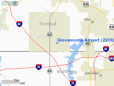
Location & QuickFacts
| FAA Information Effective: | 2008-09-25 |
| Airport Identifier: | 22OI |
| Airport Status: | Operational |
| Longitude/Latitude: | 080-50-24.3010W/41-08-56.2060N
-80.840084/41.148946 (Estimated) |
| Elevation: | 950 ft / 289.56 m (Estimated) |
| Land: | 0 acres |
| From nearest city: | 2 nautical miles SE of Lordstown, OH |
| Location: | Trumbull County, OH |
| Magnetic Variation: | 07W (1985) |
Owner & Manager
| Ownership: | Privately owned |
| Owner: | Jerry Giovannone |
| Address: | 3485 Goldner Lanes W
Warren, OH 44481 |
| Phone number: | 216-824-2675 |
| Address: |
|
Airport Operations and Facilities
| Airport Use: | Private |
| Wind indicator: | Yes |
| Segmented Circle: | No |
| Control Tower: | No |
| Sectional chart: | Detroit |
| Region: | AGL - Great Lakes |
| Boundary ARTCC: | ZOB - Cleveland |
| Tie-in FSS: | CLE - Cleveland |
| FSS on Airport: | No |
| FSS Toll Free: | 1-800-WX-BRIEF |
Runway Information
Runway 18/36
| Dimension: | 2500 x 140 ft / 762.0 x 42.7 m |
| Surface: | TURF, |
| |
Runway 18 |
Runway 36 |
| Traffic Pattern: | Left | Left |
| Obstruction: | 60 ft pline, 250.0 ft from runway | |
|
Radio Navigation Aids
| ID |
Type |
Name |
Ch |
Freq |
Var |
Dist |
| HBD | NDB | Hubbard | | 408.00 | 08W | 14.0 nm |
| UCP | NDB | Castle | | 272.00 | 09W | 20.7 nm |
| AK | NDB | Akron | | 362.00 | 07W | 25.2 nm |
| TSO | NDB | Tolson | | 395.00 | 07W | 36.9 nm |
| LQL | NDB | Lakeland | | 263.00 | 08W | 40.2 nm |
| BKL | NDB | Burke Lakefront | | 416.00 | 07W | 43.6 nm |
| EZE | NDB | Engel | | 226.00 | 07W | 44.8 nm |
| FKL | VOR | Franklin | | 109.60 | 06W | 47.7 nm |
| ACO | VOR/DME | Akron | 091X | 114.40 | 04W | 16.5 nm |
| CXR | VOR/DME | Chardon | 074X | 112.70 | 05W | 26.5 nm |
| BSV | VOR/DME | Briggs | 071X | 112.40 | 04W | 36.4 nm |
| JFN | VOR/DME | Jefferson | 099X | 115.20 | 05W | 37.0 nm |
| LNN | VOR/DME | Lost Nation | 039X | 110.20 | 08W | 40.6 nm |
| YNG | VORTAC | Youngstown | 027X | 109.00 | 05W | 13.3 nm |
| EWC | VORTAC | Ellwood City | 105X | 115.80 | 08W | 34.5 nm |
| MMJ | VORTAC | Montour | 057X | 112.00 | 08W | 49.4 nm |
| CAK | VOT | Akron/canton Regional | | 110.60 | | 30.7 nm |
| CLE | VOT | Cleveland | | 110.40 | | 48.2 nm |
Remarks
- PRVDD USERS ARE BRIEFED ON OBSTNS IN AREA. ADQ RWY LENGTH EXISTS FOR OPNS INTENDED. OBSTNS IN APP AREAS ARE REMOVED/LOWERED OR THRS DSPLCD TO PRVD 20:1 CLRNC.
Images and information placed above are from
http://www.airport-data.com/airport/22OI/
We thank them for the data!
| General Info
|
| Country |
United States
|
| State |
OHIO
|
| FAA ID |
22OI
|
| Latitude |
41-08-56.206N
|
| Longitude |
080-50-24.301W
|
| Elevation |
950 feet
|
| Near City |
LORDSTOWN
|
We don't guarantee the information is fresh and accurate. The data may
be wrong or outdated.
For more up-to-date information please refer to other sources.
|
|


