 |
|
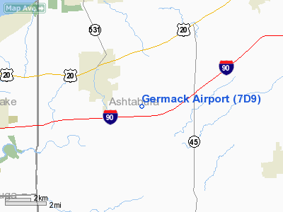
Location & QuickFacts
| FAA Information Effective: | 2008-09-25 |
| Airport Identifier: | 7D9 |
| Airport Status: | Operational |
| Longitude/Latitude: | 080-54-14.3270W/41-46-40.1960N
-80.903980/41.777832 (Estimated) |
| Elevation: | 820 ft / 249.94 m (Surveyed) |
| Land: | 31 acres |
| From nearest city: | 3 nautical miles SE of Geneva, OH |
| Location: | Ashtabula County, OH |
| Magnetic Variation: | 07W (1985) |
Owner & Manager
| Ownership: | Privately owned |
| Owner: | John Williams |
| Address: | 1419 State Route 45 South
Austinburg, OH 44010 |
| Phone number: | 440-275-3205 |
| Manager: | John Williams
ARPT ADDRESS 4180 CLAY ST GENEVA OH 44041 |
| Address: | 1419 State Route 45 South
Austinburg, OH 44010 |
| Phone number: | 440-275-3205 |
Airport Operations and Facilities
| Airport Use: | Open to public |
| Wind indicator: | Yes |
| Segmented Circle: | Yes |
| Control Tower: | No |
| Landing fee charge: | No |
| Sectional chart: | Detroit |
| Region: | AGL - Great Lakes |
| Boundary ARTCC: | ZOB - Cleveland |
| Tie-in FSS: | CLE - Cleveland |
| FSS on Airport: | No |
| FSS Toll Free: | 1-800-WX-BRIEF |
| NOTAMs Facility: | CLE (NOTAM-d service avaliable) |
Airport Communications
Airport Services
| Airframe Repair: | NONE |
| Power Plant Repair: | NONE |
| Bottled Oxygen: | NONE |
| Bulk Oxygen: | NONE |
Runway Information
Runway 01/19
| Dimension: | 3250 x 28 ft / 990.6 x 8.5 m |
| Surface: | ASPH,
RY 01/19 ROLLING SFC. |
| |
Runway 01 |
Runway 19 |
| Longitude: | 080-54-15.6300W | 080-54-13.0000W |
| Latitude: | 41-46-24.1100N | 41-46-56.2600N |
| Elevation: | 820.00 ft | 820.00 ft |
| Traffic Pattern: | Left | Left |
| Markings: | Nonstandard, Good Condition
INCORRECT SPACING AND SIZE. | Nonstandard, Good Condition
INCORRECT SPACING AND SIZE. |
| Runway End Identifier: | No | No |
| Centerline Lights: | No | No |
| Touchdown Lights: | No | No |
| Obstruction: | 33 ft tree, 201.0 ft from runway, 88 ft left of centerline
RWY 01 +57' TREES 0' FR 125' EACH SIDE OF RWY CENTERLINE EXTENDING 200' FR. +3' CABLE 15' FR 25' EACH SIDE OF CENTERLINE ON WOOD BASES. | 70 ft trees, 201.0 ft from runway, 48 ft right of centerline
RWY19 +15' ROAD, +35' PLINE, GRADE CHANGES AND +78' TREES WITH IN 125' EACH SIDE OF RWY CENTERLINE 0' FROM TO 200' FROM. |
|
Radio Navigation Aids
| ID |
Type |
Name |
Ch |
Freq |
Var |
Dist |
| LQL | NDB | Lakeland | | 263.00 | 08W | 22.1 nm |
| BKL | NDB | Burke Lakefront | | 416.00 | 07W | 37.2 nm |
| EZE | NDB | Engel | | 226.00 | 07W | 40.7 nm |
| HBD | NDB | Hubbard | | 408.00 | 08W | 41.1 nm |
| CQD | NDB | Cascade | | 372.00 | 08W | 41.2 nm |
| AK | NDB | Akron | | 362.00 | 07W | 47.8 nm |
| JFN | VOR/DME | Jefferson | 099X | 115.20 | 05W | 7.1 nm |
| CXR | VOR/DME | Chardon | 074X | 112.70 | 05W | 19.5 nm |
| LNN | VOR/DME | Lost Nation | 039X | 110.20 | 08W | 22.5 nm |
| ACO | VOR/DME | Akron | 091X | 114.40 | 04W | 42.4 nm |
| YNG | VORTAC | Youngstown | 027X | 109.00 | 05W | 28.8 nm |
| ERI | VORTAC | Erie | 031X | 109.40 | 06W | 30.9 nm |
| CLE | VOT | Cleveland | | 110.40 | | 47.9 nm |
Remarks
- DEER ON & INVOF ARPT.
- RADIO CONTROLLED MODEL ACFT ACTIVITY ON & INVOF ARPT.
- NO LINE OF SIGHT BETWEEN RY ENDS.
- (E62-01) LNDG LENGTH BASED ON 20:1 APCH RATIO.
- (E62-19) LNDG LENGTH BASED ON 20:1 APCH RATIO.
- VFR OPERNS ONLY.
Images and information placed above are from
http://www.airport-data.com/airport/7D9/
We thank them for the data!
| General Info
|
| Country |
United States
|
| State |
OHIO
|
| FAA ID |
7D9
|
| Latitude |
41-46-40.196N
|
| Longitude |
080-54-14.327W
|
| Elevation |
820 feet
|
| Near City |
GENEVA
|
We don't guarantee the information is fresh and accurate. The data may
be wrong or outdated.
For more up-to-date information please refer to other sources.
|
|


