 |
|
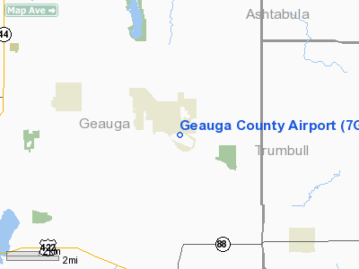
Location & QuickFacts
| FAA Information Effective: | 2008-09-25 |
| Airport Identifier: | 7G8 |
| Airport Status: | Operational |
| Longitude/Latitude: | 081-03-46.5634W/41-26-58.5416N
-81.062934/41.449595 (Estimated) |
| Elevation: | 1174 ft / 357.84 m (Surveyed) |
| Land: | 51 acres |
| From nearest city: | 1 nautical miles SE of Middlefield, OH |
| Location: | Geauga County, OH |
| Magnetic Variation: | 04W (1965) |
Owner & Manager
| Ownership: | Publicly owned |
| Owner: | Geauga Co Board Of Comm |
| Address: | Courthouse Annex, Main St.
Chardon, OH 44024 |
| Phone number: | 440-285-2222 |
| Manager: | Patty Fulop |
| Address: | P.o. Box 1308
Middlefield, OH 44062 |
| Phone number: | 440-632-1884 |
Airport Operations and Facilities
| Airport Use: | Open to public |
| Wind indicator: | Yes |
| Segmented Circle: | No |
| Control Tower: | No |
| Lighting Schedule: | DUSK-DAWN
ACTIVATE HIRL RY 11/29 &REIL RYS 11 &29-CTAF. |
| Beacon Color: | Clear-Green (lighted land airport) |
| Landing fee charge: | No |
| Sectional chart: | Detroit |
| Region: | AGL - Great Lakes |
| Traffic Pattern Alt: | 1025 ft |
| Boundary ARTCC: | ZOB - Cleveland |
| Tie-in FSS: | CLE - Cleveland |
| FSS on Airport: | No |
| FSS Toll Free: | 1-800-WX-BRIEF |
| NOTAMs Facility: | CLE (NOTAM-d service avaliable) |
| Federal Agreements: | N |
Airport Communications
| CTAF: | 123.000 |
| Unicom: | 123.000 |
Airport Services
| Fuel available: | 100LL |
| Bottled Oxygen: | NONE |
Runway Information
Runway 11/29
| Dimension: | 3500 x 65 ft / 1066.8 x 19.8 m |
| Surface: | ASPH, Fair Condition |
| Weight Limit: | Single wheel: 18500 lbs. |
| Edge Lights: | High |
| |
Runway 11 |
Runway 29 |
| Longitude: | 081-04-09.1956W | 081-03-23.9317W |
| Latitude: | 41-27-01.5293N | 41-26-55.5526N |
| Elevation: | 1174.00 ft | 1158.00 ft |
| Alignment: | 100 | 127 |
| Traffic Pattern: | Left | Left |
| Markings: | Non-precision instrument, Fair Condition
RWY 11 MARKINGS WEATHERED. | Non-precision instrument, Fair Condition
MARKINGS WEATHERED. |
| Displaced threshold: | 180.00 ft | 0.00 ft |
| VASI: | tri-color on right side | tri-color on left side
11 & 29 TRCV OTS INDEFLY. |
| Runway End Identifier: | Yes | Yes |
| Centerline Lights: | No | No |
| Touchdown Lights: | No | No |
| Obstruction: | 73 ft tank, 680.0 ft from runway, 240 ft left of centerline, 6:1 slope to clear
APCH RATIO 15:1 TO DSPLCD THLD. | 55 ft trees, 316.0 ft from runway, 100 ft left of centerline, 2:1 slope to clear |
|
Radio Navigation Aids
| ID |
Type |
Name |
Ch |
Freq |
Var |
Dist |
| LQL | NDB | Lakeland | | 263.00 | 08W | 19.9 nm |
| AK | NDB | Akron | | 362.00 | 07W | 27.1 nm |
| BKL | NDB | Burke Lakefront | | 416.00 | 07W | 27.5 nm |
| EZE | NDB | Engel | | 226.00 | 07W | 29.8 nm |
| HBD | NDB | Hubbard | | 408.00 | 08W | 29.9 nm |
| UCP | NDB | Castle | | 272.00 | 09W | 38.9 nm |
| CL | NDB | Harri | | 344.00 | 07W | 41.2 nm |
| CXR | VOR/DME | Chardon | 074X | 112.70 | 05W | 6.1 nm |
| LNN | VOR/DME | Lost Nation | 039X | 110.20 | 08W | 20.4 nm |
| ACO | VOR/DME | Akron | 091X | 114.40 | 04W | 21.5 nm |
| JFN | VOR/DME | Jefferson | 099X | 115.20 | 05W | 23.4 nm |
| BSV | VOR/DME | Briggs | 071X | 112.40 | 04W | 45.8 nm |
| DJB | VOR/DME | Dryer | 083X | 113.60 | 05W | 49.9 nm |
| YNG | VORTAC | Youngstown | 027X | 109.00 | 05W | 18.9 nm |
| ERI | VORTAC | Erie | 031X | 109.40 | 06W | 48.6 nm |
| CLE | VOT | Cleveland | | 110.40 | | 35.5 nm |
| CAK | VOT | Akron/canton Regional | | 110.60 | | 36.4 nm |
Remarks
- PARALLEL TWY CLSD EAST OF T HNGRS PERMLY.
Images and information placed above are from
http://www.airport-data.com/airport/7G8/
We thank them for the data!
| General Info
|
| Country |
United States
|
| State |
OHIO
|
| FAA ID |
7G8
|
| Latitude |
41-26-58.595N
|
| Longitude |
081-03-46.547W
|
| Elevation |
1175 feet
|
| Near City |
MIDDLEFIELD
|
We don't guarantee the information is fresh and accurate. The data may
be wrong or outdated.
For more up-to-date information please refer to other sources.
|
|


