 |
|
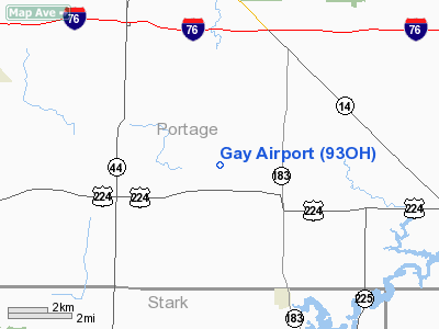
Location & QuickFacts
| FAA Information Effective: | 2008-09-25 |
| Airport Identifier: | 93OH |
| Airport Status: | Operational |
| Longitude/Latitude: | 081-11-09.3620W/41-02-40.2070N
-81.185934/41.044502 (Estimated) |
| Elevation: | 1200 ft / 365.76 m (Estimated) |
| Land: | 0 acres |
| From nearest city: | 2 nautical miles NW of Atwater, OH |
| Location: | Portage County, OH |
| Magnetic Variation: | 07W (1985) |
Owner & Manager
| Ownership: | Privately owned |
| Owner: | James G. Gay |
| Address: | 5751 Moff Road
Atwater, OH 44201 |
| Phone number: | 330-947-2319 |
| Address: |
|
Airport Operations and Facilities
| Airport Use: | Private |
| Segmented Circle: | No |
| Control Tower: | No |
| Landing fee charge: | No |
| Sectional chart: | Detroit |
| Region: | AGL - Great Lakes |
| Boundary ARTCC: | ZOB - Cleveland |
| Tie-in FSS: | CLE - Cleveland |
| FSS on Airport: | No |
| FSS Toll Free: | 1-800-WX-BRIEF
OR LOCAL CALL 253-8157. |
Airport Services
| Airframe Repair: | NONE |
| Power Plant Repair: | NONE |
| Bottled Oxygen: | NONE |
| Bulk Oxygen: | NONE |
Runway Information
Runway 18/36
| Dimension: | 2284 x 75 ft / 696.2 x 22.9 m
500' STOPWAY ON SOUTH END. |
| Surface: | TURF, |
| |
Runway 18 |
Runway 36 |
| Traffic Pattern: | Left | Left |
| Markings: | Nonstandard, | Nonstandard, |
|
Radio Navigation Aids
| ID |
Type |
Name |
Ch |
Freq |
Var |
Dist |
| AK | NDB | Akron | | 362.00 | 07W | 9.3 nm |
| TSO | NDB | Tolson | | 395.00 | 07W | 29.4 nm |
| HBD | NDB | Hubbard | | 408.00 | 08W | 30.4 nm |
| UCP | NDB | Castle | | 272.00 | 09W | 34.9 nm |
| EZE | NDB | Engel | | 226.00 | 07W | 36.1 nm |
| BKL | NDB | Burke Lakefront | | 416.00 | 07W | 36.2 nm |
| LQL | NDB | Lakeland | | 263.00 | 08W | 39.3 nm |
| CL | NDB | Harri | | 344.00 | 07W | 39.4 nm |
| MLR | NDB | Millersburg/dcmsnd | | 382.00 | 06W | 43.5 nm |
| AAU | NDB | Ashland | | 329.00 | 07W | 48.7 nm |
| CFX | NDB | Cadiz | | 239.00 | 07W | 49.2 nm |
| ACO | VOR/DME | Akron | 091X | 114.40 | 04W | 3.9 nm |
| BSV | VOR/DME | Briggs | 071X | 112.40 | 04W | 21.4 nm |
| CXR | VOR/DME | Chardon | 074X | 112.70 | 05W | 28.4 nm |
| LNN | VOR/DME | Lost Nation | 039X | 110.20 | 08W | 39.5 nm |
| JFN | VOR/DME | Jefferson | 099X | 115.20 | 05W | 47.3 nm |
| DJB | VOR/DME | Dryer | 083X | 113.60 | 05W | 48.0 nm |
| YNG | VORTAC | Youngstown | 027X | 109.00 | 05W | 28.8 nm |
| EWC | VORTAC | Ellwood City | 105X | 115.80 | 08W | 46.2 nm |
| CAK | VOT | Akron/canton Regional | | 110.60 | | 13.9 nm |
| CLE | VOT | Cleveland | | 110.40 | | 37.2 nm |
Remarks
- RWY ROLLING SFC WITH 5' DIPS.
- VFR USE ONLY.
Images and information placed above are from
http://www.airport-data.com/airport/93OH/
We thank them for the data!
| General Info
|
| Country |
United States
|
| State |
OHIO
|
| FAA ID |
93OH
|
| Latitude |
41-02-40.207N
|
| Longitude |
081-11-09.362W
|
| Elevation |
1200 feet
|
| Near City |
ATWATER
|
We don't guarantee the information is fresh and accurate. The data may
be wrong or outdated.
For more up-to-date information please refer to other sources.
|
|


